 |
|
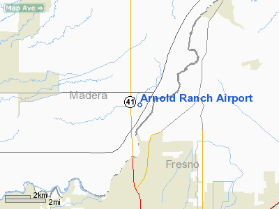
Location
& QuickFacts
|
FAA
Information Effective: |
2006-06-08 |
|
Airport
Identifier: |
37CN |
|
Longitude/Latitude: |
119-47-08.5300W/36-54-51.8160N
-119.785703/36.914393 (Estimated) |
|
Elevation: |
382 ft / 116.43 m (Estimated) |
|
Land: |
0 acres |
|
From
nearest city: |
9 nautical miles N of Fresno, CA |
|
Location: |
Madera County, CA |
|
Magnetic Variation: |
15E (1985) |
Owner
& Manager
|
Ownership: |
Privately owned |
|
Owner: |
Robert C. Arnold |
|
Address: |
11525 Highway 41
Madera, CA 93638-8859 |
|
Phone number: |
559-439-1687 |
|
Manager: |
Robert C. Arnold |
|
Address: |
11525 Highway 41
Madera, CA 93638-8859 |
|
Phone number: |
559-439-1687 |
Airport
Operations and Facilities
|
Airport
Use: |
Private |
|
Wind
indicator: |
No |
|
Segmented
Circle: |
No |
|
Control
Tower: |
No |
|
Attendance
Schedule: |
UNATNDD |
|
Landing
fee charge: |
No |
|
Sectional
chart: |
San Francisco |
|
Region: |
AWP - Western-Pacific |
|
Boundary
ARTCC: |
ZOA - Oakland |
|
Tie-in
FSS: |
RIU - Rancho Murieta |
|
FSS
on Airport: |
No |
|
FSS
Phone: |
916-354-0161 |
|
FSS
Toll Free: |
1-800-WX-BRIEF |
|
Runway Information
Runway 07/25
|
Dimension: |
2640 x 50 ft / 804.7 x 15.2 m |
|
Surface: |
ASPH-DIRT,
E 1100' PAVED, W 1540' DIRT. |
|
|
Runway 07 |
Runway 25 |
|
Traffic
Pattern: |
Left |
Left |
|
Radio Navigation
Aids
|
ID |
Type |
Name |
Ch |
Freq |
Var |
Dist |
|
FCH |
NDB |
Chandler |
|
344.00 |
15E |
11.7 nm |
|
CUK |
NDB |
Academy |
|
266.00 |
14E |
13.2 nm |
|
NLC |
TACAN |
Lemoore |
080X |
|
16E |
35.4 nm |
|
HYP |
VOR/DME |
El Nido |
089X |
114.20 |
15E |
34.7 nm |
|
VIS |
VOR/DME |
Visalia |
031X |
109.40 |
16E |
36.0 nm |
|
CZQ |
VORTAC |
Clovis |
076X |
112.90 |
15E |
2.3 nm |
|
FRA |
VORTAC |
Friant |
103X |
115.60 |
17E |
14.6 nm |
|
PXN |
VORTAC |
Panoche |
073X |
112.60 |
16E |
49.3 nm |
Based Aircraft
|
Aircraft
based on field: |
1 |
|
Single
Engine Airplanes: |
1 |
Arnold Ranch Airport
Address:
Madera County, CA
Tel:
559-439-1687
Images
and information placed above are from
http://www.airport-data.com/airport/37CN/
We
thank them for the data!
| General
Info |
| Country |
United
States |
| State |
CALIFORNIA
|
| FAA ID |
37CN
|
| Latitude |
36-54-51.816N
|
| Longitude |
119-47-08.530W
|
| Elevation |
382 feet
|
| Near City |
FRESNO
|
We don't guarantee the information is fresh and accurate. The data may
be wrong or outdated.
For more up-to-date information please refer to other sources.
|
|


