 |
|
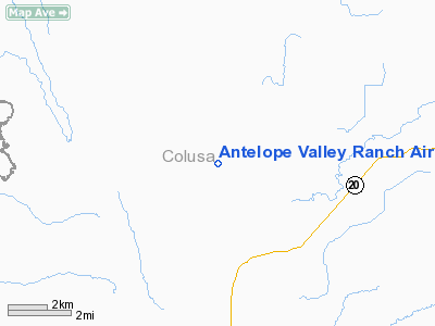
Antelope Valley Ranch Airport |
Location
& QuickFacts
|
FAA
Information Effective: |
2006-06-08 |
|
Airport
Identifier: |
4CL3 |
|
Longitude/Latitude: |
122-21-14.8200W/39-08-46.5000N
-122.354117/39.146250 (Estimated) |
|
Elevation: |
530 ft / 161.54 m (Estimated) |
|
Land: |
0 acres |
|
From
nearest city: |
10 nautical miles W of Williams, CA |
|
Location: |
Colusa County, CA |
|
Magnetic Variation: |
16E (1995) |
Owner
& Manager
|
Ownership: |
Privately owned |
|
Owner: |
Frank J. & Nancy R. Sammann |
|
Address: |
3996 Leesville Road, Po Box 1359
Williams, CA 95987 |
|
Phone
number: |
530-473-5142 |
|
Manager: |
Frank J. & Nancy R. Sammann |
|
Address: |
3996 Leesville Road, Po Box 1359
Williams, CA 95987 |
|
Phone number: |
530-473-5142 |
Airport
Operations and Facilities
|
Airport
Use: |
Private |
|
Segmented
Circle: |
No |
|
Control
Tower: |
No |
|
Attendance
Schedule: |
UNATNDD |
|
Sectional
chart: |
San Francisco |
|
Region: |
AWP - Western-Pacific |
|
Boundary
ARTCC: |
ZOA - Oakland |
|
Tie-in
FSS: |
RIU - Rancho Murieta |
|
FSS
Phone: |
916-354-0161 |
|
FSS
Toll Free: |
1-800-WX-BRIEF |
|
Runway Information
Runway 15/33
|
Dimension: |
2384 x 60 ft / 726.6 x 18.3 m |
|
Surface: |
TURF, |
|
|
Runway 15 |
Runway 33 |
|
Traffic
Pattern: |
Left |
Left |
|
Obstruction: |
|
50 ft tree, 200.0 ft from runway |
|
Radio Navigation
Aids
|
ID |
Type |
Name |
Ch |
Freq |
Var |
Dist |
|
LOP |
NDB |
Lampson |
|
217.00 |
16E |
26.3 nm |
|
MY |
NDB |
Halow |
|
222.00 |
16E |
34.7 nm |
|
OVE |
NDB |
Oroville |
|
212.00 |
16E |
40.0 nm |
|
BAB |
TACAN |
Beale |
023X |
|
16E |
42.6 nm |
|
MYV |
VOR/DME |
Marysville |
045X |
110.80 |
16E |
36.5 nm |
|
STS |
VOR/DME |
Santa Rosa |
077X |
113.00 |
16E |
43.9 nm |
|
CIC |
VOR/DME |
Chico |
035X |
109.80 |
16E |
45.3 nm |
|
MXW |
VORTAC |
Maxwell |
037X |
110.00 |
18E |
12.0 nm |
|
ILA |
VORTAC |
Williams |
091X |
114.40 |
18E |
15.9 nm |
|
ENI |
VORTAC |
Mendocino |
070X |
112.30 |
16E |
43.3 nm |
|
SMF |
VOT |
Sacramento Metropolitan |
|
111.40 |
|
45.0 nm |
Remarks
- PROVIDED
VFR OPNS, PRIVATE USE, OBSTRUCTION FREE INGRESS/EGRESS ROUTES.
Based Aircraft
|
Aircraft
based on field: |
1 |
|
Single
Engine Airplanes: |
1 |
Antelope Valley Ranch Airport
Address:
Colusa County, CA
Tel:
530-473-5142
Images
and information placed above are from
http://www.airport-data.com/airport/4CL3/
We
thank them for the data!
| General
Info |
| Country |
United
States |
| State |
CALIFORNIA
|
| FAA ID |
4CL3
|
| Latitude |
39-08-46.500N
|
| Longitude |
122-21-14.820W
|
| Elevation |
530 feet
|
| Near City |
WILLIAMS
|
We don't guarantee the information is fresh and accurate. The data may
be wrong or outdated.
For more up-to-date information please refer to other sources.
|
|


