 |
|
Angwin-parrett Field Airport |
| Angwin-Parrett Field |
| IATA: none – ICAO: none – FAA LID: 2O3 |
| Summary |
| Airport type |
Public |
| Owner |
Pacific Union College |
| Serves |
Angwin, California |
| Elevation AMSL |
1,848 ft / 563 m |
| Coordinates |
38°34′48″N 122°26′08″W / 38.58°N 122.43556°W / 38.58; -122.43556 |
| Runways |
| Direction |
Length |
Surface |
| ft |
m |
| 16/34 |
3,217 |
981 |
Asphalt |
| Statistics (2004) |
| Aircraft operations |
12,000 |
| Based aircraft |
38 |
| Source: Federal Aviation Administration |
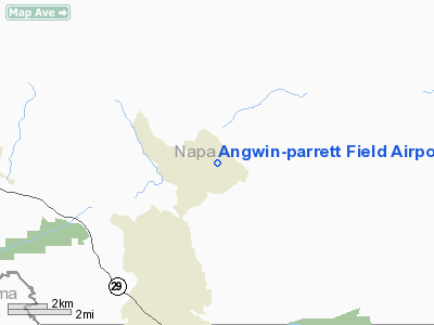
Angwin-Parrett Field (FAA LID: 2O3) is a public use airport located one nautical mile (1.85 km) east of the central business district of Angwin, in Napa County, California, United States. It is owned by Pacific Union College. It is also known as Virgil O. Parrett Field.
Facilities and aircraft
Angwin-Parrett Field covers an area of 60 acres (24 ha) at an elevation of 1,848 feet (563 m) above mean sea level. It has one runway designated 16/34 with an asphalt surface measuring 3,217 by 50 feet (981 x 15 m).
For the 12-month period ending November 19, 2004, the airport had 12,000 general aviation aircraft operations, an average of 32 per day. At that time there were 38 aircraft based at this airport: 92% single-engine and 8% multi-engine.
The above content comes from Wikipedia and is published under free licenses – click here to read more.
Location
& QuickFacts
|
FAA
Information Effective: |
2006-06-08 |
|
Airport
Identifier: |
2O3 |
|
Longitude/Latitude: |
122-26-06.9260W/38-34-42.6640N
-122.435257/38.578518 (Estimated) |
|
Elevation: |
1848 ft / 563.27 m (Estimated) |
|
Land: |
60 acres |
|
From
nearest city: |
1 nautical miles E of Angwin, CA |
|
Location: |
Napa County, CA |
|
Magnetic Variation: |
16E (1985) |
Owner
& Manager
|
Ownership: |
Privately owned |
|
Owner: |
Pacific Union College |
|
Address: |
1 Angwin Avenue
Angwin, CA 94508 |
|
Phone number: |
707-965-6219 |
|
Manager: |
Nathan Tasker |
|
Address: |
1 Angwin Avenue
Angwin, CA 94508 |
|
Phone number: |
707-965-6219 |
Airport
Operations and Facilities
|
Airport
Use: |
Open to public |
|
Wind
indicator: |
Yes |
|
Segmented
Circle: |
Yes |
|
Control
Tower: |
No |
|
Attendance
Schedule: |
ALL/SUN-FRI/0800-1700 |
|
Lighting
Schedule: |
RDO-CTL
ACTVT LIRL RY 16/34 AND TRVC RYS 16 & 34 - CTAF. |
|
Landing
fee charge: |
No |
|
Sectional
chart: |
San Francisco |
|
Region: |
AWP - Western-Pacific |
|
Traffic
Pattern Alt: |
850 ft |
|
Boundary
ARTCC: |
ZOA - Oakland |
|
Tie-in
FSS: |
OAK - Oakland |
|
FSS
on Airport: |
No |
|
FSS
Phone: |
510-273-6111 |
|
FSS
Toll Free: |
1-800-WX-BRIEF |
|
NOTAMs
Facility: |
OAK (NOTAM-d service avaliable) |
|
Federal Agreements: |
N |
Airport
Communications
|
CTAF: |
123.000 |
|
Unicom: |
123.000 |
Airport
Services
|
Fuel
available: |
100LL |
|
Airframe
Repair: |
MAJOR |
|
Power
Plant Repair: |
MAJOR |
|
Bottled
Oxygen: |
NONE |
|
Bulk
Oxygen: |
HIGH |
|
Runway Information
Runway 16/34
|
Dimension: |
3217 x 50 ft / 980.5 x 15.2 m |
|
Surface: |
ASPH, Fair Condition |
|
Edge
Lights: |
Low |
|
|
Runway 16 |
Runway 34 |
|
Traffic
Pattern: |
Left |
Right |
|
Markings: |
Basic, Good Condition |
Basic, Good Condition |
|
VASI: |
tri-color on left side |
tri-color on right side |
|
Runway
End Identifier: |
No |
No |
|
Centerline
Lights: |
No |
No |
|
Touchdown
Lights: |
No |
No |
|
Obstruction: |
50 ft tree, 1000.0 ft from runway, 210 ft left
of centerline, 16:1 slope to clear
RWY 16 FENCE IN PRIMARY SFC 100 FT L AND 86 FT R OF CNTRLN
PARALLEL TO RWY. |
95 ft trees, 1900.0 ft from runway, 200 ft
right of centerline, 20:1 slope to clear |
|
Radio Navigation
Aids
|
ID |
Type |
Name |
Ch |
Freq |
Var |
Dist |
|
LOP |
NDB |
Lampson |
|
217.00 |
16E |
32.7 nm |
|
SUU |
TACAN |
Travis |
113X |
|
17E |
30.6 nm |
|
TZZ |
VOR |
Travis |
|
116.40 |
17E |
32.6 nm |
|
STS |
VOR/DME |
Santa Rosa |
077X |
113.00 |
16E |
18.1 nm |
|
CCR |
VOR/DME |
Concord |
117X |
117.00 |
17E |
37.0 nm |
|
MCC |
VOR/DME |
Mc Clellan |
029X |
109.20 |
17E |
48.7 nm |
|
SGD |
VORTAC |
Scaggs Island |
058X |
112.10 |
17E |
24.2 nm |
|
ILA |
VORTAC |
Williams |
091X |
114.40 |
18E |
35.2 nm |
|
PYE |
VORTAC |
Point Reyes |
084X |
113.70 |
17E |
36.3 nm |
|
SAC |
VORTAC |
Sacramento |
099X |
115.20 |
17E |
42.3 nm |
|
SAU |
VORTAC |
Sausalito |
109X |
116.20 |
17E |
43.7 nm |
|
MXW |
VORTAC |
Maxwell |
037X |
110.00 |
18E |
45.5 nm |
|
ENI |
VORTAC |
Mendocino |
070X |
112.30 |
16E |
48.6 nm |
|
SMF |
VOT |
Sacramento Metropolitan |
|
111.40 |
|
40.2 nm |
|
SAC |
VOT |
Sacramento Executive |
|
111.40 |
|
44.2 nm |
Remarks
- ARPT
19 NM E OF SONOMA COUNTY ARPT.
Based Aircraft
|
Aircraft
based on field: |
38 |
|
Single
Engine Airplanes: |
35 |
|
Multi
Engine Airplanes: |
3 |
Operational Statistics
|
Aircraft
Operations: |
231/Week |
|
General
Aviation Local: |
75.0% |
|
General
Aviation Itinerant: |
25.0% |
Angwin-parrett Field Airport
Address:
Napa County, CA
Tel:
707-965-6219
Images
and information placed above are from
http://www.airport-data.com/airport/2O3/
We
thank them for the data!
| General
Info |
| Country |
United
States |
| State |
CALIFORNIA
|
| FAA ID |
2O3
|
| Latitude |
38-34-42.664N
|
| Longitude |
122-26-06.926W
|
| Elevation |
1848 feet
|
| Near City |
ANGWIN
|
We don't guarantee the information is fresh and accurate. The data may
be wrong or outdated.
For more up-to-date information please refer to other sources.
|
|


