 |
|
|
|
|
|
Location
& QuickFacts
|
FAA
Information Effective: |
2006-06-08 |
|
Airport
Identifier: |
S51 |
|
Longitude/Latitude: |
123-59-44.2580W/41-30-43.4350N
-123.995627/41.512065 (Estimated) |
|
Elevation: |
42 ft / 12.80 m (Surveyed) |
|
Land: |
24 acres |
|
From
nearest city: |
1 nautical miles S of Klamath Glen, CA |
|
Location: |
Del Norte County, CA |
|
Magnetic Variation: |
18E (1985) |
Owner
& Manager
|
Ownership: |
Publicly owned |
|
Owner: |
Del Norte County |
|
Address: |
700 5th St
Crescent City, CA 95531 |
|
Phone
number: |
707-464-7229 |
|
Manager: |
Karl H. Brown
DIR. OF PUBLIC WORKS. |
|
Address: |
700 5th St
Crescent City, CA 95531 |
|
Phone number: |
707-464-7229 |
Airport
Operations and Facilities
|
Airport
Use: |
Open to public |
|
Wind
indicator: |
Yes |
|
Segmented
Circle: |
Yes |
|
Control
Tower: |
No |
|
Attendance
Schedule: |
UNATNDD |
|
Landing
fee charge: |
No |
|
Sectional
chart: |
Klamath Falls |
|
Region: |
AWP - Western-Pacific |
|
Traffic
Pattern Alt: |
1000 ft |
|
Boundary
ARTCC: |
ZSE - Seattle |
|
Tie-in
FSS: |
OAK - Oakland |
|
FSS
on Airport: |
No |
|
FSS
Phone: |
510-273-6111 |
|
FSS
Toll Free: |
1-800-WX-BRIEF |
|
NOTAMs
Facility: |
OAK (NOTAM-d service avaliable) |
Airport
Communications
Airport
Services
|
Airframe
Repair: |
NONE |
|
Power
Plant Repair: |
NONE |
|
Bottled
Oxygen: |
NONE |
|
Bulk
Oxygen: |
NONE |
|
Runway Information
Runway 11/29
|
Dimension: |
2400 x 50 ft / 731.5 x 15.2 m |
|
Surface: |
ASPH, Good Condition |
|
Weight
Limit: |
Single wheel: 12000 lbs. |
|
|
Runway 11 |
Runway 29 |
|
Elevation: |
32.00 ft |
41.00 ft |
|
Traffic
Pattern: |
Right |
Left |
|
Markings: |
Basic, Fair Condition |
Basic, Fair Condition |
|
Runway
End Identifier: |
No |
No |
|
Centerline
Lights: |
No |
No |
|
Touchdown
Lights: |
No |
No |
|
Obstruction: |
15 ft brush, 200.0 ft from runway, 75 ft right
of centerline
15 FT BRUSH WITHIN PRIMARY SFC 75-125 FT RIGHT. |
340 ft hill, 3700.0 ft from runway, 10:1 slope
to clear |
|
Radio Navigation
Aids
|
ID |
Type |
Name |
Ch |
Freq |
Var |
Dist |
|
ACV |
VOR/DME |
Arcata |
039X |
110.20 |
17E |
32.3 nm |
|
CEC |
VORTAC |
Crescent City |
027X |
109.00 |
19E |
19.5 nm |
Remarks
- HIGH
MOUNTAINS AND TREES SURROUND ARPT; MOUNTAIN FLYING EXPERIENCE STRONGLY
RECOMMENDED.
Operational Statistics
|
Aircraft
Operations: |
29/Week |
|
General
Aviation Local: |
20.0% |
|
General
Aviation Itinerant: |
73.3% |
|
Military: |
6.7% |
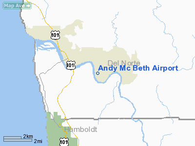
Andy Mc Beth Airport
Address:
Del Norte County, CA
Tel:
707-464-7229
Images
and information placed above are from
http://www.airport-data.com/airport/S51/
We
thank them for the data!
| General
Info |
| Country |
United
States |
| State |
CALIFORNIA
|
| FAA ID |
S51
|
| Latitude |
41-30-43.435N
|
| Longitude |
123-59-44.258W
|
| Elevation |
42 feet
|
| Near City |
KLAMATH
GLEN |
We don't guarantee the information is fresh and accurate. The data may
be wrong or outdated.
For more up-to-date information please refer to other sources.
|
|


