 |
|
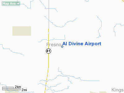
Location
& QuickFacts
|
FAA
Information Effective: |
2006-06-08 |
|
Airport
Identifier: |
65CL |
|
Longitude/Latitude: |
119-45-50.4950W/36-30-51.8190N
-119.764026/36.514394 (Estimated) |
|
Elevation: |
252 ft / 76.81 m (Estimated) |
|
Land: |
0 acres |
|
From
nearest city: |
3 nautical miles SE of Caruthers, CA |
|
Location: |
Fresno County, CA |
|
Magnetic Variation: |
15E (1985) |
Owner
& Manager
|
Ownership: |
Privately owned |
|
Owner: |
Dennis Divine |
|
Address: |
1695 E Conejo Ave
Fresno, CA 93725 |
|
Phone number: |
209-896-0731 |
|
Address: |
|
Airport
Operations and Facilities
|
Airport
Use: |
Private |
|
Wind
indicator: |
Yes |
|
Segmented
Circle: |
No |
|
Control
Tower: |
No |
|
Attendance
Schedule: |
UNATNDD |
|
Sectional
chart: |
San Francisco |
|
Region: |
AWP - Western-Pacific |
|
Boundary
ARTCC: |
ZOA - Oakland |
|
Tie-in
FSS: |
RIU - Rancho Murieta |
|
FSS
on Airport: |
No |
|
FSS
Phone: |
916-354-0161 |
|
FSS
Toll Free: |
1-800-WX-BRIEF |
|
Runway Information
Runway 16/34
|
Dimension: |
2400 x 100 ft / 731.5 x 30.5 m |
|
Surface: |
ASPH, |
|
|
Runway 16 |
Runway 34 |
|
Traffic
Pattern: |
Left |
Left |
|
Obstruction: |
40 ft pline |
|
|
Radio Navigation
Aids
|
ID |
Type |
Name |
Ch |
Freq |
Var |
Dist |
|
FCH |
NDB |
Chandler |
|
344.00 |
15E |
13.0 nm |
|
CUK |
NDB |
Academy |
|
266.00 |
14E |
14.4 nm |
|
COR |
NDB |
Salyer Farms |
|
205.00 |
16E |
29.1 nm |
|
NLC |
TACAN |
Lemoore |
080X |
|
16E |
14.2 nm |
|
ROM |
VOR |
Priest |
|
110.00 |
16E |
49.1 nm |
|
VIS |
VOR/DME |
Visalia |
031X |
109.40 |
16E |
16.2 nm |
|
CZQ |
VORTAC |
Clovis |
076X |
112.90 |
15E |
22.4 nm |
|
FRA |
VORTAC |
Friant |
103X |
115.60 |
17E |
36.4 nm |
Remarks
- ARPT
LCTD 15 NM S FRESNO AIR TERMINAL.
Based Aircraft
|
Aircraft
based on field: |
3 |
|
Single
Engine Airplanes: |
3 |
Al Divine Airport
Address:
Fresno County, CA
Tel:
209-896-0731
Images
and information placed above are from
http://www.airport-data.com/airport/65CL/
We
thank them for the data!
| General
Info |
| Country |
United
States |
| State |
CALIFORNIA
|
| FAA ID |
65CL
|
| Latitude |
36-30-51.819N
|
| Longitude |
119-45-50.495W
|
| Elevation |
252 feet
|
| Near City |
CARUTHERS
|
We don't guarantee the information is fresh and accurate. The data may
be wrong or outdated.
For more up-to-date information please refer to other sources.
|
|


