 |
|
|
|
|
|
Location
& QuickFacts
|
FAA
Information Effective: |
2006-06-08 |
|
Airport
Identifier: |
54CN |
|
Longitude/Latitude: |
120-53-56.7810W/38-45-14.6470N
-120.899106/38.754069 (Estimated) |
|
Elevation: |
1595 ft / 486.16 m (Estimated) |
|
Land: |
0 acres |
|
From
nearest city: |
5 nautical miles NW of Placerville, CA |
|
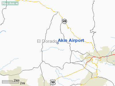
Location: |
El Dorado County, CA |
|
Magnetic Variation: |
16E (1985) |
Owner
& Manager
|
Ownership: |
Privately owned |
|
Owner: |
Edward P Akin |
|
Address: |
5500 Gold Hill Road
Placerville, CA 95667 |
|
Phone
number: |
916-626-6968 |
|
Manager: |
Edward P Akin |
|
Address: |
5500 Gold Hill Road
Placerville, CA 95667 |
|
Phone number: |
916-626-6968 |
Airport
Operations and Facilities
|
Airport Use: |
Private |
|
Wind indicator: |
Yes |
|
Segmented Circle: |
No |
|
Control Tower: |
No |
|
Attendance Schedule: |
UNATNDD |
|
Landing fee charge: |
No |
|
Sectional chart: |
San Francisco |
|
Region: |
AWP - Western-Pacific |
|
Boundary ARTCC: |
ZOA - Oakland |
|
Tie-in FSS: |
RIU - Rancho Murieta |
|
FSS on Airport: |
No |
|
FSS Phone: |
916-354-0161 |
|
FSS Toll Free: |
1-800-WX-BRIEF |
Airport
Services
|
Airframe
Repair: |
NONE |
|
Power
Plant Repair: |
NONE |
|
Runway Information
Runway 09/27
|
Dimension: |
1800 x 60 ft / 548.6 x 18.3 m |
|
Surface: |
DIRT, |
|
|
Runway 09 |
Runway 27 |
|
Traffic
Pattern: |
Right |
Left |
|
Radio Navigation
Aids
|
ID |
Type |
Name |
Ch |
Freq |
Var |
Dist |
|
MY |
NDB |
Halow |
|
222.00 |
16E |
41.6 nm |
|
BAB |
TACAN |
Beale |
023X |
|
16E |
34.1 nm |
|
TZZ |
VOR |
Travis |
|
116.40 |
17E |
49.4 nm |
|
HNW |
VOR/DME |
Hangtown |
102X |
115.50 |
17E |
7.2 nm |
|
MCC |
VOR/DME |
Mc Clellan |
029X |
109.20 |
17E |
24.3 nm |
|
MYV |
VOR/DME |
Marysville |
045X |
110.80 |
16E |
37.7 nm |
|
SWR |
VOR/DME |
Squaw Valley |
079X |
113.20 |
16E |
39.0 nm |
|
SAC |
VORTAC |
Sacramento |
099X |
115.20 |
17E |
35.9 nm |
|
LIN |
VORTAC |
Linden |
095X |
114.80 |
17E |
41.1 nm |
|
SAC |
VOT |
Sacramento Executive |
|
111.40 |
|
31.6 nm |
|
SMF |
VOT |
Sacramento Metropolitan |
|
111.40 |
|
32.7 nm |
Remarks
- ESTABD
PRIOR TO 15 MAY 1959.
Based Aircraft
|
Aircraft
based on field: |
1 |
|
Single
Engine Airplanes: |
1 |
Akin Airport
Address:
El Dorado County, CA
Tel:
916-626-6968
Images
and information placed above are from
http://www.airport-data.com/airport/54CN/
We
thank them for the data!
| General
Info |
| Country |
United
States |
| State |
CALIFORNIA
|
| FAA ID |
54CN
|
| Latitude |
38-45-14.647N
|
| Longitude |
120-53-56.781W
|
| Elevation |
1595 feet
|
| Near City |
PLACERVILLE
|
We don't guarantee the information is fresh and accurate. The data may
be wrong or outdated.
For more up-to-date information please refer to other sources.
|
|


