 |
|
Location
& QuickFacts
|
FAA
Information Effective: |
2006-06-08 |
|
Airport
Identifier: |
1CA4 |
|
Longitude/Latitude: |
114-31-36.8440W/33-52-10.0670N
-114.526901/33.869463 (Estimated) |
|
Elevation: |
300 ft / 91.44 m (Estimated) |
|
Land: |
307 acres |
|
From
nearest city: |
20 nautical miles N of Blythe, CA |
|
Location: |
Riverside County, CA |
|
Magnetic Variation: |
13E (1985) |
Owner
& Manager
|
Ownership: |
Publicly owned |
|
Owner: |
Colorado River Indian Tribes |
|
Address: |
Rt 1 Box 23b
Parker, AZ 85344 |
|
Phone number: |
619-922-3604 |
|
Manager: |
Craig Chute |
|
Address: |
Hcr 20 Box 2400
Blythe, CA 92225 |
Airport
Operations and Facilities
|
Airport
Use: |
Private |
|
Wind
indicator: |
Yes |
|
Segmented
Circle: |
Yes |
|
Control
Tower: |
No |
|
Attendance
Schedule: |
ALL/ALL/0800-1700 |
|
Sectional
chart: |
Phoenix |
|
Region: |
AWP - Western-Pacific |
|
Boundary
ARTCC: |
ZLA - Los Angeles |
|
Tie-in
FSS: |
RAL - Riverside |
|
FSS
on Airport: |
No |
|
FSS
Phone: |
951-351-3020 |
|
FSS
Toll Free: |
1-800-WX-BRIEF |
|
Runway Information
Runway 16/34
|
Dimension: |
2250 x 50 ft / 685.8 x 15.2 m |
|
Surface: |
GRVL, |
|
|
Runway 16 |
Runway 34 |
|
Traffic
Pattern: |
Left |
Right |
|
Radio Navigation
Aids
|
ID |
Type |
Name |
Ch |
Freq |
Var |
Dist |
|
PKE |
VORTAC |
Parker |
126X |
117.90 |
15E |
16.0 nm |
|
BLH |
VORTAC |
Blythe |
121X |
117.40 |
14E |
20.2 nm |
Based Aircraft
|
Aircraft
based on field: |
6 |
|
Single
Engine Airplanes: |
6 |
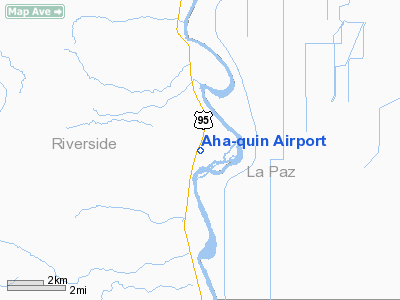
Aha-quin Airport
Address:
Riverside County, CA
Tel:
619-922-3604
Images
and information placed above are from
http://www.airport-data.com/airport/1CA4/
We
thank them for the data!
| General
Info |
| Country |
United
States |
| State |
CALIFORNIA
|
| FAA ID |
1CA4
|
| Latitude |
33-52-10.067N
|
| Longitude |
114-31-36.844W
|
| Elevation |
300 feet
|
| Near City |
BLYTHE
|
We don't guarantee the information is fresh and accurate. The data may be wrong or outdated.
For more up-to-date information please refer to other sources.
|
|


