 |
|
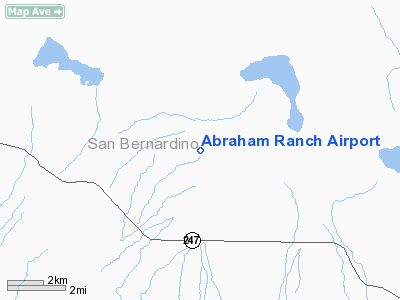
Location
& QuickFacts
|
FAA
Information Effective: |
2006-06-08 |
|
Airport
Identifier: |
7CA1 |
|
Longitude/Latitude: |
116-37-21.0850W/34-24-52.9990N
-116.622524/34.414722 (Estimated) |
|
Elevation: |
2850 ft / 868.68 m (Estimated) |
|
Land: |
0 acres |
|
From
nearest city: |
16 nautical miles SE of Lucerne Valley, CA |
|
Location: |
San Bernardino County, CA |
|
Magnetic Variation: |
14E (1985) |
Owner
& Manager
|
Ownership: |
Privately owned |
|
Owner: |
Harold W Abraham |
|
Address: |
Rr Box 3
Lake Elsinore, CA 92530 |
|
Phone
number: |
619-364-3742 |
|
Manager: |
Harold W Abraham |
|
Address: |
Rr Box 3
Lake Elsinore, CA 92530 |
|
Phone number: |
909-678-6072 |
Airport
Operations and Facilities
|
Airport
Use: |
Private |
|
Wind
indicator: |
Yes |
|
Segmented
Circle: |
No |
|
Control
Tower: |
No |
|
Attendance
Schedule: |
UNATNDD |
|
Landing
fee charge: |
No |
|
Sectional
chart: |
Los Angeles |
|
Region: |
AWP - Western-Pacific |
|
Boundary
ARTCC: |
ZLA - Los Angeles |
|
Tie-in
FSS: |
RAL - Riverside |
|
FSS
on Airport: |
No |
|
FSS
Phone: |
951-351-3020 |
|
FSS
Toll Free: |
1-800-WX-BRIEF |
|
Runway Information
Runway 09/27
|
Dimension: |
4000 x 75 ft / 1219.2 x 22.9 m |
|
Surface: |
DIRT, |
|
|
Runway 09 |
Runway 27 |
|
Traffic
Pattern: |
Right |
Left |
|
Radio Navigation
Aids
|
ID |
Type |
Name |
Ch |
Freq |
Var |
Dist |
|
SJY |
NDB |
San Jacinto |
|
227.00 |
14E |
41.7 nm |
|
SB |
NDB |
Petis |
|
397.00 |
14E |
42.8 nm |
|
NXP |
TACAN |
Coyote |
063X |
|
14E |
24.1 nm |
|
RIV |
TACAN |
March |
077X |
|
14E |
44.5 nm |
|
HDF |
VOR |
Homeland |
|
113.40 |
14E |
47.5 nm |
|
RAL |
VOR |
Riverside |
|
112.40 |
15E |
49.6 nm |
|
VCV |
VOR/DME |
Victorville |
031X |
109.40 |
14E |
39.5 nm |
|
HEC |
VORTAC |
Hector |
074X |
112.70 |
15E |
24.3 nm |
|
DAG |
VORTAC |
Daggett |
079X |
113.20 |
15E |
33.0 nm |
|
PSP |
VORTAC |
Palm Springs |
102X |
115.50 |
13E |
34.1 nm |
|
TNP |
VORTAC |
Twentynine Palms |
089X |
114.20 |
15E |
46.1 nm |
Remarks
Based Aircraft
|
Aircraft
based on field: |
4 |
|
Single
Engine Airplanes: |
2 |
|
Multi
Engine Airplanes: |
2 |
Abraham Ranch Airport
Address:
San Bernardino County, CA
Tel:
619-364-3742,
909-678-6072
Images
and information placed above are from
http://www.airport-data.com/airport/7CA1/
We
thank them for the data!
| General
Info |
| Country |
United
States |
| State |
CALIFORNIA
|
| FAA ID |
7CA1
|
| Latitude |
34-24-52.999N
|
| Longitude |
116-37-21.085W
|
| Elevation |
2850 feet
|
| Near City |
LUCERNE
VALLEY |
We don't guarantee the information is fresh and accurate. The data may be wrong or outdated.
For more up-to-date information please refer to other sources.
|
|


