 |
|
|
|
Location
& QuickFacts
|
FAA
Information Effective: |
2006-06-08 |
|
Airport
Identifier: |
06CL |
|
Longitude/Latitude: |
118-17-19.0000W/35-09-26.0000N
-118.288611/35.157222 (Estimated) |
|
Elevation: |
520 ft / 158.50 m (Estimated) |
|
Land: |
0 acres |
|
From
nearest city: |
0 nautical miles N of Glendale, CA |
|
Location: |
Los Angeles County, CA |
|
Magnetic Variation: |
14E (2000) |
Owner
& Manager
|
Ownership: |
Privately owned |
|
Owner: |
Walt Disney Pictures & Tv |
|
Address: |
500 South Buena Vista Street
Burbank, CA 91521-6371 |
|
Phone
number: |
818-560-1000 |
|
Manager: |
Lynn Beckemeyer |
|
Address: |
500 Circle Seven Drive
Glendale, CA 91201 |
|
Phone number: |
818-560-1000 |
Airport
Operations and Facilities
|
Airport
Use: |
Private |
|
Wind
indicator: |
Yes |
|
Segmented
Circle: |
No |
|
Control
Tower: |
No |
|
Attendance
Schedule: |
ALL/ALL/ALL |
|
Lighting
Schedule: |
DUSK-DAWN |
|
Sectional
chart: |
Los Angeles |
|
Region: |
AWP - Western-Pacific |
|
Boundary
ARTCC: |
ZLA - Los Angeles |
|
Responsible
ARTCC: |
ZLA - Los Angeles |
|
Tie-in
FSS: |
HHR - Hawthorne |
|
FSS
Phone: |
310-970-0102 |
|
FSS
Toll Free: |
1-800-WX-BRIEF |
|
Runway Information
Helipad H1
|
Dimension: |
46 x 46 ft / 14.0 x 14.0 m |
|
Surface: |
CONC, |
|
|
Runway H1 |
Runway |
|
Traffic
Pattern: |
Left |
Left |
|
Radio Navigation
Aids
|
ID |
Type |
Name |
Ch |
Freq |
Var |
Dist |
|
GWF |
NDB |
Gen William J Fox |
|
282.00 |
15E |
25.4 nm |
|
NID |
TACAN |
China Lake |
053X |
|
16E |
43.3 nm |
|
EDW |
VORTAC |
Edwards |
111X |
116.40 |
15E |
29.3 nm |
|
LHS |
VORTAC |
Lake Hughes |
021X |
108.40 |
15E |
31.9 nm |
|
PMD |
VORTAC |
Palmdale |
092X |
114.50 |
15E |
33.5 nm |
|
GMN |
VORTAC |
Gorman |
108X |
116.10 |
16E |
35.3 nm |
|
EHF |
VORTAC |
Shafter |
101X |
115.40 |
14E |
44.3 nm |
|
BFL |
VOT |
Bakersfield |
|
111.20 |
|
40.5 nm |
Remarks
- PROVIDED
VFR OPNS; PRIVATE USE; SPONSOR SHALL ENSURE OBSTRUCTION FREE INGRESS
AND EGRESS ROUTES AND COORDINATE OPERATIONS WITH BURBANK AIRPORT ATCT.
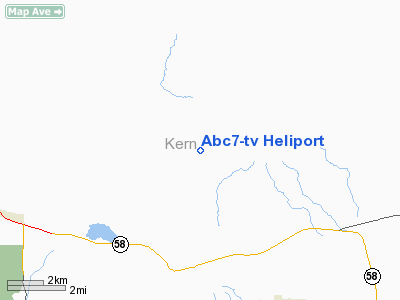
Abc7-tv Heliport
Address:
Los Angeles County, CA
Tel:
818-560-1000
Images
and information placed above are from
http://www.airport-data.com/airport/06CL/
We
thank them for the data!
| General
Info |
| Country |
United
States |
| State |
CALIFORNIA
|
| FAA ID |
06CL
|
| Latitude |
35-09-26.000N
|
| Longitude |
118-17-19.000W
|
| Elevation |
520 feet
|
| Near City |
GLENDALE
|
We don't guarantee the information is fresh and accurate. The data may be wrong or outdated.
For more up-to-date information please refer to other sources.
|
|


