 |
|
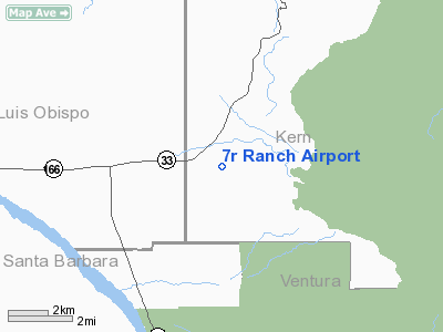
Location
& QuickFacts
|
FAA
Information Effective: |
2006-06-08 |
|
Airport
Identifier: |
CL25 |
|
Longitude/Latitude: |
119-27-06.4330W/34-56-07.9050N
-119.451787/34.935529 (Estimated) |
|
Elevation: |
3176 ft / 968.04 m (Estimated) |
|
Land: |
200 acres |
|
From
nearest city: |
8 nautical miles E of Cuyama, CA |
|
Location: |
Kern County, CA |
|
Magnetic Variation: |
14E (1985) |
Owner
& Manager
|
Ownership: |
Privately owned |
|
Owner: |
Augustine Prasciunas |
|
Address: |
Po Box 293
Maricopa, CA 93252 |
|
Phone number: |
310-831-6310 |
|
Manager: |
Augustine Prasciunas |
|
Address: |
Po Box 293
Maricopa, CA 93252 |
|
Phone number: |
310-831-6310 |
Airport
Operations and Facilities
|
Airport
Use: |
Private |
|
Wind
indicator: |
Yes |
|
Segmented
Circle: |
No |
|
Control
Tower: |
No |
|
Attendance
Schedule: |
UNATNDD |
|
Landing
fee charge: |
No |
|
Sectional
chart: |
Los Angeles |
|
Region: |
AWP - Western-Pacific |
|
Boundary
ARTCC: |
ZLA - Los Angeles |
|
Tie-in
FSS: |
RIU - Rancho Murieta |
|
FSS
on Airport: |
No |
|
FSS
Phone: |
916-354-0161 |
|
FSS
Toll Free: |
1-800-WX-BRIEF |
|
Runway Information
Runway 11/29
|
Dimension: |
2350 x 40 ft / 716.3 x 12.2 m |
|
Surface: |
TURF, |
|
|
Runway 11 |
Runway 29 |
|
Traffic
Pattern: |
Left |
Left |
|
Radio Navigation
Aids
|
ID |
Type |
Name |
Ch |
Freq |
Var |
Dist |
|
CMA |
VOR/DME |
Camarillo |
105X |
115.80 |
15E |
46.9 nm |
|
FLW |
VORTAC |
Fellows |
122X |
117.50 |
16E |
22.5 nm |
|
RZS |
VORTAC |
San Marcus |
096X |
114.90 |
14E |
30.1 nm |
|
GMN |
VORTAC |
Gorman |
108X |
116.10 |
16E |
30.2 nm |
|
EHF |
VORTAC |
Shafter |
101X |
115.40 |
14E |
37.3 nm |
|
GVO |
VORTAC |
Gaviota |
085X |
113.80 |
16E |
39.8 nm |
|
FIM |
VORTAC |
Fillmore |
072X |
112.50 |
15E |
44.8 nm |
|
LHS |
VORTAC |
Lake Hughes |
021X |
108.40 |
15E |
45.8 nm |
|
AVE |
VORTAC |
Avenal |
118X |
117.10 |
16E |
50.0 nm |
|
BFL |
VOT |
Bakersfield |
|
111.20 |
|
35.5 nm |
Remarks
Based Aircraft
|
Aircraft
based on field: |
2 |
|
Single
Engine Airplanes: |
2 |
7r Ranch Airport
Address:
Kern County, CA
Tel:
310-831-6310
Images
and information placed above are from
http://www.airport-data.com/airport/CL25/
We
thank them for the data!
| General
Info |
| Country |
United
States |
| State |
CALIFORNIA
|
| FAA ID |
CL25
|
| Latitude |
34-56-07.905N
|
| Longitude |
119-27-06.433W
|
| Elevation |
3176 feet
|
| Near City |
CUYAMA
|
We don't guarantee the information is fresh and accurate. The data may be wrong or outdated.
For more up-to-date information please refer to other sources.
|
|


