 |
|
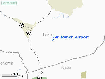
Location
& QuickFacts
|
FAA
Information Effective: |
2006-06-08 |
|
Airport
Identifier: |
81CA |
|
Longitude/Latitude: |
122-33-47.9400W/38-43-53.6500N
-122.563317/38.731569 (Estimated) |
|
Elevation: |
1153 ft / 351.43 m (Estimated) |
|
Land: |
0 acres |
|
From
nearest city: |
3 nautical miles SE of Middletown, CA |
|
Location: |
Lake County, CA |
|
Magnetic Variation: |
16E (1985) |
Owner
& Manager
|
Ownership: |
Privately owned |
|
Owner: |
W. F. Bottoms |
|
Address: |
61 Laurel Lane
El Sobrante, CA 94803 |
|
Phone
number: |
510-222-0886 |
|
Manager: |
D B Middleton |
|
Address: |
18975 Butts Canyon Rd
Middleton, CA 95461 |
|
Phone number: |
707-987-0957 |
Airport
Operations and Facilities
|
Airport
Use: |
Private |
|
Wind
indicator: |
Yes |
|
Segmented
Circle: |
No |
|
Control
Tower: |
No |
|
Attendance
Schedule: |
UNATNDD |
|
Landing
fee charge: |
No |
|
Sectional
chart: |
San Francisco |
|
Region: |
AWP - Western-Pacific |
|
Boundary
ARTCC: |
ZOA - Oakland |
|
Tie-in
FSS: |
OAK - Oakland |
|
FSS
on Airport: |
No |
|
FSS
Phone: |
510-273-6111 |
|
FSS
Toll Free: |
1-800-WX-BRIEF |
|
Runway Information
Runway 12/30
|
Dimension: |
6100 x 50 ft / 1859.3 x 15.2 m |
|
Surface: |
TURF, |
|
|
Runway 12 |
Runway 30 |
|
Traffic
Pattern: |
Left |
Left |
|
Obstruction: |
60 ft trees, 400.0 ft from runway |
60 ft trees, 400.0 ft from runway |
|
Radio Navigation
Aids
|
ID |
Type |
Name |
Ch |
Freq |
Var |
Dist |
|
LOP |
NDB |
Lampson |
|
217.00 |
16E |
21.8 nm |
|
SUU |
TACAN |
Travis |
113X |
|
17E |
41.2 nm |
|
TZZ |
VOR |
Travis |
|
116.40 |
17E |
42.4 nm |
|
STS |
VOR/DME |
Santa Rosa |
077X |
113.00 |
16E |
17.8 nm |
|
CCR |
VOR/DME |
Concord |
117X |
117.00 |
17E |
48.0 nm |
|
ILA |
VORTAC |
Williams |
091X |
114.40 |
18E |
32.3 nm |
|
SGD |
VORTAC |
Scaggs Island |
058X |
112.10 |
17E |
34.4 nm |
|
ENI |
VORTAC |
Mendocino |
070X |
112.30 |
16E |
38.5 nm |
|
MXW |
VORTAC |
Maxwell |
037X |
110.00 |
18E |
38.7 nm |
|
PYE |
VORTAC |
Point Reyes |
084X |
113.70 |
17E |
41.7 nm |
|
SMF |
VOT |
Sacramento Metropolitan |
|
111.40 |
|
45.7 nm |
Based Aircraft
|
Aircraft
based on field: |
2 |
|
Single
Engine Airplanes: |
1 |
|
Multi
Engine Airplanes: |
1 |
7-m Ranch Airport
Address:
Lake County, CA
Tel:
510-222-0886,
707-987-0957
Images
and information placed above are from
http://www.airport-data.com/airport/81CA/
We
thank them for the data!
| General
Info |
| Country |
United
States |
| State |
CALIFORNIA
|
| FAA ID |
81CA
|
| Latitude |
38-43-53.650N
|
| Longitude |
122-33-47.940W
|
| Elevation |
1153 feet
|
| Near City |
MIDDLETOWN
|
We don't guarantee the information is fresh and accurate. The data may be wrong or outdated.
For more up-to-date information please refer to other sources.
|
|


