 |
|
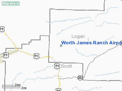
Worth James Ranch Airport |
Location
& QuickFacts
| FAA
Information Effective: |
2006-02-16 |
| Airport
Identifier: |
4AR7 |
| Longitude/Latitude: |
094-07-00.7470W/35-05-00.3430N
-94.116874/35.083429 (Estimated) |
| Elevation: |
650
ft / 198.12 m (Estimated) |
| Land: |
0 acres |
| From
nearest city: |
10
nautical miles SW of Booneville, AR |
| Location: |
Logan County, AR |
| Magnetic
Variation: |
05E
(1985) |
Owner &
Manager
| Ownership: |
Privately owned |
| Address: |
Logan
County, AR |
| Manager: |
Gaston P. Gibson |
| Address: |
Po
Box 4157 Asher
Little Rock, AR 72214 |
| Phone
number: |
501-562-6900 |
Airport
Operations and Facilities
| Airport
Use: |
Private |
| Wind
indicator: |
Yes |
| Segmented
Circle: |
No |
| Control
Tower: |
No |
| Attendance
Schedule: |
UNATNDD |
| Landing
fee charge: |
No |
| Sectional
chart: |
Memphis |
| Region: |
ASW
- Southwest |
| Boundary
ARTCC: |
ZME - Memphis |
| Tie-in
FSS: |
JBR
- Jonesboro |
| FSS
on Airport: |
No |
| FSS
Phone: |
870-935-3471 |
| FSS
Toll Free: |
1-800-WX-BRIEF |
Airport
Communications
Airport
Services
| Airframe
Repair: |
NONE |
| Power
Plant Repair: |
NONE |
Runway
Information
Runway
01/19
| Dimension: |
4800 x
200 ft / 1463.0 x 61.0 m |
| Surface: |
TURF,
|
| |
Runway 01 |
Runway 19 |
| Traffic
Pattern: |
Right |
Right |
|
Runway
07/25
| Dimension: |
2500 x
200 ft / 762.0 x 61.0 m |
| Surface: |
TURF,
|
| |
Runway 07 |
Runway 25 |
| Traffic
Pattern: |
Left |
Left |
|
Radio Navigation
Aids
|
ID |
Type |
Name |
Ch |
Freq |
Var |
Dist |
| MEZ |
NDB |
Mena |
|
242.00 |
04E |
32.5 nm |
| IQS |
NDB |
Sallisaw |
|
520.00 |
05E |
38.3 nm |
| CZE |
NDB |
Clarksville |
|
201.00 |
04E |
41.2 nm |
| FSM |
VORTAC |
Fort Smith |
041X |
110.40 |
07E |
19.8 nm |
| PGO |
VORTAC |
Rich Mountain |
082X |
113.50 |
04E |
34.3 nm |
Remarks
Worth James Ranch Airport
Address: Logan County,
AR
Tel: 501-562-6900
Images and information placed
above are from
http://www.airport-data.com/airport/4AR7/
We
thank them for the data!
|
General Info |
| Country |
United
States |
| State |
ARKANSAS
|
| FAA
ID |
4AR7
|
| Latitude |
35-05-00.343N
|
| Longitude |
094-07-00.747W
|
| Elevation |
650
feet |
| Near
City |
BOONEVILLE
|
We don't guarantee the information is fresh and accurate. The data may be wrong or outdated.
For more up-to-date information please refer to other sources.
|
|


