 |
|
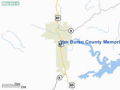
Van Buren County Memorial Hospital Heliport |
Location
& QuickFacts
| FAA
Information Effective: |
2005-10-27 |
| Airport
Identifier: |
31AR |
| Longitude/Latitude: |
092-27-12.5680W/35-34-33.2790N
-92.453491/35.575911 (Estimated) |
| Elevation: |
700
ft / 213.36 m (Estimated) |
| Land: |
0 acres |
| From
nearest city: |
2
nautical miles S of Clinton, AR |
| Location: |
Van Buren County, AR |
| Magnetic
Variation: |
04E
(1985) |
Owner
& Manager
| Ownership: |
Privately
owned |
| Address: |
P.o.
Box 206
Clinton, AR 72031 |
| Phone
number: |
501-745-2401 |
| Manager: |
Greg
Mc Neil, Admir. |
| Address: |
Van Buren
County, AR |
| Phone
number: |
501-745-2401 |
Airport
Operations and Facilities
| Airport
Use: |
Private
MEDICAL. |
| Wind
indicator: |
Yes |
| Segmented
Circle: |
No |
| Control
Tower: |
No |
| Attendance
Schedule: |
UNATNDD |
| Lighting
Schedule: |
PHONE
REQ
FOR PERIMETER LGTS CALL 501-745-2401. |
| Sectional
chart: |
Memphis |
| Region: |
ASW
- Southwest |
| Boundary
ARTCC: |
ZME
- Memphis |
| Tie-in
FSS: |
JBR
- Jonesboro |
| FSS
on Airport: |
No |
| FSS
Phone: |
870-935-3471 |
| FSS
Toll Free: |
1-800-WX-BRIEF |
Runway
Information
Helipad
H1
| Dimension: |
40 x 40 ft / 12.2 x 12.2
m |
| Surface: |
CONC,
|
| |
Runway
H1 |
Runway
|
|
Traffic Pattern: |
Left |
Left |
|
Radio
Navigation Aids
|
ID |
Type |
Name |
Ch |
Freq |
Var |
Dist |
| HBZ |
NDB |
Heber Springs |
|
256.00 |
03E |
22.0 nm |
| VLX |
NDB |
Wilcox |
|
348.00 |
02E |
24.8 nm |
| BDQ |
NDB |
Bridge |
|
208.00 |
04E |
29.2 nm |
| CWS |
NDB |
Conway |
|
302.00 |
05E |
29.6 nm |
| INY |
NDB |
Independence County |
|
317.00 |
03E |
33.3 nm |
| MPJ |
NDB |
Morrilton |
|
410.00 |
07E |
35.9 nm |
| RUE |
NDB |
Russellville |
|
379.00 |
03E |
36.8 nm |
| SRC |
NDB |
Searcy |
|
323.00 |
02E |
41.5 nm |
| TYV |
NDB |
Toneyville |
|
290.00 |
04E |
43.1 nm |
| CZE |
NDB |
Clarksville |
|
201.00 |
04E |
47.9 nm |
| LRF |
TACAN |
Jacksonville |
029X |
|
04E |
42.1 nm |
| FLP |
VOR/DME |
Flippin |
075X |
112.80 |
03E |
43.5 nm |
Van Buren County Memorial
Hospital Heliport
Address: Van Buren County,
AR
Tel: 501-745-2401
Images and information
placed above are from
http://www.airport-data.com/airport/31AR/
We
thank them for the data!
|
General Info |
| Country |
United
States |
| State |
ARKANSAS
|
| FAA
ID |
31AR
|
| Latitude |
35-34-33.279N
|
| Longitude |
092-27-12.568W
|
| Elevation |
700
feet |
| Near
City |
CLINTON
|
We don't guarantee the information is fresh and accurate. The data may be wrong or outdated.
For more up-to-date information please refer to other sources.
|
|


