 |
|
Location
& QuickFacts
|
FAA Information Effective: |
2005-10-27 |
|
Airport Identifier: |
HEE |
|
Longitude/Latitude: |
090-40-33.1910W/34-34-35.3630N
-90.675886/34.576490 (Estimated) |
|
Elevation: |
242
ft / 73.76 m (Surveyed) |
|
Land: |
610
acres |
|
From nearest city: |
5
nautical miles NW of Helena/west Helena, AR |
|
Location: |
Phillips
County, AR |
|
Magnetic Variation: |
01E
(2000) |
Owner &
Manager
|
Ownership: |
Publicly
owned |
|
Owner: |
Helena
West Helena |
|
Address: |
City
Of Helena
West Helena, AR 72342 |
|
Phone number: |
870-338-9831 |
|
Manager: |
Darryl
Riddell |
|
Address: |
Phillips
County, AR |
|
Phone number: |
870-572-9011 |
Airport
Operations and Facilities
|
Airport Use: |
Open
to public |
|
Wind indicator: |
Yes |
|
Segmented Circle: |
Yes |
|
Control Tower: |
No |
|
Attendance Schedule: |
ALL/MON-SAT/DALGT |
|
Lighting Schedule: |
DUSK-DAWN |
|
Beacon Color: |
Clear-Green
(lighted land airport) |
|
Landing fee charge: |
No |
|
Sectional chart: |
Memphis |
|
Region: |
ASW
- Southwest |
|
Traffic Pattern Alt: |
960
ft |
|
Boundary ARTCC: |
ZME
- Memphis |
|
Tie-in FSS: |
JBR
- Jonesboro |
|
FSS on Airport: |
No |
|
FSS Phone: |
870-935-3471 |
|
FSS Toll Free: |
1-800-WX-BRIEF |
|
NOTAMs Facility: |
JBR
(NOTAM-d service avaliable) |
|
Federal Agreements: |
NGRY3 |
Airport
Communications
| CTAF: |
122.800 |
|
Unicom: |
122.800
|
Airport
Services
|
Fuel available: |
100LLA |
|
Airframe Repair: |
MAJOR |
|
Power Plant Repair: |
MAJOR |
|
Bottled Oxygen: |
NONE |
|
Bulk Oxygen: |
NONE |
Runway
Information
Runway
08/26
|
Dimension: |
3009
x 60 ft / 917.1 x 18.3 m |
|
Surface: |
ASPH,
Fair Condition |
| Weight Limit: |
Single
wheel: 16000 lbs. |
|
Edge Lights: |
Medium |
| |
Runway 08 |
Runway 26 |
|
Longitude: |
090-40-40.4590W |
090-40-04.4800W |
| Latitude: |
34-34-20.2760N |
34-34-20.2400N |
|
Elevation: |
237.00
ft |
242.00
ft |
| Alignment: |
90 |
127 |
|
Traffic Pattern: |
Left |
Left |
| Markings: |
Basic,
Fair Condition |
Basic,
Fair Condition |
|
Runway
17/35
|
Dimension: |
5000
x 96 ft / 1524.0 x 29.3 m |
|
Surface: |
ASPH,
Fair Condition |
| Weight Limit: |
Single
wheel: 15000 lbs. |
|
Edge Lights: |
Medium |
| |
Runway 17 |
Runway 35 |
|
Longitude: |
090-40-39.4150W |
090-40-39.8950W |
| Latitude: |
34-35-09.1640N |
34-34-19.7080N |
|
Elevation: |
240.00
ft |
237.00
ft |
| Alignment: |
127 |
0 |
|
Traffic Pattern: |
Left |
Left |
| Markings: |
Non-precision instrument, Fair Condition |
Non-precision instrument, Fair Condition |
|
Crossing Height: |
39.00
ft |
53.00
ft |
| VASI: |
2-light PAPI on left side |
2-light PAPI on left side |
|
Visual Glide Angle: |
3.00° |
4.00° |
| Runway End Identifier: |
Yes |
Yes |
|
Radio Navigation
Aids
|
ID |
Type |
Name |
Ch |
Freq |
Var |
Dist |
| HEE |
NDB |
Thompson-robbins |
|
251.00 |
01E |
0.3
nm |
|
CKM |
NDB |
Clarksdale |
|
341.00 |
02E |
18.8
nm |
| FCY |
NDB |
Forrest
City |
|
332.00 |
01E |
22.4
nm |
|
BKZ |
NDB |
Brinkley |
|
242.00 |
02E |
30.8
nm |
| AWM |
NDB |
West
Memphis |
|
362.00 |
01E |
40.3
nm |
|
ME |
NDB |
Elvis |
|
287.00 |
01E |
41.7
nm |
| SGT |
NDB |
Stuttgart |
|
269.00 |
02E |
45.6
nm |
|
RNV |
NDB |
Renova |
|
272.00 |
04E |
46.4
nm |
| SPQ |
NDB |
Spain |
|
414.00 |
04E |
48.6
nm |
|
UJM |
VOR/DME |
Marvell |
033X |
109.60 |
01E |
0.1
nm |
| GQE |
VOR/DME |
Gilmore |
077X |
113.00 |
04E |
47.3
nm |
|
MEM |
VORTAC |
Memphis |
122X |
117.50 |
01E |
43.2
nm |
| MEM |
VOT |
Memphis
Metropolitn |
|
111.00 |
|
44.6
nm |
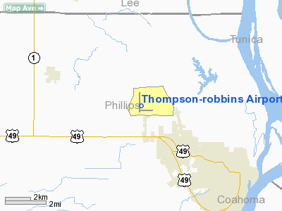
Thompson-robbins Airport
Address:
Phillips County, AR
Tel: 870-572-9011
Images and information placed
above are from
http://www.airport-data.com/airport/HEE/
We
thank them for the data!
|
General Info |
| Country |
United
States |
| State |
ARKANSAS
|
| FAA
ID |
HEE
|
| Latitude |
34-34-35.363N
|
| Longitude |
090-40-33.191W
|
| Elevation |
242
feet |
| Near
City |
HELENA/WEST
HELENA |
We don't guarantee the information is fresh and accurate. The data may be wrong or outdated.
For more up-to-date information please refer to other sources.
|
|


