 |
|
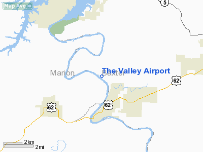
Location
& QuickFacts
|
FAA Information Effective: |
2005-10-27 |
|
Airport Identifier: |
61AR |
|
Longitude/Latitude: |
092-31-50.5840W/36-18-30.2440N
-92.530718/36.308401 (Estimated) |
|
Elevation: |
500
ft / 152.40 m (Estimated) |
|
Land: |
0
acres |
|
From nearest city: |
3
nautical miles N of Cotter, AR |
|
Location: |
Baxter
County, AR |
|
Magnetic Variation: |
04E
(1985) |
Owner &
Manager
|
Ownership: |
Privately
owned |
|
Owner: |
Valley
Aero Association |
|
Address: |
385
Valley Airport Drive
Cotter,
AR 72626 |
|
Phone number: |
501-430-5250 |
|
Manager: |
Valley
Aero Association |
|
Address: |
385
Valley Airport Drive
Cotter,
AR 72626 |
|
Phone number: |
501-430-5250 |
Airport
Operations and Facilities
|
Airport Use: |
Private |
|
Wind indicator: |
Yes |
|
Segmented Circle: |
Yes |
|
Control Tower: |
No |
|
Attendance Schedule: |
UNATNDD |
|
Landing fee charge: |
No |
|
Sectional chart: |
Kansas
City |
|
Region: |
ASW
- Southwest |
|
Boundary ARTCC: |
ZME
- Memphis |
|
Tie-in FSS: |
JBR
- Jonesboro |
|
FSS on Airport: |
No |
|
FSS Phone: |
870-935-3471 |
|
FSS Toll Free: |
1-800-WX-BRIEF |
Airport
Communications
Airport
Services
|
Airframe Repair: |
NONE |
|
Power Plant Repair: |
NONE |
Runway
Information
Runway
10/28
|
Dimension: |
2800
x 24 ft / 853.4 x 7.3 m |
|
Surface: |
ASPH,
|
| |
Runway 10 |
Runway 28 |
|
Traffic Pattern: |
Right |
Left |
|
Radio Navigation
Aids
|
ID |
Type |
Name |
Ch |
Freq |
Var |
Dist |
| VLX |
NDB |
Wilcox |
|
348.00 |
02E |
33.9
nm |
|
PLK |
NDB |
Point
Lookout/dcmsnd |
|
204.00 |
03E |
38.9
nm |
| AOV |
NDB |
Bilmart |
|
341.00 |
02E |
40.4
nm |
|
AJX |
NDB |
Ash
Flat |
|
344.00 |
03E |
45.5
nm |
| UNO |
NDB |
Pomona |
|
335.00 |
02E |
45.8
nm |
|
FLP |
VOR/DME |
Flippin |
075X |
112.80 |
03E |
3.5
nm |
| HRO |
VOR/DME |
Harrison |
072X |
112.50 |
04E |
33.1
nm |
|
HUW |
VOR/DME |
Hutton |
053X |
111.60 |
02E |
45.5
nm |
| DGD |
VORTAC |
Dogwood |
031X |
109.40 |
06E |
46.1
nm |
Remarks
- FLY-IN HOMESITE DEVELOPMENT--FACILITIES
BELONG TO OWNERS.
- 250-FOOT HILLS AND TREES
WITHIN 1/4 MILE ALL AROUND ARPT.
The Valley
Airport
Address:
Baxter County,
AR
Tel: 501-430-5250
Images and information placed
above are from
http://www.airport-data.com/airport/61AR/
We
thank them for the data!
|
General Info |
| Country |
United
States |
| State |
ARKANSAS
|
| FAA
ID |
61AR
|
| Latitude |
36-18-30.244N
|
| Longitude |
092-31-50.584W
|
| Elevation |
500
feet |
| Near
City |
COTTER
|
We don't guarantee the information is fresh and accurate. The data may be wrong or outdated.
For more up-to-date information please refer to other sources.
|
|


