 |
|
South Arkansas Regional At Goodwin Field Airport |
South Arkansas Regional Airport
at Goodwin Field |
| IATA: ELD – ICAO: KELD – FAA LID: ELD |
| Summary |
| Airport type |
Public |
| Owner |
City of El Dorado |
| Location |
El Dorado, Arkansas |
| Elevation AMSL |
277 ft / 84 m |
| Coordinates |
33°13′16″N 092°48′48″W / 33.22111°N 92.81333°W / 33.22111; -92.81333 |
| Runways |
| Direction |
Length |
Surface |
| ft |
m |
| 4/22 |
6,601 |
2,012 |
Asphalt |
| 13/31 |
5,100 |
1,554 |
Concrete |
| 17/35 (closed) |
3,733 |
1,138 |
Concrete |
| Statistics (2006) |
| Aircraft operations |
28,206 |
| Based aircraft |
41 |
| Source: Federal Aviation Administration |
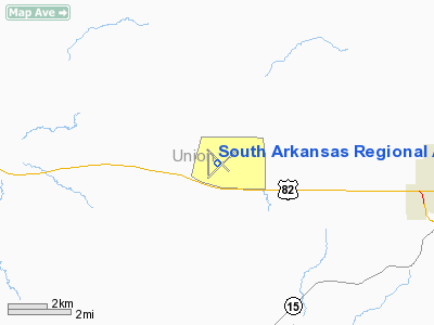
South Arkansas Regional Airport at Goodwin Field (IATA: ELD, ICAO: KELD, FAA LID: ELD) is a public airport located eight miles (13 km) west of the central business district of El Dorado, a city in Union County, Arkansas, United States. It is mostly used for general aviation, but is also served by one commercial airline. Service is subsidized by the Essential Air Service program.
As per Federal Aviation Administration records, the airport had 2,182 passenger boardings (enplanements) in calendar year 2005 and 1,954 enplanements in 2006. According to the FAA's National Plan of Integrated Airport Systems for 2007-2011, it is a general aviation airport (the commercial service category requires at least 2,500 passenger boardings per year). Facilities and aircraft
South Arkansas Regional Airport covers an area of 1,540 acres (623 ha) and has two runways now that 17/35 has been closed: 4/22 with an asphalt paved surface measuring 6,601 x 150 ft (2,012 x 46 m) and 13/31 with a concrete paved surface measuring 5,100 x 100 ft (1,554 x 30 m).
For the 12-month period ending April 30, 2006, the airport had 28,206 aircraft operations, an average of 77 per day: 81% general aviation, 17% air taxi and 2% military. There are 41 aircraft based at this airport: 73% single engine, 12% multi-engine, 12% jet aircraft and 2% helicopters.
Airline and destinations
| Airlines |
Destinations |
| SeaPort Airlines |
Memphis |
The above content comes from Wikipedia and is published under free licenses – click here to read more.
Location
& QuickFacts
| FAA
Information Effective: |
2005-10-27 |
| Airport
Identifier: |
ELD |
| Longitude/Latitude: |
092-48-47.8000W/33-13-15.5000N
-92.813278/33.220972 (Estimated) |
| Elevation: |
277
ft / 84.43 m (Surveyed) |
| Land: |
1540 acres |
| From
nearest city: |
8
nautical miles W of El Dorado, AR |
| Location: |
Union County, AR |
| Magnetic
Variation: |
03E
(2000) |
Owner &
Manager
| Ownership: |
Publicly owned |
| Owner: |
City
Of El Dorado |
| Address: |
Po
Box 2170
El Dorado, AR 71731 |
| Phone
number: |
870-862-7911 |
| Manager: |
Gary Harrell |
| Address: |
418
Airport Dr.
El Dorado, AR 71730 |
| Phone
number: |
870-881-4192 |
Airport
Operations and Facilities
| Airport
Use: |
Open to public |
| Wind
indicator: |
Yes |
| Segmented
Circle: |
No |
| Control
Tower: |
No |
| Attendance
Schedule: |
ALL/MON-SAT/0700-1800,ALL/SUN/1300-1800
FOR SVC AFT HRS CALL 870-862-7516; FEE CHARGED. |
| Lighting
Schedule: |
DUSK-DAWN
HIRL RY 04/22 PRESET LOW INTST; TO INCR INTST & ACTVT MIRL RY
13/31; MALSR RY 22 & TWY LGTS - CTAF. |
| Beacon
Color: |
Clear-Green
(lighted land airport) |
| Landing
fee charge: |
No |
| Sectional
chart: |
Memphis |
| Region: |
ASW
- Southwest |
| Traffic
Pattern Alt: |
1000 ft |
| Boundary
ARTCC: |
ZFW
- Fort Worth |
| Tie-in
FSS: |
JBR - Jonesboro |
| FSS
on Airport: |
No |
| FSS
Phone: |
870-935-3471 |
| FSS
Toll Free: |
1-800-WX-BRIEF |
| NOTAMs
Facility: |
ELD
(NOTAM-d service avaliable) |
| Federal
Agreements: |
NGY3 |
Airport
Communications
| CTAF: |
123.000 |
| Unicom: |
123.000
|
Airport
Services
Runway
Information
Runway
04/22
| Dimension: |
6601
x 150 ft / 2012.0 x 45.7 m
PAVEMENT 150 FT WIDE; EDGES NOT MARKED; CENTER 75 FT USABLE. REMAINDER
75 FT HAS CRACKS & VEGETATION. |
| Surface: |
ASPH, Good Condition |
| Surface Treatment: |
Saw-cut or plastic
Grooved |
| Weight
Limit: |
Single
wheel: 75000 lbs.
Dual wheel: 200000 lbs. |
| Edge Lights: |
High |
| |
Runway 04 |
Runway 22 |
| Longitude: |
092-49-07.5508W |
092-48-11.7312W |
| Latitude: |
33-12-50.1877N |
33-13-35.6139N |
| Elevation: |
259.00 ft |
259.00 ft |
| Alignment: |
46 |
127 |
| Traffic Pattern: |
Left |
Left |
| Markings: |
Non-precision
instrument, Good Condition |
Precision
instrument, Good Condition |
| Crossing
Height: |
49.00 ft |
55.00 ft |
| VASI: |
4-light
PAPI on left side |
4-light
PAPI on left side |
| Visual Glide
Angle: |
3.00° |
3.00° |
| Approach
lights: |
|
MALSR |
| Obstruction: |
50 ft trees,
1200.0 ft from runway, 20:1 slope to clear |
, 50:1 slope to clear |
|
Runway
13/31
| Dimension: |
5100
x 100 ft / 1554.5 x 30.5 m
PAVEMENT 150 FT WIDE; EDGES NOT MARKED; CENTER 75 FT USABLE. REMAINDER
75 FT HAS CRACKS & VEGETATION. |
| Surface: |
CONC, Good Condition |
| Weight Limit: |
Single wheel: 25000 lbs.
|
| Edge
Lights: |
Medium |
| |
Runway 13 |
Runway 31 |
| Longitude: |
092-49-06.6122W |
092-48-24.8527W |
| Latitude: |
33-13-39.1845N |
33-13-02.9309N |
| Elevation: |
277.00 ft |
243.00 ft |
| Alignment: |
127 |
127 |
| Traffic Pattern: |
Left |
Left |
| Markings: |
Basic, Good
Condition |
Basic, Good
Condition |
| Obstruction: |
50 ft trees,
1050.0 ft from runway, 17:1 slope to clear |
50 ft tree,
700.0 ft from runway, 10:1 slope to clear |
|
Runway
17/35
| Dimension: |
3733
x 75 ft / 1137.8 x 22.9 m
PAVEMENT 150 FT WIDE; EDGES NOT MARKED; CENTER 75 FT USABLE. REMAINDER
75 FT HAS CRACKS & VEGETATION. |
| Surface: |
CONC, Poor Condition |
| Weight Limit: |
Single wheel: 25000 lbs.
|
| |
Runway 17 |
Runway 35 |
| Longitude: |
092-49-04.6851W |
092-49-05.3951W |
| Latitude: |
33-13-31.0375N |
33-12-54.1132N |
| Elevation: |
275.00 ft |
258.00 ft |
| Alignment: |
127 |
1 |
| Traffic Pattern: |
Left |
Left |
| Markings: |
Basic,
Poor Condition
/35 MKGS FADED OR MISSING; COVERED BY VEGETATION. |
Basic, Poor
Condition |
| Obstruction: |
50 ft trees,
2305.0 ft from runway, 42:1 slope to clear |
, 50:1 slope to clear |
|
Radio Navigation
Aids
|
ID |
Type |
Name |
Ch |
Freq |
Var |
Dist |
| AGO |
NDB |
Magnolia |
|
266.00 |
04E |
20.2 nm |
| CDH |
NDB |
Camden |
|
335.00 |
03E |
23.7 nm |
| HMQ |
NDB |
Homer |
|
212.00 |
02E |
27.6 nm |
| SPH |
NDB |
Springhill |
|
375.00 |
05E |
35.0 nm |
| ROQ |
NDB |
Ruston |
|
368.00 |
03E |
38.5 nm |
| REN |
NDB |
Warren |
|
226.00 |
04E |
41.0 nm |
| MNE |
NDB |
Minden |
|
201.00 |
04E |
42.7 nm |
| ELD |
VORTAC |
El Dorado |
102X |
115.50 |
07E |
4.1 nm |
Remarks
- DEER ON & INVOF RYS.
- RY 17 HAS A HUMP LCTD
NEAR THLD.
- TWY A CLSD FM TERMINAL
RAMP TO AER 31 INDEFLY.
- RY 17/35 CLSD INDEFLY.
South Arkansas Regional
At Goodwin Field Airport
Address: Union County, AR
Tel: 870-881-4192
Images and information placed
above are from
http://www.airport-data.com/airport/ELD/
We
thank them for the data!
|
General Info |
| Country |
United
States |
| State |
ARKANSAS
|
| FAA
ID |
ELD
|
| Latitude |
33-13-15.105N
|
| Longitude |
092-48-47.706W
|
| Elevation |
277
feet |
| Near
City |
EL
DORADO |
We don't guarantee the information is fresh and accurate. The data may be wrong or outdated.
For more up-to-date information please refer to other sources.
|
|


