 |
|
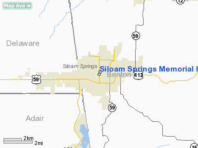
Siloam Springs Memorial Hospital Heliport |
Location
& QuickFacts
| FAA
Information Effective: |
2005-10-27 |
| Airport
Identifier: |
AR69 |
| Longitude/Latitude: |
094-32-27.7860W/36-10-53.2910N
-94.541052/36.181470 (Estimated) |
| Elevation: |
1140
ft / 347.47 m (Estimated) |
| Land: |
0
acres |
| From
nearest city: |
0
nautical miles N of Siloam Springs, AR |
| Location: |
Benton
County, AR |
| Magnetic
Variation: |
05E
(1985) |
Owner &
Manager
|
Ownership: |
Publicly
owned |
|
Owner: |
Siloam
Springs Mem Hosp |
| Address: |
205
E Jefferson
Siloam Springs, AR 72761 |
| Phone
number: |
501-524-4141 |
| Manager: |
Larry
N Winder Adm |
| Address: |
205
E Jefferson
Siloam Springs, AR 72761 |
| Phone
number: |
501-524-4141 |
Airport
Operations and Facilities
| Airport
Use: |
Open
to public
MEDICAL. |
| Segmented
Circle: |
No |
| Control
Tower: |
No |
| Attendance
Schedule: |
UNATNDD |
| Sectional
chart: |
Kansas
City |
| Region: |
ASW
- Southwest |
| Boundary
ARTCC: |
ZME
- Memphis |
| Tie-in
FSS: |
JBR
- Jonesboro |
| FSS
Phone: |
870-935-3471 |
| FSS
Toll Free: |
1-800-WX-BRIEF |
Runway Information
Helipad
H1
| Dimension: |
50
x 50 ft / 15.2 x 15.2 m |
| Surface: |
ASPH,
|
| |
Runway
H1 |
Runway
|
| Traffic Pattern: |
Left |
Left |
|
Radio Navigation
Aids
| ID |
Type |
Name |
Ch |
Freq |
Var |
Dist |
| SLG |
NDB |
Siloam
Springs |
|
284.00 |
04E |
2.6
nm |
| TQH |
NDB |
Tahlequah |
|
215.00 |
05E |
27.3
nm |
| IQS |
NDB |
Sallisaw |
|
520.00 |
05E |
48.6
nm |
| DAK |
VOR/DME |
Drake |
025X |
108.80 |
07E |
18.6
nm |
| EOS |
VOR/DME |
Neosho |
120X |
117.30 |
07E |
40.1
nm |
| RZC |
VORTAC |
Razorback |
111X |
116.40 |
04E |
20.7
nm |
| FSM |
VORTAC |
Fort
Smith |
041X |
110.40 |
07E |
49.4
nm |
Remarks
Siloam
Springs Memorial Hospital Heliport
Address:
Benton County,
AR
Tel: 501-524-4141
Images
and information placed above are from
http://www.airport-data.com/airport/AR69/
We thank
them for the data!
| General Info |
| Country |
United
States |
| State |
ARKANSAS
|
| FAA
ID |
AR69
|
| Latitude |
36-10-53.291N
|
| Longitude |
094-32-27.786W
|
| Elevation |
1140
feet |
| Near
City |
SILOAM
SPRINGS |
We don't guarantee the information is fresh and accurate. The data may be wrong or outdated.
For more up-to-date information please refer to other sources.
|
|


