 |
|
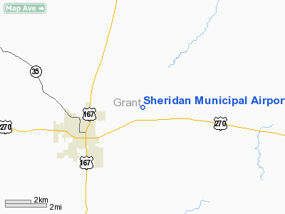
Sheridan Municipal Airport |
Location
& QuickFacts
|
FAA Information Effective: |
2005-10-27 |
|
Airport Identifier: |
9M8 |
|
Longitude/Latitude: |
092-21-03.5490W/34-19-42.3450N
-92.350986/34.328429 (Estimated) |
|
Elevation: |
232
ft / 70.71 m (Estimated) |
|
Land: |
79
acres |
|
From nearest city: |
3
nautical miles E of Sheridan, AR |
|
Location: |
Grant
County, AR |
|
Magnetic Variation: |
04E
(1985) |
Owner &
Manager
|
Ownership: |
Publicly
owned |
|
Owner: |
Sheridan
& Grant County |
|
Address: |
Po
Box 44
Sheridan, AR 72150 |
|
Phone number: |
870-942-3921 |
|
Manager: |
Airport
Commission |
|
Address: |
233
Airport Road
Sheridan, AR 72150 |
|
Phone number: |
870-917-8054 |
Airport
Operations and Facilities
|
Airport Use: |
Open
to public |
|
Wind indicator: |
Yes |
|
Segmented Circle: |
No |
|
Control Tower: |
No |
|
Attendance Schedule: |
ALL/ALL/0800-1730 |
|
Lighting Schedule: |
DUSK-DAWN |
|
Beacon Color: |
Clear-Green
(lighted land airport) |
|
Landing fee charge: |
No |
|
Sectional chart: |
Memphis |
|
Region: |
ASW
- Southwest |
|
Boundary ARTCC: |
ZME
- Memphis |
|
Tie-in FSS: |
JBR
- Jonesboro |
|
FSS on Airport: |
No |
|
FSS Phone: |
870-935-3471 |
|
FSS Toll Free: |
1-800-WX-BRIEF |
|
NOTAMs Facility: |
JBR
(NOTAM-d service avaliable) |
|
Federal Agreements: |
N |
Airport
Communications
| CTAF: |
122.800 |
|
Unicom: |
122.800
|
Airport
Services
|
Fuel available: |
100LLMOGAS |
|
Airframe Repair: |
MAJOR |
|
Power Plant Repair: |
MAJOR |
Runway
Information
Runway
01/19
|
Dimension: |
3000
x 50 ft / 914.4 x 15.2 m |
|
Surface: |
ASPH,
Fair Condition |
| Weight Limit: |
Single
wheel: 12500 lbs. |
|
Edge Lights: |
Medium |
| |
Runway 01 |
Runway 19 |
|
Traffic Pattern: |
Left |
Left |
| Markings: |
Basic,
Fair Condition |
Basic,
Good Condition |
|
Obstruction: |
60 ft trees, 1400.0 ft from runway, 20:1 slope to clear |
50 ft trees, 1200.0 ft from runway, 20:1 slope to clear |
|
Radio Navigation
Aids
|
ID |
Type |
Name |
Ch |
Freq |
Var |
Dist |
| MVQ |
NDB |
Malvern |
|
215.00 |
04E |
20.4
nm |
|
ADF |
NDB |
Arkadelphia |
|
275.00 |
02E |
40.9
nm |
| TYV |
NDB |
Toneyville |
|
290.00 |
04E |
40.9
nm |
|
HO |
NDB |
Hossy |
|
385.00 |
04E |
42.0
nm |
| SGT |
NDB |
Stuttgart |
|
269.00 |
02E |
42.7
nm |
|
CWS |
NDB |
Conway |
|
302.00 |
05E |
45.6
nm |
| CDH |
NDB |
Camden |
|
335.00 |
03E |
47.7
nm |
|
REN |
NDB |
Warren |
|
226.00 |
04E |
48.7
nm |
| LRF |
TACAN |
Jacksonville |
029X |
|
04E |
36.7
nm |
|
PBF |
VOR/DME |
Pine
Bluff |
107X |
116.00 |
04E |
21.7
nm |
| HOT |
VOR/DME |
Hot
Springs |
037X |
110.00 |
04E |
37.8
nm |
|
LIT |
VORTAC |
Little
Rock |
086X |
113.90 |
05E |
22.6
nm |
Sheridan Municipal
Airport
Address:
Grant County, AR
Tel: 870-917-8054
Images and information placed
above are from
http://www.airport-data.com/airport/9M8/
We
thank them for the data!
|
General Info |
| Country |
United
States |
| State |
ARKANSAS
|
| FAA
ID |
9M8
|
| Latitude |
34-19-42.345N
|
| Longitude |
092-21-03.549W
|
| Elevation |
232
feet |
| Near
City |
SHERIDAN
|
We don't guarantee the information is fresh and accurate. The data may be wrong or outdated.
For more up-to-date information please refer to other sources.
|
|


