 |
|
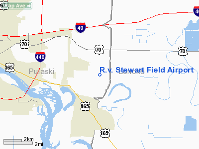
R.v. Stewart Field Airport |
Location
& QuickFacts
|
FAA Information Effective: |
2005-10-27 |
|
Airport Identifier: |
AR55 |
|
Longitude/Latitude: |
092-05-24.5180W/34-44-23.3280N
-92.090144/34.739813 (Estimated) |
|
Elevation: |
251
ft / 76.50 m (Estimated) |
|
Land: |
52
acres |
|
From nearest city: |
6
nautical miles E of North Little Rock, AR |
|
Location: |
Pulaski
County, AR |
|
Magnetic Variation: |
04E
(1985) |
Owner &
Manager
|
Ownership: |
Privately
owned |
|
Owner: |
R.v.
Stewart |
|
Address: |
15926
Faulkner Lake Road
North Little Rock , AR 72117 |
|
Phone number: |
501-961-1054 |
|
Manager: |
R.v.
Stewart |
|
Address: |
15926
Faulkner Lake Road
North Little Rock , AR 72117 |
|
Phone number: |
501-961-1054 |
Airport
Operations and Facilities
|
Airport Use: |
Private |
|
Wind indicator: |
Yes |
|
Segmented Circle: |
No |
|
Control Tower: |
No |
|
Attendance Schedule: |
UNATNDD |
|
Sectional chart: |
Memphis |
|
Region: |
ASW
- Southwest |
|
Boundary ARTCC: |
ZME
- Memphis |
|
Tie-in FSS: |
JBR
- Jonesboro |
|
FSS Phone: |
870-935-3471 |
|
FSS Toll Free: |
1-800-WX-BRIEF |
Airport
Services
|
Fuel available: |
100LLMOGAS |
Runway
Information
Runway
18/36
|
Dimension: |
2800
x 110 ft / 853.4 x 33.5 m |
|
Surface: |
TURF,
|
| |
Runway 18 |
Runway 36 |
|
Traffic Pattern: |
Left |
Left |
|
Radio Navigation
Aids
|
ID |
Type |
Name |
Ch |
Freq |
Var |
Dist |
| TYV |
NDB |
Toneyville |
|
290.00 |
04E |
13.3
nm |
|
SGT |
NDB |
Stuttgart |
|
269.00 |
02E |
25.0
nm |
| CWS |
NDB |
Conway |
|
302.00 |
05E |
26.5
nm |
|
SRC |
NDB |
Searcy |
|
323.00 |
02E |
33.4
nm |
| BDQ |
NDB |
Bridge |
|
208.00 |
04E |
38.9
nm |
|
MVQ |
NDB |
Malvern |
|
215.00 |
04E |
41.3
nm |
| BKZ |
NDB |
Brinkley |
|
242.00 |
02E |
45.8
nm |
|
HBZ |
NDB |
Heber
Springs |
|
256.00 |
03E |
46.7
nm |
| MPJ |
NDB |
Morrilton |
|
410.00 |
07E |
47.0
nm |
|
LRF |
TACAN |
Jacksonville |
029X |
|
04E |
11.2
nm |
| PBF |
VOR/DME |
Pine
Bluff |
107X |
116.00 |
04E |
30.7
nm |
|
LIT |
VORTAC |
Little
Rock |
086X |
113.90 |
05E |
5.8
nm |
R.v. Stewart Field Airport
Address:
Pulaski County,
AR
Tel: 501-961-1054
Images and information placed
above are from
http://www.airport-data.com/airport/AR55/
We
thank them for the data!
|
General Info |
| Country |
United
States |
| State |
ARKANSAS
|
| FAA
ID |
AR55
|
| Latitude |
34-44-23.328N
|
| Longitude |
092-05-24.518W
|
| Elevation |
251
feet |
| Near
City |
NORTH
LITTLE ROCK |
We don't guarantee the information is fresh and accurate. The data may be wrong or outdated.
For more up-to-date information please refer to other sources.
|
|


