 |
|
Location
& QuickFacts
|
FAA Information Effective: |
2005-10-27 |
|
Airport Identifier: |
70AR |
|
Longitude/Latitude: |
089-59-50.3210W/35-59-40.2550N
-89.997311/35.994515 (Estimated) |
|
Elevation: |
242
ft / 73.76 m (Estimated) |
|
Land: |
0
acres |
|
From nearest city: |
3
nautical miles NW of Gosnell, AR |
|
Location: |
Mississippi
County, AR |
|
Magnetic Variation: |
02E
(1985) |
Owner &
Manager
|
Ownership: |
Privately
owned |
|
Owner: |
James
C. Price |
|
Address: |
6653
N Hwy 151, Rte 3 Box 417c
Blytheville, AR 72315 |
|
Phone number: |
501-532-5525 |
|
Address: |
Mississippi
County, AR |
Airport
Operations and Facilities
|
Airport Use: |
Private |
|
Segmented Circle: |
No |
|
Control Tower: |
No |
|
Attendance Schedule: |
UNATNDD |
|
Sectional chart: |
Memphis |
|
Region: |
ASW
- Southwest |
|
Boundary ARTCC: |
ZME
- Memphis |
|
Tie-in FSS: |
JBR
- Jonesboro |
|
FSS on Airport: |
No |
|
FSS Phone: |
870-935-3471 |
|
FSS Toll Free: |
1-800-WX-BRIEF |
Airport
Services
|
Airframe Repair: |
NONE |
|
Power Plant Repair: |
NONE |
Runway
Information
Runway
09/27
|
Dimension: |
2400
x 75 ft / 731.5 x 22.9 m |
|
Surface: |
TURF,
|
| |
Runway 09 |
Runway 27 |
|
Traffic Pattern: |
Left |
Left |
|
Radio Navigation
Aids
|
ID |
Type |
Name |
Ch |
Freq |
Var |
Dist |
| IUI |
NDB |
Hicks |
|
350.00 |
01E |
8.7
nm |
|
MXA |
NDB |
Manila |
|
282.00 |
01E |
9.9
nm |
| TKX |
NDB |
Kennett |
|
358.00 |
00E |
14.2
nm |
|
BPW |
NDB |
Osceola |
|
239.00 |
02E |
18.2
nm |
| PGR |
NDB |
Paragould |
|
383.00 |
01E |
25.3
nm |
|
DNT |
NDB |
Nally
Dunston |
|
343.00 |
01W |
28.8
nm |
| COO |
NDB |
Covington |
|
326.00 |
02E |
31.5
nm |
|
MIG |
NDB |
Millington |
|
232.00 |
04E |
43.1
nm |
| FD |
NDB |
Earli |
|
278.00 |
03E |
43.5
nm |
|
TNZ |
NDB |
Lawrence
County |
|
227.00 |
01E |
46.7
nm |
| SPQ |
NDB |
Spain |
|
414.00 |
04E |
47.7
nm |
|
DXE |
NDB |
Dexter |
|
423.00 |
00E |
47.8
nm |
| GOJ |
VOR |
Gosnell |
|
111.80 |
01E |
3.8
nm |
|
JBR |
VOR/DME |
Jonesboro |
023X |
108.60 |
02E |
29.7
nm |
| GQE |
VOR/DME |
Gilmore |
077X |
113.00 |
04E |
45.5
nm |
|
DYR |
VORTAC |
Dyersburg |
115X |
116.80 |
03E |
33.1
nm |
| MAW |
VORTAC |
Malden |
049X |
111.20 |
03E |
34.0
nm |
|
ARG |
VORTAC |
Walnut
Ridge |
092X |
114.50 |
04E |
47.0
nm |
Remarks
- RESTRD TO CONDS PER FAA
FORM 2681.COMPATIBLE TFC PAT WITH BYH/AFB.
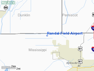
Randal Field
Airport
Address:
Mississippi
County, AR
Tel: 501-532-5525
Images and information placed
above are from
http://www.airport-data.com/airport/70AR/
We
thank them for the data!
|
General Info |
| Country |
United
States |
| State |
ARKANSAS
|
| FAA
ID |
70AR
|
| Latitude |
35-59-40.255N
|
| Longitude |
089-59-50.321W
|
| Elevation |
242
feet |
| Near
City |
GOSNELL
|
We don't guarantee the information is fresh and accurate. The data may be wrong or outdated.
For more up-to-date information please refer to other sources.
|
|


