 |
|
Location
& QuickFacts
|
FAA Information Effective: |
2005-10-27 |
|
Airport Identifier: |
5AR8 |
|
Longitude/Latitude: |
094-07-00.6950W/33-37-00.4350N
-94.116860/33.616788 (Estimated) |
|
Elevation: |
321
ft / 97.84 m (Estimated) |
|
Land: |
0
acres |
|
From nearest city: |
3
nautical miles S of Ashdown, AR |
|
Location: |
Little
River County, AR |
|
Magnetic Variation: |
05E
(1985) |
Owner &
Manager
|
Ownership: |
Privately
owned |
|
Owner: |
Bunn
Fawcett |
|
Address: |
Route
3, Box 90
Ashdown, AR 71822 |
|
Phone number: |
501-898-5254 |
|
Manager: |
Bunm
Fawceit |
|
Address: |
Route
3, Box 90
Ashdown, AR 71822 |
|
Phone number: |
501-898-5254 |
Airport
Operations and Facilities
|
Airport Use: |
Private |
|
Wind indicator: |
Yes |
|
Segmented Circle: |
No |
|
Control Tower: |
No |
|
Attendance Schedule: |
UNATNDD |
|
Landing fee charge: |
No |
|
Sectional chart: |
Memphis |
|
Region: |
ASW
- Southwest |
|
Boundary ARTCC: |
ZFW
- Fort Worth |
|
Tie-in FSS: |
JBR
- Jonesboro |
|
FSS on Airport: |
No |
|
FSS Phone: |
870-935-3471 |
|
FSS Toll Free: |
1-800-WX-BRIEF |
Airport
Services
|
Airframe Repair: |
NONE |
|
Power Plant Repair: |
NONE |
Runway
Information
Runway
14/32
|
Dimension: |
3168
x 45 ft / 965.6 x 13.7 m |
|
Surface: |
TURF,
|
| |
Runway 14 |
Runway 32 |
|
Traffic Pattern: |
Left |
Left |
|
Radio Navigation
Aids
|
ID |
Type |
Name |
Ch |
Freq |
Var |
Dist |
| HPC |
NDB |
Hope |
|
362.00 |
03E |
24.2
nm |
|
DEQ |
NDB |
De
Queen |
|
281.00 |
04E |
29.4
nm |
| ATA |
NDB |
Atlanta |
|
347.00 |
04E |
31.1
nm |
|
IBO |
NDB |
Idabel |
|
271.00 |
03E |
40.2
nm |
| VIV |
NDB |
Vivian |
|
284.00 |
06E |
45.8
nm |
|
TXK |
VORTAC |
Texarkana |
110X |
116.30 |
07E |
6.6
nm |
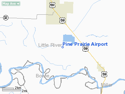
Pine Prairie Airport
Address:
Little River
County, AR
Tel: 501-898-5254
Images and information placed
above are from
http://www.airport-data.com/airport/5AR8/
We
thank them for the data!
|
General Info |
| Country |
United
States |
| State |
ARKANSAS
|
| FAA
ID |
5AR8
|
| Latitude |
33-37-00.435N
|
| Longitude |
094-07-00.695W
|
| Elevation |
321
feet |
| Near
City |
ASHDOWN
|
We don't guarantee the information is fresh and accurate. The data may be wrong or outdated.
For more up-to-date information please refer to other sources.
|
|


