 |
|
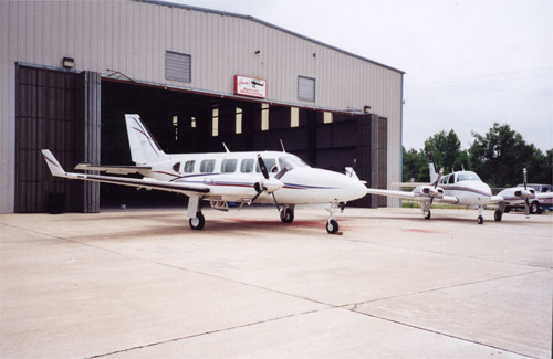
Ozark-franklin County Airport |

- Centrally Located in
Ozark, Franklin County, Arkansas
- 28 Years Experience in
the Aircraft Industry
- 2 Year Warranty on Workmanshi
Location
& QuickFacts
| FAA
Information Effective: |
2005-10-27 |
| Airport
Identifier: |
7M5 |
| Longitude/Latitude: |
093-50-21.5070W/35-30-38.5050N
-93.839307/35.510696 (Estimated) |
| Elevation: |
648
ft / 197.51 m (Surveyed) |
| Land: |
46 acres |
| From
nearest city: |
2
nautical miles NW of Ozark, AR |
| Location: |
Franklin County, AR |
| Magnetic
Variation: |
04E
(1995) |
Owner &
Manager
| Ownership: |
Publicly owned |
| Owner: |
Don
Gray |
| Address: |
Po Box 596
Ozark, AR 72949 |
| Phone
number: |
800-322-GRAY
501-667-3359 |
| Url: |
www.grayaircraft.com
|
| Manager: |
Dale
Gray |
| Address: |
Franklin County, AR |
| Phone
number: |
501-667-3359 |
| Email: |
grayaircraft@ar-digit.net
|
Airport
Operations and Facilities
| Airport
Use: |
Open to public |
| Wind
indicator: |
Yes |
| Segmented
Circle: |
Yes |
| Control
Tower: |
No |
| Attendance
Schedule: |
ALL/MON-SAT/0800-1700 |
| Lighting
Schedule: |
DUSK-DAWN
ACTVT MIRL RY 04/22 - CTAF. |
| Beacon
Color: |
Clear-Green
(lighted land airport) |
| Landing
fee charge: |
No |
| Sectional
chart: |
Memphis |
| Region: |
ASW
- Southwest |
| Boundary
ARTCC: |
ZME - Memphis |
| Tie-in
FSS: |
JBR
- Jonesboro |
| FSS
on Airport: |
No |
| FSS
Phone: |
870-935-3471 |
| FSS
Toll Free: |
1-800-WX-BRIEF |
| NOTAMs
Facility: |
JBR
(NOTAM-d service avaliable) |
| Federal
Agreements: |
NGY |
Airport
Communications
| CTAF: |
122.800 |
|
Unicom: |
122.800
|
Airport
Services
| Fuel
available: |
100LL |
| Airframe
Repair: |
MAJOR |
| Power
Plant Repair: |
MAJOR |
| Bottled
Oxygen: |
NONE |
| Bulk
Oxygen: |
NONE |
Runway
Information
Runway
04/22
| Dimension: |
3302 x
60 ft / 1006.4 x 18.3 m |
| Surface: |
ASPH, Good Condition |
| Weight Limit: |
Single wheel: 12000 lbs.
|
| Edge
Lights: |
Medium |
| |
Runway 04 |
Runway 22 |
| Longitude: |
093-50-36.1800W |
093-50-06.8250W |
| Latitude: |
35-30-27.4240N |
35-30-49.5640N |
| Elevation: |
606.00 ft |
648.00 ft |
| Alignment: |
47 |
127 |
| Traffic
Pattern: |
Left |
Left |
| Markings: |
Non-precision
instrument, Good Condition |
Non-precision
instrument, Good Condition |
| Crossing
Height: |
40.00 ft |
40.00 ft |
| VASI: |
2-light PAPI
on left side |
2-light PAPI
on left side |
| Visual
Glide Angle: |
3.00° |
3.00° |
| Obstruction: |
5 ft bldg,
250.0 ft from runway, 10:1 slope to clear |
50 ft tree,
913.0 ft from runway, 411 ft right of centerline, 14:1 slope
to clear |
|
Radio Navigation
Aids
|
ID |
Type |
Name |
Ch |
Freq |
Var |
Dist |
| CZE |
NDB |
Clarksville |
|
201.00 |
04E |
20.5 nm |
| RUE |
NDB |
Russellville |
|
379.00 |
03E |
39.5 nm |
| IQS |
NDB |
Sallisaw |
|
520.00 |
05E |
47.2 nm |
| DAK |
VOR/DME |
Drake |
025X |
108.80 |
07E |
36.4 nm |
| FSM |
VORTAC |
Fort Smith |
041X |
110.40 |
07E |
22.4 nm |
| RZC |
VORTAC |
Razorback |
111X |
116.40 |
04E |
46.3 nm |
Ozark-franklin County
Airport
P.O. Box 596
Ozark, AR 72949
Tel (800) 322-GRAY
Tel (501) 667-3359
E-mail: grayaircraft@ar-digit.net
URL: http://www.grayaircraft.com
Images
and information placed above are from
http://www.airport-data.com/airport/7M5/
http://www.grayaircraft.com
We thank them for the data!
|
General Info |
| Country |
United
States |
| State |
ARKANSAS
|
| FAA
ID |
7M5
|
| Latitude |
35-30-38.505N
|
| Longitude |
093-50-21.507W
|
| Elevation |
648
feet |
| Near
City |
OZARK
|
We don't guarantee the information is fresh and accurate. The data may be wrong or outdated.
For more up-to-date information please refer to other sources.
|
|


