 |
|
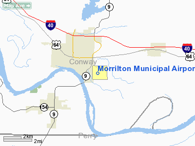
Morrilton Municipal Airport |
Location & QuickFacts
| FAA
Information Effective: |
2005-10-27 |
|
Airport Identifier: |
BDQ |
| Longitude/Latitude: |
092-42-48.5900W/35-08-10.3030N
-92.713497/35.136195 (Estimated) |
|
Elevation: |
321
ft / 97.84 m (Estimated) |
| Land: |
100 acres |
|
From nearest city: |
2 nautical miles SE of Morrilton, AR |
| Location: |
Conway County, AR |
|
Magnetic Variation: |
04E
(1985) |
Owner & Manager
| Ownership: |
Publicly owned |
|
Owner: |
City Of Morrilton
MORRILTON AIRPORT COMMISSION. |
| Address: |
Po Box 438
Morrilton, AR 72110 |
|
Phone number: |
501-354-3484 |
| Manager: |
Garry Lilley |
|
Address: |
1
Airport Road
Morrilton, AR 72110 |
| Phone
number: |
501-354-8020 |
Airport Operations and Facilities
| Airport
Use: |
Open to public |
|
Wind indicator: |
Yes |
| Segmented
Circle: |
Yes |
|
Control Tower: |
No |
| Attendance
Schedule: |
ALL/ALL/0800-1800
FOR SVC AFT HRS CALL 501-354-5347. |
|
Lighting Schedule: |
DUSK-DAWN
ACTVT MIRL RY 09/27 - 122.9. |
| Beacon
Color: |
Clear-Green
(lighted land airport) |
|
Landing fee charge: |
No |
| Sectional
chart: |
Memphis |
|
Region: |
ASW
- Southwest |
| Boundary
ARTCC: |
ZME - Memphis |
|
Tie-in FSS: |
JBR
- Jonesboro |
| FSS
on Airport: |
No |
|
FSS Phone: |
870-935-3471 |
| FSS
Toll Free: |
1-800-WX-BRIEF |
|
NOTAMs Facility: |
JBR (NOTAM-d service avaliable) |
| Federal
Agreements: |
NGY |
Airport
Communications
|
CTAF: |
122.800 |
|
Unicom: |
122.800 |
Airport
Services
| Fuel
available: |
100LL
SELF SERVICE FUEL WITH CREDIT CARD. |
|
Airframe Repair: |
MAJOR |
| Power
Plant Repair: |
MAJOR |
Runway Information
Runway 09/27
| Dimension: |
4000
x 50 ft / 1219.2 x 15.2 m |
| Surface: |
ASPH, Fair Condition |
| Weight Limit: |
Single wheel: 4000 lbs.
|
| Edge
Lights: |
Medium |
|
|
Runway 09 |
Runway 27 |
| Longitude: |
092-43-12.1900W |
092-42-24.7900W |
| Latitude: |
35-08-00.3000N |
35-08-00.3000N |
| Elevation: |
321.00
ft |
310.00
ft |
| Traffic
Pattern: |
Left |
Left |
| Markings: |
Non-precision
instrument, Fair Condition |
Non-precision
instrument, Fair Condition |
|
Radio Navigation Aids
|
ID |
Type |
Name |
Ch |
Freq |
Var |
Dist |
| BDQ |
NDB |
Bridge |
|
208.00 |
04E |
0.2 nm |
|
MPJ |
NDB |
Morrilton |
|
410.00 |
07E |
10.5 nm |
| CWS |
NDB |
Conway |
|
302.00 |
05E |
14.4 nm |
|
RUE |
NDB |
Russellville |
|
379.00 |
03E |
20.1 nm |
| TYV |
NDB |
Toneyville |
|
290.00 |
04E |
35.9 nm |
|
CZE |
NDB |
Clarksville |
|
201.00 |
04E |
40.2 nm |
| HBZ |
NDB |
Heber Springs |
|
256.00 |
03E |
41.3 nm |
|
MVQ |
NDB |
Malvern |
|
215.00 |
04E |
48.3 nm |
| SRC |
NDB |
Searcy |
|
323.00 |
02E |
48.4 nm |
|
HO |
NDB |
Hossy |
|
385.00 |
04E |
48.9 nm |
| LRF |
TACAN |
Jacksonville |
029X |
|
04E |
30.3 nm |
|
HOT |
VOR/DME |
Hot Springs |
037X |
110.00 |
04E |
43.7 nm |
| LIT |
VORTAC |
Little Rock |
086X |
113.90 |
05E |
38.1 nm |
Remarks
- ULTRALIGHT ACTIVITY ON & INVOF ARPT.
Morrilton Municipal Airport
Address: Conway County, AR
Tel: 501-354-8020
|
General Info |
| Country |
United
States |
| State |
ARKANSAS
|
| FAA
ID |
BDQ
|
| Latitude |
35-08-10.303N
|
| Longitude |
092-42-48.590W
|
| Elevation |
321
feet |
| Near
City |
MORRILTON
|
We don't guarantee the information is fresh and accurate. The data may be wrong or outdated.
For more up-to-date information please refer to other sources.
|
|


