 |
|
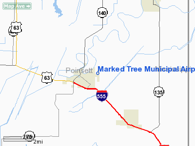
Marked Tree Municipal Airport |
Location
& QuickFacts
|
FAA Information Effective: |
2005-10-27 |
|
Airport Identifier: |
6M8 |
|
Longitude/Latitude: |
090-24-00.0000W/35-32-08.0000N
-90.400000/35.535556 (Estimated) |
|
Elevation: |
219
ft / 66.75 m (Surveyed) |
|
Land: |
52 acres |
|
From nearest city: |
1 nautical miles E of Marked Tree, AR |
|
Location: |
Poinsett County, AR |
|
Magnetic Variation: |
02E
(1985) |
Owner
& Manager
|
Ownership: |
Publicly owned |
|
Owner: |
City
Of Marked Tree |
|
Address: |
Municipal Bldg
Marked Tree, AR 72365 |
|
Phone number: |
870-358-3216 |
|
Manager: |
Lawrence Ashlock
MAYOR. |
|
Address: |
1 Elm Street
Marked Tree, AR 72365 |
|
Phone number: |
870-358-3216 |
Airport
Operations and Facilities
|
Airport Use: |
Open to public |
|
Wind indicator: |
Yes |
|
Segmented Circle: |
Yes |
|
Control Tower: |
No |
|
Attendance Schedule: |
IREG |
|
Lighting Schedule: |
DUSK-DAWN
ACTVT LIRL RY 18/36 - CTAF. |
|
Beacon Color: |
Clear-Green (lighted land airport) |
|
Landing fee charge: |
No |
|
Sectional chart: |
Memphis |
|
Region: |
ASW
- Southwest |
|
Boundary ARTCC: |
ZME - Memphis |
|
Tie-in FSS: |
JBR
- Jonesboro |
|
FSS on Airport: |
No |
|
FSS Phone: |
870-935-3471 |
|
FSS Toll Free: |
1-800-WX-BRIEF |
|
NOTAMs Facility: |
JBR (NOTAM-d service avaliable) |
|
Federal Agreements: |
NGY |
Airport
Communication
|
CTAF: |
122.800 |
|
Unicom: |
122.800
|
Airport
Services
|
Airframe Repair: |
NONE |
|
Power Plant Repair: |
NONE |
Runway
Information
Runway
18/36
|
Dimension: |
2700
x 60 ft / 823.0 x 18.3 m |
|
Surface: |
ASPH, Fair Condition |
|
Weight Limit: |
Single
wheel: 8000 lbs. |
|
Edge Lights: |
Low |
|
|
Runway
18 |
Runway
36 |
|
Longitude: |
090-24-00.2800W |
090-24-00.3700W |
|
Latitude: |
35-32-10.0200N |
35-31-43.3100N |
|
Traffic Pattern: |
Left |
Left |
|
Markings: |
Basic, Fair Condition |
Basic, Fair Condition |
|
Obstruction: |
, 50:1 slope to clear |
15 ft road, 500.0 ft from runway, 20:1 slope to
clear |
|
Radio
Navigation Aids
| ID |
Type |
Name |
Ch |
Freq |
Var |
Dist |
|
BPW |
NDB |
Osceola |
|
239.00 |
02E |
21.1
nm |
|
MXA |
NDB |
Manila |
|
282.00 |
01E |
24.5 nm |
|
AWM |
NDB |
West
Memphis |
|
362.00 |
01E |
25.2
nm |
|
SPQ |
NDB |
Spain |
|
414.00 |
04E |
26.4 nm |
|
MIG |
NDB |
Millington |
|
232.00 |
04E |
27.6
nm |
|
PGR |
NDB |
Paragould |
|
383.00 |
01E |
32.1 nm |
|
ME |
NDB |
Elvis |
|
287.00 |
01E |
32.7
nm |
|
IUI |
NDB |
Hicks |
|
350.00 |
01E |
36.7 nm |
|
EWP |
NDB |
Newport |
|
400.00 |
04E |
38.7
nm |
|
COO |
NDB |
Covington |
|
326.00 |
02E |
39.9 nm |
|
FCY |
NDB |
Forrest
City |
|
332.00 |
01E |
40.2
nm |
|
OLV |
NDB |
Olive Branch |
|
275.00 |
01E |
44.9 nm |
|
TKX |
NDB |
Kennett |
|
358.00 |
00E |
45.2
nm |
|
TNZ |
NDB |
Lawrence County |
|
227.00 |
01E |
47.7 nm |
|
GOJ |
VOR |
Gosnell |
|
111.80 |
01E |
33.5
nm |
|
GQE |
VOR/DME |
Gilmore |
077X |
113.00 |
04E |
12.0 nm |
|
JBR |
VOR/DME |
Jonesboro |
023X |
108.60 |
02E |
22.4
nm |
|
MEM |
VORTAC |
Memphis |
122X |
117.50 |
01E |
37.4 nm |
|
ARG |
VORTAC |
Walnut
Ridge |
092X |
114.50 |
04E |
43.8
nm |
|
MEM |
VOT |
Memphis Metropolitn |
|
111.00 |
|
35.8 nm |
Remarks
- NUMEROUS AGRICULTURAL
ACFT OPNS FM FEB-NOV 500 FT AGL AND BELOW.
- 221 FT TOWER 5391 FT SOUTH OF ARPT ON RY CNTRLN.
Marked Tree Municipal Airport
Address:
Poinsett
County, AR
Tel:
870-358-3216
Images
and information placed above are from
http://www.airport-data.com/airport/6M8/
We thank them for the data!
| General Info |
| Country |
United
States |
| State |
ARKANSAS
|
| FAA
ID |
6M8
|
| Latitude |
35-32-00.293N
|
| Longitude |
090-24-05.365W
|
| Elevation |
219
feet |
| Near
City |
MARKED
TREE |
We don't guarantee the information is fresh and accurate. The data may be wrong or outdated.
For more up-to-date information please refer to other sources.
|
|


