 |
|
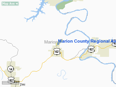
Marion County Regional Airport |
Coordinates: 36°17′27.22″N 092°35′24.91″W / 36.2908944°N 92.5902528°W / 36.2908944; -92.5902528 Marion County Regional Airport (ICAO: KFLP, FAA LID: FLP) is a county-owned and operated public-use airport located one mile north of the central business district of Flippin, a city in Marion County, Arkansas, United States. The airport serves the surrounding areas including the Buffalo National River and the Bull Shoals/White River State Park. It is a general aviation airport. There is no scheduled airline service.
Facilities and aircraft
Marion County Regional Airport consists of one asphalt-paved runway (4/22) measuring 5,000 x 75 ft. (1,524 x 23 m), 5 aircraft hangars, and one terminal building.
For the 12-month period ending April 30, 2005, the airport averaged 46 aircraft operations per day. 81% general aviation, 18% air taxi and 1% military. There are 30 aircraft based at this airport: 70% single engine, 13% multi-engine, 10% ultralight, and 7% jet aircraft.
The above content comes from Wikipedia and is published under free licenses – click here to read more.
Location
& QuickFacts
|
FAA Information Effective: |
2005-10-27 |
|
Airport Identifier: |
FLP |
|
Longitude/Latitude: |
092-35-24.9100W/36-17-27.2200N
-92.590253/36.290894 (Estimated) |
|
Elevation: |
719
ft / 219.15 m (Surveyed) |
|
Land: |
80
acres |
|
From nearest city: |
1 nautical miles N of Flippin, AR |
|
Location: |
Marion
County, AR |
|
Magnetic Variation: |
04E
(1985) |
Owner
& Manager
|
Ownership: |
Publicly
owned |
|
Owner: |
Marion
County |
|
Address: |
Box
545
Yellville, AR 72687 |
|
Phone number: |
870-449-6231 |
|
Manager: |
David
Davis |
|
Address: |
954
Airport 980
Flippin, AR 72634 |
|
Phone number: |
870-453-2241 |
Airport
Operations and Facilities
|
Airport Use: |
Open
to public |
|
Wind indicator: |
Yes |
|
Segmented Circle: |
No |
|
Control Tower: |
No |
|
Attendance Schedule: |
ALL/ALL/0800-1700 |
|
Lighting Schedule: |
DUSK-DAWN
ACTVT MIRL RY 04/22 AND PAPI RYS 04 & 22 - CTAF. |
|
Beacon Color: |
Clear-Green (lighted land airport) |
|
Landing fee charge: |
No |
|
Sectional chart: |
Kansas
City |
|
Region: |
ASW
- Southwest |
|
Traffic Pattern Alt: |
1000
ft |
|
Boundary ARTCC: |
ZME
- Memphis |
|
Tie-in FSS: |
JBR
- Jonesboro |
|
FSS on Airport: |
No |
|
FSS Phone: |
870-935-3471 |
|
FSS Toll Free: |
1-800-WX-BRIEF |
Airport
Communication
|
CTAF: |
123.000 |
|
Unicom: |
123.000
|
Airport
Services
|
Fuel available: |
100LLA
FOR FUEL AT NIGHT CALL 870-427-5343 OR 870-453-8689; FEE CHARGED. |
|
Airframe Repair: |
MAJOR |
|
Power Plant Repair: |
MAJOR |
|
Bottled Oxygen: |
NONE |
|
Bulk Oxygen: |
NONE |
Runway
Information
Runway
04/22
|
Dimension: |
5000
x 75 ft / 1524.0 x 22.9 m |
|
Surface: |
ASPH,
Fair Condition |
|
Weight Limit: |
Single
wheel: 30000 lbs. |
|
Edge Lights: |
Medium
MIRL OTS INDEFLY. |
|
|
Runway
04 |
Runway
22 |
|
Longitude: |
092-35-48.7080W |
092-35-01.1130W |
|
Latitude: |
36-17-11.7280N |
36-17-42.7120N |
|
Elevation: |
669.00
ft |
719.00
ft |
|
Alignment: |
51 |
127 |
|
Traffic Pattern: |
Left |
Left |
|
Markings: |
Basic, Good Condition
RY 04/22 MARKINGS FADED. |
Non-precision instrument, Good Condition |
|
Crossing Height: |
55.00
ft |
52.00
ft |
|
VASI: |
2-light PAPI on left side |
2-light PAPI on left side |
|
Visual Glide Angle: |
3.50° |
3.00° |
|
Obstruction: |
150 ft trees, 3900.0 ft from runway, 500 ft right
of centerline, 24:1 slope to clear |
30 ft trees, 1400.0 ft from runway, 20 ft right
of centerline, 40:1 slope to clear |
|
Radio
Navigation Aids
| ID |
Type |
Name |
Ch |
Freq |
Var |
Dist |
|
VLX |
NDB |
Wilcox |
|
348.00 |
02E |
35.0
nm |
|
PLK |
NDB |
Point
Lookout/dcmsnd |
|
204.00 |
03E |
37.0
nm |
|
AOV |
NDB |
Bilmart |
|
341.00 |
02E |
41.0
nm |
|
AJX |
NDB |
Ash
Flat |
|
344.00 |
03E |
48.2
nm |
|
UNO |
NDB |
Pomona |
|
335.00 |
02E |
48.5
nm |
|
FLP |
VOR/DME |
Flippin |
075X |
112.80 |
03E |
6.4
nm |
|
HRO |
VOR/DME |
Harrison |
072X |
112.50 |
04E |
30.2
nm |
|
HUW |
VOR/DME |
Hutton |
053X |
111.60 |
02E |
48.2
nm |
|
DGD |
VORTAC |
Dogwood |
031X |
109.40 |
06E |
46.2
nm |
Remarks
- NO LINE OF SIGHT BTN RY ENDS.
- ULTRALIGHT ACTIVITY
ON & INVOF ARPT.
Marion County Regional Airport
Address:
Marion
County, AR
Tel:
870-453-2241
Images
and information placed above are from
http://www.airport-data.com/airport/FLP/
We thank them for the data!
| General Info |
| Country |
United
States |
| State |
ARKANSAS
|
| FAA
ID |
FLP
|
| Latitude |
36-17-27.151N
|
| Longitude |
092-35-24.843W
|
| Elevation |
719
feet |
| Near
City |
FLIPPIN
|
We don't guarantee the information is fresh and accurate. The data may be wrong or outdated.
For more up-to-date information please refer to other sources.
|
|


