 |
|
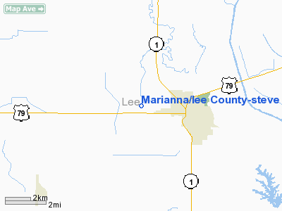
Marianna/lee County-steve Edwards Field Airport |
Location
& QuickFacts
|
FAA Information Effective: |
2005-10-27 |
|
Airport Identifier: |
6M7 |
|
Longitude/Latitude: |
090-48-38.0000W/34-46-49.0000N
-90.810556/34.780278 (Estimated) |
|
Elevation: |
217
ft / 66.14 m (Estimated) |
|
Land: |
22 acres |
|
From nearest city: |
3
nautical miles W of Marianna, AR |
|
Location: |
Lee County, AR |
|
Magnetic Variation: |
03E
(1985) |
Owner &
Manager
|
Ownership: |
Publicly owned |
|
Owner: |
City
Of Marianna |
|
Address: |
16 Pourt St
Marianna, AR 72360 |
|
Phone number: |
870-295-6089 |
|
Manager: |
Doug Gibson |
|
Address: |
Box
478
Marianna, AR 72360 |
|
Phone number: |
870-295-3485 |
Airport
Operations and Facilities
|
Airport Use: |
Open to public |
|
Wind indicator: |
Yes |
|
Segmented Circle: |
No |
|
Control Tower: |
No |
|
Attendance Schedule: |
ALL/MON-FRI/DALGT,ALL/SAT/SR-1200 |
|
Lighting Schedule: |
RDO-CTL
ACTVT MIRL RY 18/36 - CTAF. |
|
Landing fee charge: |
No |
|
Sectional chart: |
Memphis |
|
Region: |
ASW - Southwest |
|
Boundary ARTCC: |
ZME
- Memphis |
|
Tie-in FSS: |
JBR - Jonesboro |
|
FSS on Airport: |
No |
|
FSS Phone: |
870-935-3471 |
|
FSS Toll Free: |
1-800-WX-BRIEF |
|
NOTAMs Facility: |
JBR
(NOTAM-d service avaliable) |
|
Federal Agreements: |
N |
Airport
Communications
|
CTAF: |
122.800 |
|
Unicom: |
122.800
|
Airport
Services
|
Fuel available: |
100LL
FOR FUEL OTHER HRS CALL 870-295-4288. |
|
Bottled Oxygen: |
NONE |
|
Bulk Oxygen: |
NONE |
Runway
Information
Runway
18/36
|
Dimension: |
4000
x 74 ft / 1219.2 x 22.6 m |
|
Surface: |
ASPH,
|
|
Edge Lights: |
Medium |
|
|
Runway 18 |
Runway 36 |
|
Longitude: |
090-48-35.3500W |
090-48-36.1400W |
|
Latitude: |
34-47-18.1200N |
34-46-38.5600N |
|
Elevation: |
217.00
ft |
217.00
ft |
|
Traffic Pattern: |
Left |
Left |
|
Radio Navigation
Aids
|
ID |
Type |
Name |
Ch |
Freq |
Var |
Dist |
|
FCY |
NDB |
Forrest City |
|
332.00 |
01E |
9.8 nm |
|
HEE |
NDB |
Thompson-robbins |
|
251.00 |
01E |
14.2
nm |
|
BKZ |
NDB |
Brinkley |
|
242.00 |
02E |
19.1 nm |
|
CKM |
NDB |
Clarksdale |
|
341.00 |
02E |
32.7
nm |
|
AWM |
NDB |
West Memphis |
|
362.00 |
01E |
35.7 nm |
|
SGT |
NDB |
Stuttgart |
|
269.00 |
02E |
39.2
nm |
|
ME |
NDB |
Elvis |
|
287.00 |
01E |
40.1 nm |
|
SPQ |
NDB |
Spain |
|
414.00 |
04E |
45.1
nm |
|
UJM |
VOR/DME |
Marvell |
033X |
109.60 |
01E |
14.1 nm |
|
GQE |
VOR/DME |
Gilmore |
077X |
113.00 |
04E |
37.8
nm |
|
MEM |
VORTAC |
Memphis |
122X |
117.50 |
01E |
43.2 nm |
|
MEM |
VOT |
Memphis
Metropolitn |
|
111.00 |
|
44.1
nm |
Remarks
- RY 36 75 FT UNLGTD PLINE
1500 FT SOUTH OF THLD.
- PAEW ADJ RYS & TWYS.
LEE COUNTY-MARIANNA
Address:
Lee County, AR
Tel: 870-295-3485
|
General Info |
| Country |
United
States |
| State |
ARKANSAS
|
| FAA
ID |
6M7
|
| Latitude |
34-46-49.000N
|
| Longitude |
090-48-38.000W
|
| Elevation |
217
feet |
| Near
City |
MARIANNA
|
We don't guarantee the information is fresh and accurate. The data may be wrong or outdated.
For more up-to-date information please refer to other sources.
|
|


