 |
|
Location
& QuickFacts
| FAA
Information Effective: |
2005-10-27 |
| Airport
Identifier: |
05XS |
| Longitude/Latitude: |
091-32-35.4320W/33-04-45.4460N
-91.543176/33.079291 (Estimated) |
| Elevation: |
105
ft / 32.00 m (Estimated) |
| Land: |
10 acres |
| From
nearest city: |
1
nautical miles N of Wilmot, AR |
| Location: |
Ashley
County, AR |
| Magnetic
Variation: |
03E
(1990) |
Owner &
Manager
| Ownership: |
Privately
owned |
| Owner: |
Nelda
B. Johnson Trust
WM. L. JOHNSON FAMILY TRUST. |
| Address: |
Po
Box 295 Hwy 165 N
Wilmot, AR 71676 |
| Phone
number: |
501-473-5548 |
| Manager: |
James
W. Johnson |
| Address: |
Ashley
County, AR |
| Phone
number: |
501-473-5548 |
Airport
Operations and Facilities
| Airport
Use: |
Private |
| Segmented
Circle: |
No |
| Control
Tower: |
No |
| Attendance
Schedule: |
UNATNDD |
| Sectional
chart: |
Memphis |
| Region: |
ASW
- Southwest |
| Boundary
ARTCC: |
ZME
- Memphis |
| Tie-in
FSS: |
JBR
- Jonesboro |
| FSS
on Airport: |
No |
| FSS
Phone: |
870-935-3471 |
| FSS
Toll Free: |
1-800-WX-BRIEF |
Runway
Information
Runway
01/19
| Dimension: |
2600
x 100 ft / 792.5 x 30.5 m |
| Surface: |
TURF,
|
| |
Runway 01 |
Runway 19 |
| Traffic
Pattern: |
Left |
Left |
| Obstruction: |
50
ft trees, 100.0 ft from runway |
50
ft trees, 100.0 ft from runway |
|
Radio Navigation
Aids
| ID |
Type |
Name |
Ch |
Freq |
Var |
Dist |
| BLE |
NDB |
Lake Providence |
|
278.00 |
03E |
23.2 nm |
|
BQP |
NDB |
Bastrop |
|
329.00 |
03E |
26.0
nm |
| MTQ |
NDB |
Metcalf |
|
359.00 |
03E |
35.0 nm |
|
REN |
NDB |
Warren |
|
226.00 |
04E |
39.5
nm |
| MRK |
NDB |
Molly Ridge |
|
338.00 |
02E |
42.1 nm |
|
IDL |
NDB |
Indianola |
|
284.00 |
03E |
49.8
nm |
| MON |
VOR/DME |
Monticello |
053X |
111.60 |
04E |
30.3 nm |
|
GLH |
VOR/DME |
Greenville |
039X |
110.20 |
04E |
38.8
nm |
| MLU |
VORTAC |
Monroe |
119X |
117.20 |
03E |
42.0 nm |
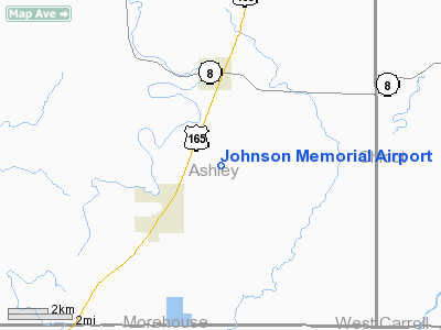
Johnson Memorial Airport
Address: Ashley County,
AR
Tel: 501-473-5548
Images and information placed
above are from
http://www.airport-data.com/airport/05XS/
We
thank them for the data!
|
General Info |
| Country |
United
States |
| State |
ARKANSAS
|
| FAA
ID |
05XS
|
| Latitude |
33-04-45.446N
|
| Longitude |
091-32-35.432W
|
| Elevation |
105
feet |
| Near
City |
WILMOT
|
We don't guarantee the information is fresh and accurate. The data may be wrong or outdated.
For more up-to-date information please refer to other sources.
|
|


