 |
|
Location
& QuickFacts
| FAA
Information Effective: |
2005-10-27 |
| Airport
Identifier: |
AR98 |
| Longitude/Latitude: |
091-11-20.4470W/35-15-52.3110N
-91.189013/35.264531 (Estimated) |
| Elevation: |
208
ft / 63.40 m (Estimated) |
| Land: |
0 acres |
| From
nearest city: |
1
nautical miles NE of Mc Crory, AR |
| Location: |
Woodruff
County, AR |
| Magnetic
Variation: |
03E
(1990) |
Owner &
Manager
| Ownership: |
Privately
owned |
| Owner: |
Robert
A. Pulley |
| Address: |
P.o.
Box 212
Mc Crory, AR 72101 |
| Phone
number: |
501-731-2468 |
| Manager: |
Robert
A. Pulley |
| Address: |
Woodruff
County, AR |
| Phone
number: |
501-731-5233 |
Airport
Operations and Facilities
| Airport
Use: |
Private |
| Wind
indicator: |
Yes |
| Segmented
Circle: |
No |
| Control
Tower: |
No |
| Attendance
Schedule: |
ALL/MON-FRI/0800-1700 |
| Sectional
chart: |
Memphis |
| Region: |
ASW
- Southwest |
| Boundary
ARTCC: |
ZME
- Memphis |
| Tie-in
FSS: |
JBR
- Jonesboro |
| FSS
on Airport: |
No |
| FSS
Phone: |
870-935-3471 |
| FSS
Toll Free: |
1-800-WX-BRIEF |
Runway
Information
Runway
18/36
| Dimension: |
2575
x 45 ft / 784.9 x 13.7 m |
| Surface: |
TURF,
|
| |
Runway 18 |
Runway 36 |
| Traffic
Pattern: |
Right |
Left |
| Displaced
threshold: |
400.00 ft |
0.00 ft |
| Obstruction: |
40
ft plines, 300.0 ft from runway |
|
|
Radio Navigation
Aids
| ID |
Type |
Name |
Ch |
Freq |
Var |
Dist |
| EWP |
NDB |
Newport |
|
400.00 |
04E |
22.7 nm |
|
BKZ |
NDB |
Brinkley |
|
242.00 |
02E |
23.0
nm |
| SRC |
NDB |
Searcy |
|
323.00 |
02E |
26.9 nm |
|
FCY |
NDB |
Forrest
City |
|
332.00 |
01E |
28.2
nm |
| INY |
NDB |
Independence County |
|
317.00 |
03E |
39.7 nm |
|
SGT |
NDB |
Stuttgart |
|
269.00 |
02E |
41.2
nm |
| HBZ |
NDB |
Heber Springs |
|
256.00 |
03E |
43.0 nm |
|
TYV |
NDB |
Toneyville |
|
290.00 |
04E |
44.9
nm |
| AWM |
NDB |
West Memphis |
|
362.00 |
01E |
47.6 nm |
|
HEE |
NDB |
Thompson-robbins |
|
251.00 |
01E |
48.7
nm |
| GQE |
VOR/DME |
Gilmore |
077X |
113.00 |
04E |
35.2 nm |
|
JBR |
VOR/DME |
Jonesboro |
023X |
108.60 |
02E |
47.0
nm |
| UJM |
VOR/DME |
Marvell |
033X |
109.60 |
01E |
48.6 nm |
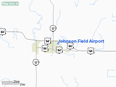
Johnson Field Airport
Address: Woodruff
County, AR
Tel: 501-731-5233
Images and information placed
above are from
http://www.airport-data.com/airport/AR98/
We
thank them for the data!
|
General Info |
| Country |
United
States |
| State |
ARKANSAS
|
| FAA
ID |
AR98
|
| Latitude |
35-15-52.311N
|
| Longitude |
091-11-20.447W
|
| Elevation |
208
feet |
| Near
City |
MC
CRORY |
We don't guarantee the information is fresh and accurate. The data may be wrong or outdated.
For more up-to-date information please refer to other sources.
|
|


