 |
|
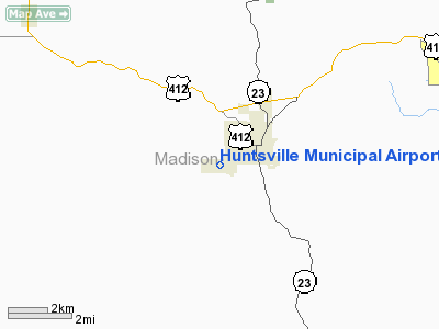
Huntsville Municipal Airport |
Location
& QuickFacts
|
FAA Information Effective: |
2005-10-27 |
|
Airport Identifier: |
H34 |
|
Longitude/Latitude: |
093-45-17.3920W/36-04-41.5740N
-93.754831/36.078215 (Estimated) |
|
Elevation: |
1749
ft / 533.10 m (Surveyed) |
|
Land: |
56
acres |
|
From nearest city: |
2
nautical miles SW of Huntsville, AR |
|
Location: |
Madison
County, AR |
|
Magnetic Variation: |
05E
(1985) |
Owner &
Manager
|
Ownership: |
Publicly
owned |
|
Owner: |
City
Of Huntsville |
|
Address: |
Po
Box C
Huntsville, AR 72740 |
|
Phone number: |
501-738-6725 |
|
Manager: |
Airport
Commission |
|
Address: |
Po
Drawer C
Huntsville, AR 72740 |
|
Phone number: |
501-738-6725 |
Airport
Operations and Facilities
|
Airport Use: |
Open
to public |
|
Wind indicator: |
Yes |
|
Segmented Circle: |
No |
|
Control Tower: |
No |
|
Attendance Schedule: |
UNATNDD |
|
Lighting Schedule: |
DUSK-DAWN
ACTVT MIRL RY 12/30 - CTAF. |
|
Beacon Color: |
Clear-Green
(lighted land airport) |
|
Landing fee charge: |
No |
|
Sectional chart: |
Kansas
City |
|
Region: |
ASW
- Southwest |
|
Boundary ARTCC: |
ZME
- Memphis |
|
Tie-in FSS: |
JBR
- Jonesboro |
|
FSS on Airport: |
No |
|
FSS Phone: |
870-935-3471 |
|
FSS Toll Free: |
1-800-WX-BRIEF |
|
NOTAMs Facility: |
JBR
(NOTAM-d service avaliable) |
Airport
Communications
|
CTAF: |
122.800 |
|
Unicom: |
122.800
|
Runway
Information
Runway
03/21
|
Dimension: |
1250
x 60 ft / 381.0 x 18.3 m |
|
Surface: |
TURF,
Good Condition |
| |
Runway 03 |
Runway 21 |
|
Traffic Pattern: |
Left |
Left |
|
Obstruction: |
8 ft trees, 250.0 ft from runway, 31:1 slope to clear |
,
50:1 slope to clear |
|
Runway
12/30
|
Dimension: |
3600
x 60 ft / 1097.3 x 18.3 m |
|
Surface: |
ASPH,
Good Condition |
|
Weight Limit: |
Single
wheel: 12500 lbs. |
|
Edge Lights: |
Medium |
| |
Runway 12 |
Runway 30 |
|
Longitude: |
093-45-31.6900W |
093-44-55.5900W |
|
Latitude: |
36-04-50.2700N |
36-04-29.2700N |
|
Elevation: |
1744.00
ft |
1744.00
ft |
|
Traffic Pattern: |
Left |
Left |
|
Markings: |
Non-precision instrument, Poor Condition
RY 12/30 MARKINGS FADED & PEELING. |
Basic,
Poor Condition |
|
Radio Navigation
Aids
| ID |
Type |
Name |
Ch |
Freq |
Var |
Dist |
| FCY |
NDB |
Forrest
City |
|
332.00 |
01E |
20.2
nm |
|
SGT |
NDB |
Stuttgart |
|
269.00 |
02E |
24.3
nm |
| HEE |
NDB |
Thompson-robbins |
|
251.00 |
01E |
30.9
nm |
|
SRC |
NDB |
Searcy |
|
323.00 |
02E |
33.9
nm |
| TYV |
NDB |
Toneyville |
|
290.00 |
04E |
41.8
nm |
|
EWP |
NDB |
Newport |
|
400.00 |
04E |
45.8
nm |
| CKM |
NDB |
Clarksdale |
|
341.00 |
02E |
48.1
nm |
Remarks
- ULTRALIGHT ACTIVITY ON
& INVOF ARPT.
Huntsville Municipal
Airport
Address:
Madison County,
AR
Tel: 501-738-6725
|
General Info |
| Country |
United
States |
| State |
ARKANSAS
|
| FAA
ID |
H34
|
| Latitude |
36-04-41.574N
|
| Longitude |
093-45-17.392W
|
| Elevation |
1749
feet |
| Near
City |
HUNTSVILLE
|
We don't guarantee the information is fresh and accurate. The data may be wrong or outdated.
For more up-to-date information please refer to other sources.
|
|


