 |
|
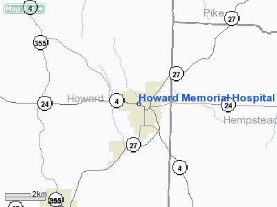
Howard Memorial Hospital Heliport |
Location
& QuickFacts
|
FAA Information Effective: |
2005-10-27 |
|
Airport Identifier: |
0AR8 |
|
Longitude/Latitude: |
093-51-07.6650W/33-57-00.4080N
-93.852129/33.950113 (Estimated) |
|
Elevation: |
549
ft / 167.34 m (Estimated) |
|
Land: |
0
acres |
|
From nearest city: |
0
nautical miles N of Nashville, AR |
|
Location: |
Howard
County, AR |
|
Magnetic Variation: |
04E
(1990) |
Owner
& Manager
|
Ownership: |
Privately
owned |
|
Owner: |
Howard
Memorial Hospital |
|
Address: |
800
W Leslie
Nashville, AR 71852 |
|
Phone number: |
501-845-4400 |
|
Manager: |
Charles
Lonchar |
|
Address: |
800
W Leslie
Nashville, AR 71852 |
|
Phone number: |
501-845-4400 |
Airport
Operations and Facilities
|
Airport Use: |
Private
MEDICAL USE. |
|
Wind indicator: |
Yes |
|
Segmented Circle: |
No |
|
Control Tower: |
No |
|
Attendance Schedule: |
UNATNDD |
|
Sectional chart: |
Memphis |
|
Region: |
ASW
- Southwest |
|
Boundary ARTCC: |
ZFW
- Fort Worth |
|
Tie-in FSS: |
JBR
- Jonesboro |
|
FSS on Airport: |
No |
|
FSS Phone: |
870-935-3471 |
|
FSS Toll Free: |
1-800-WX-BRIEF |
Runway
Information
Helipad
H1
|
Dimension: |
30
x 30 ft / 9.1 x 9.1 m |
|
Surface: |
CONC,
|
| |
Runway
H1 |
Runway
|
|
Traffic Pattern: |
Left |
Left |
|
Radio
Navigation Aids
| ID |
Type |
Name |
Ch |
Freq |
Var |
Dist |
|
HPC |
NDB |
Hope |
|
362.00 |
03E |
17.3
nm |
|
DEQ |
NDB |
De
Queen |
|
281.00 |
04E |
27.9
nm |
|
ADF |
NDB |
Arkadelphia |
|
275.00 |
02E |
37.8
nm |
|
MEZ |
NDB |
Mena |
|
242.00 |
04E |
40.1
nm |
|
HO |
NDB |
Hossy |
|
385.00 |
04E |
43.5
nm |
|
IBO |
NDB |
Idabel |
|
271.00 |
03E |
49.5
nm |
|
HOT |
VOR/DME |
Hot
Springs |
037X |
110.00 |
04E |
49.4
nm |
|
TXK |
VORTAC |
Texarkana |
110X |
116.30 |
07E |
28.5
nm |
Remarks
- PRVDD THE TREES IN APCH
PATH ARE REMOVED.
Howard Memorial Hospital
Heliport
Address:
Howard County,
AR
Tel: 501-845-4400
Images and information
placed above are from
http://www.airport-data.com/airport/0AR8/
We
thank them for the data!
|
General Info |
| Country |
United
States |
| State |
ARKANSAS
|
| FAA
ID |
0AR8
|
| Latitude |
33-57-00.408N
|
| Longitude |
093-51-07.665W
|
| Elevation |
549
feet |
| Near
City |
NASHVILLE
|
We don't guarantee the information is fresh and accurate. The data may be wrong or outdated.
For more up-to-date information please refer to other sources.
|
|


