 |
|
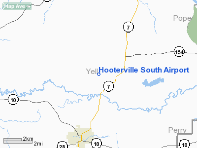
Hooterville South Airport |
Location
& QuickFacts
|
FAA Information Effective: |
2005-10-27 |
|
Airport Identifier: |
0AR1 |
|
Longitude/Latitude: |
093-12-07.1400W/35-05-40.8170N
-93.201983/35.094671 (Estimated) |
|
Elevation: |
370
ft / 112.78 m (Estimated) |
|
Land: |
0
acres |
|
From nearest city: |
2
nautical miles SW of Centerville, AR |
|
Location: |
Yell
County, AR |
|
Magnetic Variation: |
04E
(1990) |
Owner &
Manager
|
Ownership: |
Privately
owned |
|
Owner: |
J
& B Farms |
|
Address: |
Rt.
1 Box 306
Danville, AR 32833 |
|
Phone number: |
501-576-2800 |
|
Manager: |
Jimmy
Weaver, Pres. |
|
Address: |
Rt.
1 Box 306
Danville, AR 32833 |
|
Phone number: |
501-576-2800 |
Airport
Operations and Facilities
|
Airport Use: |
Private |
|
Wind indicator: |
Yes |
|
Segmented Circle: |
No |
|
Control Tower: |
No |
|
Attendance Schedule: |
UNATNDD |
|
Sectional chart: |
Memphis |
|
Region: |
ASW
- Southwest |
|
Boundary ARTCC: |
ZME
- Memphis |
|
Tie-in FSS: |
JBR
- Jonesboro |
|
FSS on Airport: |
No |
|
FSS Phone: |
870-935-3471 |
|
FSS Toll Free: |
1-800-WX-BRIEF |
Runway
Information
Runway
09/27
|
Dimension: |
2400
x 75 ft / 731.5 x 22.9 m |
|
Surface: |
TURF,
|
| |
Runway 09 |
Runway 27 |
|
Traffic Pattern: |
Left |
Left |
|
Radio Navigation
Aids
| ID |
Type |
Name |
Ch |
Freq |
Var |
Dist |
|
RUE |
NDB |
Russellville |
|
379.00 |
03E |
11.1
nm |
|
MPJ |
NDB |
Morrilton |
|
410.00 |
07E |
13.7
nm |
|
BDQ |
NDB |
Bridge |
|
208.00 |
04E |
24.2
nm |
|
CZE |
NDB |
Clarksville |
|
201.00 |
04E |
25.0
nm |
|
CWS |
NDB |
Conway |
|
302.00 |
05E |
38.1
nm |
|
HO |
NDB |
Hossy |
|
385.00 |
04E |
40.4
nm |
|
HOT |
VOR/DME |
Hot
Springs |
037X |
110.00 |
04E |
37.4
nm |
Hooterville South Airport
Address:
Yell County, AR
Tel: 501-576-2800
Images and information placed
above are from
http://www.airport-data.com/airport/0AR1/
We
thank them for the data!
|
General Info |
| Country |
United
States |
| State |
ARKANSAS
|
| FAA
ID |
0AR1
|
| Latitude |
35-05-40.817N
|
| Longitude |
093-12-07.140W
|
| Elevation |
370
feet |
| Near
City |
CENTERVILLE
|
We don't guarantee the information is fresh and accurate. The data may be wrong or outdated.
For more up-to-date information please refer to other sources.
|
|


