 |
|
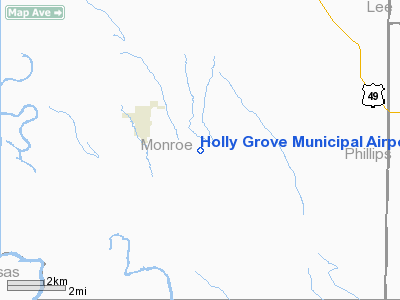
Holly Grove Municipal Airport |
Location
& QuickFacts
|
FAA Information Effective: |
2005-10-27 |
|
Airport Identifier: |
2A6 |
|
Longitude/Latitude: |
091-09-54.8000W/34-34-56.8000N
-91.165222/34.582444 (Estimated) |
|
Elevation: |
176
ft / 53.64 m (Estimated) |
|
Land: |
67
acres |
|
From nearest city: |
1
nautical miles SE of Holly Grove, AR |
|
Location: |
Monroe
County, AR |
|
Magnetic Variation: |
03E
(1985) |
Owner &
Manager
|
Ownership: |
Publicly
owned |
|
Owner: |
City
Of Holly Grove |
|
Address: |
City
Of Holly Grove
Holly Grove, AR 72069 |
|
Phone number: |
870-462-3422 |
|
Manager: |
Mike
Richardson |
|
Address: |
Monroe
County, AR |
|
Phone number: |
870-462-3675 |
Airport
Operations and Facilities
|
Airport Use: |
Open
to public |
|
Wind indicator: |
Yes |
|
Segmented Circle: |
Yes |
|
Control Tower: |
No |
|
Attendance Schedule: |
ALL/MON-SAT/0800-1700
FOR ATTENDANT AFT HRS CALL 870-462-8805/3491. |
|
Lighting Schedule: |
DUSK-DAWN
ACTVT MIRL RY 15/33 - CTAF. |
|
Beacon Color: |
Clear-Green
(lighted land airport)
ROTG BCN OTS INDEFLY. |
|
Sectional chart: |
Memphis |
|
Region: |
ASW
- Southwest |
|
Boundary ARTCC: |
ZME
- Memphis |
|
Tie-in FSS: |
JBR
- Jonesboro |
|
FSS on Airport: |
No |
|
FSS Phone: |
870-935-3471 |
|
FSS Toll Free: |
1-800-WX-BRIEF |
|
NOTAMs Facility: |
JBR
(NOTAM-d service avaliable) |
Airport
Communications
Runway Information
Runway 15/33
|
Dimension: |
4469
x 50 ft / 1362.2 x 15.2 m |
|
Surface: |
ASPH,
Good Condition |
|
Weight Limit: |
Single
wheel: 12500 lbs. |
|
Edge Lights: |
Medium |
| |
Runway
15 |
Runway
33 |
|
Longitude: |
091-10-09.1300W |
091-09-40.6500W |
|
Latitude: |
34-35-15.5200N |
34-34-38.1100N |
|
Elevation: |
175.00
ft |
176.00
ft |
|
Traffic Pattern: |
Left |
Left |
|
Markings: |
Numbers
only, Fair Condition |
Numbers
only, Fair Condition |
|
Crossing Height: |
10.00
ft |
10.00
ft |
|
VASI: |
tri-color on right side |
tri-color on left side |
|
Visual Glide Angle: |
3.00° |
3.00° |
|
Obstruction: |
,
50:1 slope to clear |
10 ft fence, 201.0 ft from runway
10 FT FENCE 150 FT CROSSING RY EXTENDING INTO RPZ. |
|
Radio Navigation
Aids
| ID |
Type |
Name |
Ch |
Freq |
Var |
Dist |
|
BKZ |
NDB |
Brinkley |
|
242.00 |
02E |
18.0
nm |
|
SGT |
NDB |
Stuttgart |
|
269.00 |
02E |
21.7
nm |
|
HEE |
NDB |
Thompson-robbins |
|
251.00 |
01E |
24.2
nm |
|
FCY |
NDB |
Forrest
City |
|
332.00 |
01E |
29.0
nm |
|
CKM |
NDB |
Clarksdale |
|
341.00 |
02E |
36.6
nm |
|
SRC |
NDB |
Searcy |
|
323.00 |
02E |
47.1
nm |
|
TYV |
NDB |
Toneyville |
|
290.00 |
04E |
47.7
nm |
|
UJM |
VOR/DME |
Marvell |
033X |
109.60 |
01E |
24.3
nm |
|
PBF |
VOR/DME |
Pine
Bluff |
107X |
116.00 |
04E |
42.8
nm |
Holly
Grove Municipal Airport
Address:
Monroe County,
AR
Tel:
870-462-3675
Images and
information placed above are from
http://www.airport-data.com/airport/2A6/
We thank them for the data!
| General Info |
| Country |
United
States |
| State |
ARKANSAS
|
| FAA
ID |
2A6
|
| Latitude |
34-35-00.353N
|
| Longitude |
091-09-57.435W
|
| Elevation |
176
feet |
| Near
City |
HOLLY
GROVE |
We don't guarantee the information is fresh and accurate. The data may be wrong or outdated.
For more up-to-date information please refer to other sources.
|
|


