 |
|
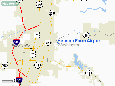
Location
& QuickFacts
|
FAA Information Effective: |
2005-10-27 |
|
Airport Identifier: |
AR35 |
|
Longitude/Latitude: |
094-06-18.7280W/36-05-12.2830N
-94.105202/36.086745 (Estimated) |
|
Elevation: |
1420
ft / 432.82 m (Estimated) |
|
Land: |
0
acres |
|
From nearest city: |
3
nautical miles E of Fayetteville, AR |
|
Location: |
Washington
County, AR |
|
Magnetic Variation: |
05E
(1985) |
Owner &
Manager
|
Ownership: |
Privately
owned |
|
Owner: |
David
Henson |
|
Address: |
Rt
1 Box 37
Fayetteville, AR 72701 |
|
Phone number: |
501-521-3133 |
|
Manager: |
David
Henson |
|
Address: |
Rt
1 Box 37
Fayetteville, AR 72701 |
|
Phone number: |
501-521-3133 |
Airport
Operations and Facilities
|
Airport Use: |
Private |
|
Wind indicator: |
Yes |
|
Segmented Circle: |
No |
|
Control Tower: |
No |
|
Attendance Schedule: |
UNATNDD |
|
Landing fee charge: |
No |
|
Sectional chart: |
Kansas
City |
|
Region: |
ASW
- Southwest |
|
Boundary ARTCC: |
ZME
- Memphis |
|
Tie-in FSS: |
JBR
- Jonesboro |
|
FSS on Airport: |
No |
|
FSS Phone: |
870-935-3471 |
|
FSS Toll Free: |
1-800-WX-BRIEF |
Runway Information
Runway 15/33
|
Dimension: |
2000
x 150 ft / 609.6 x 45.7 m |
|
Surface: |
TURF,
|
| |
Runway
15 |
Runway
33 |
| Traffic Pattern: |
Left |
Left |
|
Runway 18/36
|
Dimension: |
1600
x 200 ft / 487.7 x 61.0 m |
|
Surface: |
TURF,
|
| |
Runway
18 |
Runway
36 |
| Traffic Pattern: |
Left |
Left |
|
Radio Navigation
Aids
| ID |
Type |
Name |
Ch |
Freq |
Var |
Dist |
|
SLG |
NDB |
Siloam
Springs |
|
284.00 |
04E |
19.6
nm |
|
TQH |
NDB |
Tahlequah |
|
215.00 |
05E |
44.8
nm |
|
CZE |
NDB |
Clarksville |
|
201.00 |
04E |
49.8
nm |
|
DAK |
VOR/DME |
Drake |
025X |
108.80 |
07E |
5.2
nm |
|
HRO |
VOR/DME |
Harrison |
072X |
112.50 |
04E |
45.4
nm |
|
EOS |
VOR/DME |
Neosho |
120X |
117.30 |
07E |
48.2
nm |
|
RZC |
VORTAC |
Razorback |
111X |
116.40 |
04E |
9.6
nm |
|
FSM |
VORTAC |
Fort
Smith |
041X |
110.40 |
07E |
42.8
nm |
Henson Farm Airport
Address:
Washington County,
AR
Tel:
501-521-3133
Images and
information placed above are from
http://www.airport-data.com/airport/AR35/
We thank them for the data!
| General Info |
| Country |
United
States |
| State |
ARKANSAS
|
| FAA
ID |
AR35
|
| Latitude |
36-05-12.283N
|
| Longitude |
094-06-18.728W
|
| Elevation |
1420
feet |
| Near
City |
FAYETTEVILLE
|
We don't guarantee the information is fresh and accurate. The data may be wrong or outdated.
For more up-to-date information please refer to other sources.
|
|


