 |
|
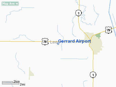
Location
& QuickFacts
| FAA
Information Effective: |
2005-10-27 |
| Airport
Identifier: |
AR18 |
| Longitude/Latitude: |
090-50-25.4090W/34-46-17.3490N
-90.840391/34.771486 (Estimated) |
| Elevation: |
205
ft / 62.48 m (Estimated) |
| Land: |
0 acres |
| From
nearest city: |
3
nautical miles W of Marianna, AR |
| Location: |
Lee
County, AR |
| Magnetic
Variation: |
03E
(1985) |
Owner &
Manager
| Ownership: |
Privately
owned |
| Owner: |
W
H Gerrard |
| Address: |
|
| Phone
number: |
501-295-6300 |
| Manager: |
Jack
Frost |
| Address: |
Frost
Flying Service--route 2
Marianna, AR 72360 |
| Phone
number: |
501-295-6300 |
Airport
Operations and Facilities
| Airport
Use: |
Private |
| Wind
indicator: |
No |
| Segmented
Circle: |
No |
| Control
Tower: |
No |
| Attendance
Schedule: |
UNATNDD |
| Landing
fee charge: |
No |
| Sectional
chart: |
Memphis |
| Region: |
ASW
- Southwest |
| Boundary
ARTCC: |
ZME
- Memphis |
| Tie-in
FSS: |
JBR
- Jonesboro |
| FSS
on Airport: |
No |
| FSS
Phone: |
870-935-3471 |
| FSS
Toll Free: |
1-800-WX-BRIEF |
Airport
Services
| Airframe
Repair: |
NONE |
| Power
Plant Repair: |
NONE |
Runway
Information
Runway
08/26
| Dimension: |
2300
x 66 ft / 701.0 x 20.1 m |
| Surface: |
TURF,
|
| |
Runway
08 |
Runway
26 |
| Traffic
Pattern: |
Left |
Left |
|
Radio Navigation
Aids
| ID |
Type |
Name |
Ch |
Freq |
Var |
Dist |
| FCY |
NDB |
Forrest City |
|
332.00 |
01E |
10.7 nm |
|
HEE |
NDB |
Thompson-robbins |
|
251.00 |
01E |
14.5
nm |
| BKZ |
NDB |
Brinkley |
|
242.00 |
02E |
17.9 nm |
|
CKM |
NDB |
Clarksdale |
|
341.00 |
02E |
32.9
nm |
| AWM |
NDB |
West Memphis |
|
362.00 |
01E |
37.2 nm |
|
SGT |
NDB |
Stuttgart |
|
269.00 |
02E |
37.7
nm |
| ME |
NDB |
Elvis |
|
287.00 |
01E |
41.7 nm |
|
SPQ |
NDB |
Spain |
|
414.00 |
04E |
46.7
nm |
| UJM |
VOR/DME |
Marvell |
033X |
109.60 |
01E |
14.4 nm |
|
GQE |
VOR/DME |
Gilmore |
077X |
113.00 |
04E |
38.9
nm |
| MEM |
VORTAC |
Memphis |
122X |
117.50 |
01E |
44.7 nm |
|
MEM |
VOT |
Memphis
Metropolitn |
|
111.00 |
|
45.6
nm |
Remarks
- AIRSTRIP
USED BY AG-OPERATORS.
- VFR ONLY;
PRVDD THRS ARE LCTD TO PRVD A MNM 20:1 CLNC OVER ALL OBSTNS IN FINAL
APCH AREAS.
Gerrard Airport
Address: Lee County, AR
Tel: 501-295-6300
Images and information placed
above are from
http://www.airport-data.com/airport/AR18/
We
thank them for the data!
|
General Info |
| Country |
United
States |
| State |
ARKANSAS
|
| FAA
ID |
AR18
|
| Latitude |
34-46-17.349N
|
| Longitude |
090-50-25.409W
|
| Elevation |
205
feet |
| Near
City |
MARIANNA |
We don't guarantee the information is fresh and accurate. The data may be wrong or outdated.
For more up-to-date information please refer to other sources.
|
|


