 |
|
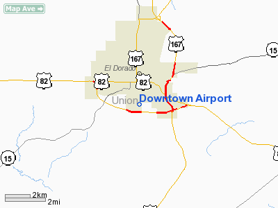
Location
& QuickFacts
|
FAA Information Effective: |
2005-10-27 |
|
Airport Identifier: |
F43 |
|
Longitude/Latitude: |
092-39-47.6000W/33-11-28.5000N
-92.663222/33.191250 (Estimated) |
|
Elevation: |
256
ft / 78.03 m (Surveyed) |
|
Land: |
88 acres |
|
From nearest city: |
0
nautical miles S of El Dorado, AR |
|
Location: |
Union
County, AR |
|
Magnetic Variation: |
04E
(1985) |
Owner &
Manager
|
Ownership: |
Publicly
owned |
|
Owner: |
City
Of El Dorado |
|
Address: |
City
Hall
El Dorado, AR 71730 |
|
Phone number: |
870-862-7911 |
|
Manager: |
Irwin
E Stevens-bobby Tucker |
|
Address: |
100w
Sharp St
El Dorado, AR 71730 |
|
Phone number: |
870-863-5068 |
Airport
Operations and Facilities
|
Airport Use: |
Open
to public |
|
Wind indicator: |
Yes |
|
Segmented Circle: |
No |
|
Control Tower: |
No |
|
Attendance Schedule: |
ALL/MON-FRI/0800-1700 |
|
Lighting Schedule: |
DUSK-DAWN |
|
Beacon Color: |
Clear-Green
(lighted land airport) |
|
Landing fee charge: |
No |
|
Sectional chart: |
Memphis |
|
Region: |
ASW
- Southwest |
|
Boundary ARTCC: |
ZFW
- Fort Worth |
|
Tie-in FSS: |
JBR
- Jonesboro |
|
FSS on Airport: |
No |
|
FSS Phone: |
870-935-3471 |
|
FSS Toll Free: |
1-800-WX-BRIEF |
|
NOTAMs Facility: |
JBR
(NOTAM-d service avaliable) |
Airport
Communications
|
CTAF: |
122.800 |
|
Unicom: |
122.800
|
Airport
Services
|
Fuel available: |
100LL
FOR FUEL AFT HRS CALL 870-863-6776; 24 HR SELF SERVICE CREDIT CARD
AVBL. |
|
Airframe Repair: |
MAJOR |
|
Power Plant Repair: |
MAJOR |
Runway
Information
Runway
18/36
|
Dimension: |
3000
x 60 ft / 914.4 x 18.3 m |
|
Surface: |
ASPH,
Fair Condition |
| Weight
Limit: |
Single wheel: 7000
lbs. |
|
Edge Lights: |
Low |
| |
Runway
18 |
Runway
36 |
|
Longitude: |
092-39-47.7600W |
092-39-47.4600W |
|
Latitude: |
33-11-43.3400N |
33-11-13.6600N |
|
Traffic Pattern: |
Left |
Left |
|
Markings: |
Basic,
Fair Condition |
Basic,
Fair Condition |
|
Crossing Height: |
0.00 ft |
17.00 ft |
|
Displaced threshold: |
115.00
ft
THLD DSPLCD 115 FT NIGHTS ONLY. |
260.00
ft
THLD DSPLCD 260 FT NIGHTS ONLY. |
|
VASI: |
|
2-box
on left side
VASI OTS INDEFLY. |
|
Visual Glide Angle: |
0.00° |
4.30° |
|
Obstruction: |
20
ft trees, 201.0 ft from runway
APCH RATIO 20:1 TO DSPLCD THLD.
+20 FT TREE 30 FT FM THLD 20 FT R, EXTDD INTO PRIMARY SFC. |
40
ft trees, 1100.0 ft from runway, 22:1 slope to clear
APCH RATIO 34:1 TO DSPLCD THLD. |
|
Radio Navigation
Aids
| ID |
Type |
Name |
Ch |
Freq |
Var |
Dist |
| CDH |
NDB |
Camden |
|
335.00 |
03E |
25.9
nm |
|
AGO |
NDB |
Magnolia |
|
266.00 |
04E |
27.8
nm |
| HMQ |
NDB |
Homer |
|
212.00 |
02E |
29.5
nm |
|
ROQ |
NDB |
Ruston |
|
368.00 |
03E |
35.2
nm |
| REN |
NDB |
Warren |
|
226.00 |
04E |
35.6
nm |
|
SPH |
NDB |
Springhill |
|
375.00 |
05E |
41.0
nm |
| MNE |
NDB |
Minden |
|
201.00 |
04E |
46.2
nm |
|
TUF |
NDB |
Stuckey |
|
350.00 |
03E |
47.2
nm |
| BQP |
NDB |
Bastrop |
|
329.00 |
03E |
47.3
nm |
|
ELD |
VORTAC |
El
Dorado |
102X |
115.50 |
07E |
5.6
nm |
Remarks
- ULTRALIGHT
ACTIVITY ON & INVOF ARPT.
Downtown
Airport
Address: Union County, AR
Tel: 870-863-5068
Images and information placed
above are from
http://www.airport-data.com/airport/F43/
We
thank them for the data!
|
General Info |
| Country |
United
States |
| State |
ARKANSAS
|
| FAA
ID |
F43
|
| Latitude |
33-11-39.469N
|
| Longitude |
092-39-47.561W
|
| Elevation |
256
feet |
| Near
City |
EL
DORADO |
We don't guarantee the information is fresh and accurate. The data may be wrong or outdated.
For more up-to-date information please refer to other sources.
|
|


