 |
|
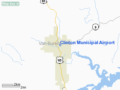
Clinton Municipal Airport |
Location
& QuickFacts
|
FAA
Information Effective: |
2005-10-27 |
|
Airport
Identifier: |
4M4 |
|
Longitude/Latitude: |
092-27-06.5690W/35-35-52.2790N
-92.451825/35.597855 (Estimated) |
|
Elevation: |
513 ft / 156.36 m (Surveyed) |
|
Land: |
52 acres |
|
From
nearest city: |
1
nautical miles NE of Clinton, AR |
|
Location: |
Van Buren County, AR |
|
Magnetic
Variation: |
04E (1985) |
Owner
& Manager
|
Ownership: |
Publicly owned |
|
Owner: |
City Of Clinton |
|
Address: |
Po Box 277
Clinton, AR 72031 |
|
Phone
number: |
501-745-8110 |
|
Manager: |
Will Dawson |
|
Address: |
Van Buren County, AR |
|
Phone
number: |
501-745-6550 |
Airport
Operations and Facilities
|
Airport Use: |
Open to public |
|
Wind indicator: |
Yes |
|
Segmented Circle: |
No |
|
Control Tower: |
No |
|
Attendance Schedule: |
ALL/ALL/0800-1800 |
|
Lighting Schedule: |
DUSK-DAWN
ACTVT MIRL RY 13/31 - CTAF. |
|
Beacon Color: |
Clear-Green
(lighted land airport) |
|
Landing fee charge: |
No |
|
Sectional chart: |
Memphis |
|
Region: |
ASW - Southwest |
|
Boundary ARTCC: |
ZME - Memphis |
|
Tie-in FSS: |
JBR - Jonesboro |
|
FSS on Airport: |
No |
|
FSS Phone: |
870-935-3471 |
|
FSS Toll Free: |
1-800-WX-BRIEF |
|
NOTAMs Facility: |
JBR
(NOTAM-d service avaliable) |
|
Federal Agreements: |
N |
Airport
Communications
|
CTAF: |
122.700 |
|
Unicom: |
122.700 |
Airport
Services
|
Fuel available: |
100LL
24 HR SELF SVC FUEL AVBL WITH CREDIT CARD. |
|
Airframe Repair: |
MAJOR |
|
Power Plant Repair: |
MAJOR |
|
Bottled Oxygen: |
NONE |
|
Bulk Oxygen: |
NONE |
Runway
Information
Runway
13/31
|
Dimension: |
4012 x 50 ft / 1222.9
x 15.2 m |
| Surface: |
ASPH,
Good Condition |
| Edge
Lights: |
Medium |
|
|
Runway
13 |
Runway
31 |
|
Traffic Pattern: |
Left |
Left |
|
Markings: |
Basic, Good Condition |
Basic, Good Condition |
|
Crossing Height: |
0.00 ft |
69.00 ft |
|
VASI: |
|
2-light
PAPI on left side |
|
Visual Glide
Angle: |
0.00° |
4.00° |
|
Obstruction: |
30
ft trees, 451.0 ft from runway, 8:1 slope to clear |
120
ft trees, 1820.0 ft from runway, 13:1 slope to clear |
|
Radio
Navigation Aids
|
ID |
Type |
Name |
Ch |
Freq |
Var |
Dist |
|
HBZ |
NDB |
Heber
Springs |
|
256.00 |
03E |
22.1
nm |
|
VLX |
NDB |
Wilcox |
|
348.00 |
02E |
23.8
nm |
|
BDQ |
NDB |
Bridge |
|
208.00 |
04E |
30.4
nm |
|
CWS |
NDB |
Conway |
|
302.00 |
05E |
30.9
nm |
|
INY |
NDB |
Independence
County |
|
317.00 |
03E |
32.9
nm |
|
MPJ |
NDB |
Morrilton |
|
410.00 |
07E |
37.0
nm |
|
RUE |
NDB |
Russellville |
|
379.00 |
03E |
37.6
nm |
|
SRC |
NDB |
Searcy |
|
323.00 |
02E |
42.2
nm |
|
TYV |
NDB |
Toneyville |
|
290.00 |
04E |
44.2
nm |
|
CZE |
NDB |
Clarksville |
|
201.00 |
04E |
48.2
nm |
|
LRF |
TACAN |
Jacksonville |
029X |
|
04E |
43.3
nm |
|
FLP |
VOR/DME |
Flippin |
075X |
112.80 |
03E |
42.2
nm |
Remarks
- USE EXTREME
CARE RAPIDLY RISING TERRAIN 3 MILES SW THRU NE.
- USE EXTREME
CARE RAPIDLY RISING TERRAIN 3 MILES NW OF ARPT.
- FOR SVC
CALL 501-745-6489; FEE CHARGED.
- DEER ON & INVOF ARPT.
Clinton
Municipal Airport
Address:
Van Buren County, AR
Tel: 501-745-6550
Images and
information placed above are from
http://www.airport-data.com/airport/4M4/
We thank them
for the data!
|
General
Info |
|
Country |
United States |
|
State |
ARKANSAS |
|
FAA ID |
4M4 |
|
Latitude |
35-35-52.279N |
|
Longitude |
092-27-06.569W |
|
Elevation |
513 feet |
|
Near City |
CLINTON |
We don't guarantee the information is fresh and accurate. The data may be wrong or outdated.
For more up-to-date information please refer to other sources.
|
|


