 |
|
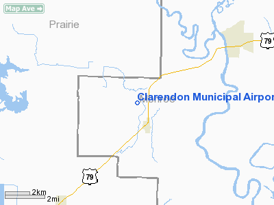
Clarendon Municipal Airport |
Location
& QuickFacts
| FAA
Information Effective: |
2005-10-27 |
| Airport
Identifier: |
4M8 |
| Longitude/Latitude: |
091-23-39.9770W/34-38-52.7050N
-91.394438/34.647974 (Estimated) |
| Elevation: |
217
ft / 66.14 m (Surveyed) |
| Land: |
222
acres |
| From
nearest city: |
5
nautical miles SW of Clarendon, AR |
| Location: |
Monroe
County, AR |
| Magnetic
Variation: |
03E
(1985) |
Owner
& Manager
| Ownership: |
Publicly
owned |
| Owner: |
City
Of Clarendon |
| Address: |
270
Madison
Clarendon, AR 72029 |
| Phone
number: |
870-747-3802 |
| Manager: |
Jim
Mckown |
| Address: |
Po
Box 227
Roe, AR
72134 |
| Phone
number: |
870-241-3781 |
Airport
Operations and Facilities
| Airport
Use: |
Open
to public |
| Wind
indicator: |
Yes |
| Segmented
Circle: |
No |
| Control
Tower: |
No |
| Attendance
Schedule: |
ALL/MON-FRI/0800-1700,ALL/SAT/0800-1200 |
| Lighting
Schedule: |
DUSK-DAWN
ACTVT MIRL RY 18/36 - 123.8 |
| Beacon
Color: |
Clear-Green
(lighted land airport) |
| Landing
fee charge: |
No |
| Sectional
chart: |
Memphis |
| Region: |
ASW
- Southwest |
| Boundary
ARTCC: |
ZME
- Memphis |
| Tie-in
FSS: |
JBR
- Jonesboro |
| FSS
on Airport: |
No |
| FSS
Phone: |
870-935-3471 |
| FSS
Toll Free: |
1-800-WX-BRIEF |
| NOTAMs
Facility: |
JBR
(NOTAM-d service avaliable) |
| Federal
Agreements: |
NR |
Airport
Communications
| CTAF: |
122.800 |
| Unicom: |
122.800 |
Airport
Services
| Fuel
available: |
100LL |
| Airframe
Repair: |
MINOR |
| Power
Plant Repair: |
MINOR |
| Bottled
Oxygen: |
NONE |
| Bulk
Oxygen: |
NONE |
Runway
Information
Runway
18/36
| Dimension: |
2420 x
30 ft / 737.6 x
9.1 m |
| Surface: |
ASPH,
Good Condition |
| Weight Limit: |
Single wheel: 4000 lbs. |
| Edge
Lights: |
Medium |
|
|
Runway
18 |
Runway
36 |
| Longitude: |
091-23-38.7610W |
091-23-39.3950W |
| Latitude: |
34-39-04.6710N |
34-38-40.7440N |
| Elevation: |
212.00
ft |
205.00
ft |
| Alignment: |
127 |
1 |
| Traffic
Pattern: |
Left |
Left |
| Displaced
threshold: |
200.00
ft |
0.00
ft |
| Obstruction: |
15 ft road, 300.0 ft from runway, 6:1 slope to clear
APCH SLOPE 33:1 TO DSPLCD THLD. |
,
50:1 slope to clear |
|
Radio
Navigation Aids
| ID |
Type |
Name |
Ch |
Freq |
Var |
Dist |
| SGT |
NDB |
Stuttgart |
|
269.00 |
02E |
9.8 nm |
| BKZ |
NDB |
Brinkley |
|
242.00 |
02E |
17.6
nm |
| FCY |
NDB |
Forrest
City |
|
332.00 |
01E |
35.3 nm |
| HEE |
NDB |
Thompson-robbins |
|
251.00 |
01E |
35.8
nm |
| TYV |
NDB |
Toneyville |
|
290.00 |
04E |
35.9 nm |
| SRC |
NDB |
Searcy |
|
323.00 |
02E |
37.8
nm |
| CKM |
NDB |
Clarksdale |
|
341.00 |
02E |
48.5 nm |
| LRF |
TACAN |
Jacksonville |
029X |
|
04E |
41.0
nm |
| PBF |
VOR/DME |
Pine Bluff |
107X |
116.00 |
04E |
35.7 nm |
| UJM |
VOR/DME |
Marvell |
033X |
109.60 |
01E |
35.9
nm |
| LIT |
VORTAC |
Little
Rock |
086X |
113.90 |
05E |
38.9 nm |
Remarks
·
RY 18/36 AGRICULTURE ACFT USE TURF 2400
FT BY 100 FT AREA EAST
SIDE OF PAVED RWY; SOFT WHEN WET.
·
PRE DATES THE ACT.
Clarendon Municipal Airport
Address:
Monroe County, AR
Tel: 870-241-3781
Images and
information placed above are from
http://www.airport-data.com/airport/4M8/
We thank them
for the data!
| General
Info |
| Country |
United
States |
| State |
ARKANSAS
|
| FAA
ID |
4M8
|
| Latitude |
34-38-55.345N
|
| Longitude |
091-23-40.456W
|
| Elevation |
217
feet |
| Near
City |
CLARENDON
|
We don't guarantee the information is fresh and accurate. The data may be wrong or outdated.
For more up-to-date information please refer to other sources.
|
|


