 |
|
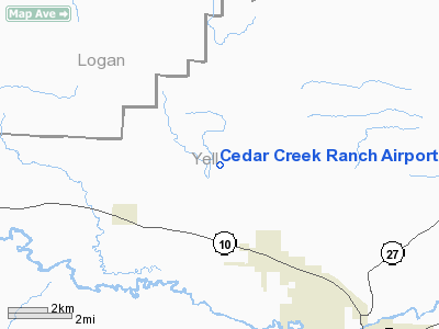
Cedar Creek Ranch Airport |
Location
& QuickFacts
|
FAA Information Effective: |
2005-10-27 |
|
Airport Identifier: |
AR23 |
|
Longitude/Latitude: |
093-28-30.6740W/35-08-00.3210N
-93.475187/35.133423 (Estimated) |
|
Elevation: |
420
ft / 128.02 m (Estimated) |
|
Land: |
0
acres |
|
From nearest city: |
3
nautical miles NW of Belleville, AR |
|
Location: |
Yell
County, AR |
|
Magnetic Variation: |
04E
(1985) |
Owner
& Manager
|
Ownership: |
Privately
owned |
|
Owner: |
Carl
Woodson |
|
Address: |
Po
Box 88
Belleville, AR 72824 |
|
Phone number: |
501-493-2441 |
|
Manager: |
Carl
Woodson |
|
Address: |
Po
Box 88
Belleville, AR 72824 |
|
Phone number: |
501-493-2441 |
Airport
Operations and Facilities
|
Airport Use: |
Private |
|
Wind indicator: |
Yes |
|
Segmented Circle: |
No |
|
Control Tower: |
No |
|
Attendance Schedule: |
UNATNDD |
|
Lighting Schedule: |
PHONE
REQ
FOR RWY LIGHTS PHONE 501-493-2441. |
|
Landing fee charge: |
No |
|
Sectional chart: |
Memphis |
|
Region: |
ASW
- Southwest |
|
Boundary ARTCC: |
ZME
- Memphis |
|
Tie-in FSS: |
JBR
- Jonesboro |
|
FSS on Airport: |
No |
|
FSS Phone: |
870-935-3471 |
|
FSS Toll Free: |
1-800-WX-BRIEF |
Runway
Information
Runway
16/34
| Dimension: |
3700
x 70 ft / 1127.8 x 21.3 m |
| Surface: |
TURF, |
|
Edge Lights: |
Low |
|
|
Runway
16 |
Runway
34 |
| Traffic Pattern: |
Left |
Left |
| Displaced threshold: |
600.00
ft |
0.00
ft |
| Obstruction: |
30
ft pline, 600.0 ft from runway |
30
ft trees, 2000.0 ft from runway |
|
Radio
Navigation Aids
| ID |
Type |
Name |
Ch |
Freq |
Var |
Dist |
|
RUE |
NDB |
Russellville |
|
379.00 |
03E |
20.1
nm |
|
CZE |
NDB |
Clarksville |
|
201.00 |
04E |
20.3
nm |
|
MPJ |
NDB |
Morrilton |
|
410.00 |
07E |
27.1
nm |
|
BDQ |
NDB |
Bridge |
|
208.00 |
04E |
37.5
nm |
|
HO |
NDB |
Hossy |
|
385.00 |
04E |
45.0
nm |
|
HOT |
VOR/DME |
Hot
Springs |
037X |
110.00 |
04E |
43.7
nm |
|
FSM |
VORTAC |
Fort
Smith |
041X |
110.40 |
07E |
42.0
nm |
Remarks
- RWY SOFT WHEN WET (WINTER MINTHS).
Cedar Creek Ranch Airport
Address: Yell County, AR
Tel: 501-493-2441
Images and information
placed above are from
http://www.airport-data.com/airport/AR23/
We thank them for the data!
|
General Info |
| Country |
United
States |
| State |
ARKANSAS
|
| FAA
ID |
AR23
|
| Latitude |
35-08-00.321N
|
| Longitude |
093-28-30.674W
|
| Elevation |
420
feet |
| Near
City |
BELLEVILLE
|
We don't guarantee the information is fresh and accurate. The data may be wrong or outdated.
For more up-to-date information please refer to other sources.
|
|


