 |
|
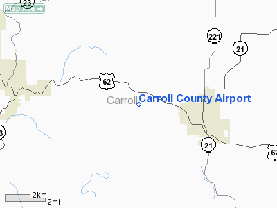
Location
& QuickFacts
|
FAA
Information Effective: |
2005-10-27 |
|
Airport
Identifier: |
4M1 |
|
Longitude/Latitude: |
093-37-28.4000W/36-22-52.8000N
-93.624556/36.381333 (Estimated) |
|
Elevation: |
1207
ft / 367.89 m (Estimated) |
|
Land: |
51
acres |
|
From
nearest city: |
3
nautical miles W of Berryville, AR |
|
Location: |
Carroll
County, AR |
|
Magnetic
Variation: |
04E
(1985) |
Owner &
Manager
|
Ownership: |
Publicly
owned |
|
Owner: |
Carroll
County |
|
Address: |
210
West Church St.
Berryville, AR 72616 |
|
Phone
number: |
870-423-2967 |
|
Manager: |
Perry
Evans |
|
Address: |
210
West Church Str
Berryville, AR 72616 |
|
Phone
number: |
479-244-5210 |
Airport
Operations and Facilities
|
Airport
Use: |
Open
to public |
|
Wind
indicator: |
Yes |
|
Segmented
Circle: |
Yes |
|
Control
Tower: |
No |
|
Attendance
Schedule: |
ALL/MON-FRI/0800-1600 |
|
Lighting
Schedule: |
DUSK-DAWN
ACTVT MIRL RY 07/25 - CTAF. |
|
Beacon
Color: |
Clear-Green
(lighted land airport) |
|
Landing
fee charge: |
No |
|
Sectional
chart: |
Kansas
City |
|
Region: |
ASW
- Southwest |
|
Boundary
ARTCC: |
ZME
- Memphis |
|
Tie-in
FSS: |
JBR
- Jonesboro |
|
FSS
on Airport: |
No |
|
FSS
Phone: |
870-935-3471 |
|
FSS
Toll Free: |
1-800-WX-BRIEF |
|
NOTAMs
Facility: |
JBR
(NOTAM-d service avaliable) |
|
Federal
Agreements: |
NGY |
Airport
Communications
Airport
Services
|
Airframe
Repair: |
MAJOR |
|
Power
Plant Repair: |
MAJOR |
|
Bottled
Oxygen: |
NONE |
|
Bulk
Oxygen: |
NONE |
Runway
Information
Runway
07/25
|
Dimension: |
3555 x 75 ft / 1083.6
x 22.9 m |
|
Surface: |
ASPH, Fair Condition |
|
Weight Limit: |
Single
wheel: 12000 lbs. |
|
Edge
Lights: |
Medium |
|
|
Runway
07 |
Runway
25 |
| Longitude: |
093-37-49.1900W |
093-37-07.5200W |
|
Latitude: |
36-22-47.8300N |
36-22-57.8700N |
| Traffic
Pattern: |
Left |
Left |
|
Markings: |
Basic, Fair Condition |
Basic, Fair Condition |
| Crossing
Height: |
23.00
ft |
30.00
ft |
|
VASI: |
2-light
PAPI on left side |
2-light
PAPI on left side |
| Visual
Glide Angle: |
3.00° |
4.00° |
|
Obstruction: |
20
ft trees, 695.0 ft from runway, 124 ft right of centerline,
24:1 slope to clear |
12
ft trees, 500.0 ft from runway, 200 ft right of centerline,
25:1 slope to clear |
|
Radio Navigation
Aids
|
ID |
Type |
Name |
Ch |
Freq |
Var |
Dist |
|
PLK |
NDB |
Point
Lookout/dcmsnd |
|
204.00 |
03E |
24.1
nm |
|
SLG |
NDB |
Siloam Springs |
|
284.00 |
04E |
43.4 nm |
|
HRO |
VOR/DME |
Harrison |
072X |
112.50 |
04E |
20.3
nm |
|
DAK |
VOR/DME |
Drake |
025X |
108.80 |
07E |
34.4 nm |
|
EOS |
VOR/DME |
Neosho |
120X |
117.30 |
07E |
48.0
nm |
|
RZC |
VORTAC |
Razorback |
111X |
116.40 |
04E |
25.4 nm |
Remarks
- NO LINE
OF SIGHT BTN RY ENDS.
- ULTRALIGHT
& POWERED PARACHUTE ACTIVITY ON & INVOF ARPT.
Carroll County Airport
Address: Carroll County,
AR
Tel: 479-244-5210
Images and information
placed above are from
http://www.airport-data.com/airport/4M1/
We thank them for the data!
|
General Info |
|
Country |
United States
|
|
State |
ARKANSAS |
|
FAA ID |
4M1 |
|
Latitude |
36-23-00.252N
|
|
Longitude |
093-37-00.684W
|
|
Elevation |
1207 feet |
|
Near City |
BERRYVILLE
|
We don't guarantee the information is fresh and accurate. The data may be wrong or outdated.
For more up-to-date information please refer to other sources.
|
|


