 |
|
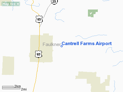
Location
& QuickFacts
|
FAA
Information Effective: |
2005-10-27 |
|
Airport
Identifier: |
AR06 |
|
Longitude/Latitude: |
092-20-36.0000W/35-13-57.0000N
-92.343333/35.232500 (Estimated) |
|
Elevation: |
325
ft / 99.06 m (Estimated) |
|
Land: |
0
acres |
|
From
nearest city: |
3
nautical miles E of Conway, AR |
|
Location: |
Faulkner
County, AR |
|
Magnetic
Variation: |
03E
(1995) |
Owner &
Manager
|
Ownership: |
Privately
owned |
|
Owner: |
William
R Otto, Sr |
|
Address: |
1010
Front Street
Conway, AR 72032 |
|
Phone
number: |
501-327-1323 |
|
Manager: |
William
R Otto, Sr |
|
Address: |
1010
Front Street
Conway, AR 72032 |
|
Phone
number: |
501-327-1323 |
Airport
Operations and Facilities
|
Airport
Use: |
Private |
|
Segmented
Circle: |
No |
|
Control
Tower: |
No |
|
Attendance
Schedule: |
UNATNDD |
|
Sectional
chart: |
Memphis |
|
Region: |
ASW
- Southwest |
|
Boundary
ARTCC: |
ZME
- Memphis |
|
Tie-in
FSS: |
JBR
- Jonesboro |
|
FSS
Phone: |
870-935-3471 |
|
FSS
Toll Free: |
1-800-WX-BRIEF |
Runway
Information
Runway
10/28
|
Dimension: |
2640 x 50 ft / 804.7
x 15.2 m |
|
Surface: |
TURF, |
|
|
Runway
10 |
Runway
28 |
|
Traffic Pattern: |
Left |
Left |
|
Obstruction: |
100
ft trees, 1320.0 ft from runway |
100
ft trees, 600.0 ft from runway |
|
Radio Navigation
Aids
|
ID |
Type |
Name |
Ch |
Freq |
Var |
Dist |
|
CWS |
NDB |
Conway |
|
302.00 |
05E |
9.8
nm |
|
BDQ |
NDB |
Bridge |
|
208.00 |
04E |
19.0 nm |
|
TYV |
NDB |
Toneyville |
|
290.00 |
04E |
23.2
nm |
|
HBZ |
NDB |
Heber Springs |
|
256.00 |
03E |
23.5 nm |
|
MPJ |
NDB |
Morrilton |
|
410.00 |
07E |
29.4
nm |
|
SRC |
NDB |
Searcy |
|
323.00 |
02E |
30.0 nm |
|
RUE |
NDB |
Russellville |
|
379.00 |
03E |
36.9
nm |
|
INY |
NDB |
Independence County |
|
317.00 |
03E |
39.3 nm |
|
VLX |
NDB |
Wilcox |
|
348.00 |
02E |
40.1
nm |
|
LRF |
TACAN |
Jacksonville |
029X |
|
04E |
21.0 nm |
|
LIT |
VORTAC |
Little
Rock |
086X |
113.90 |
05E |
34.3
nm |
Cantrell Farms Airport
Address: Faulkner County,
AR
Tel: 501-327-1323
Images and information
placed above are from
http://www.airport-data.com/airport/AR06/
We thank them for the data!
|
General Info |
|
Country |
United States
|
|
State |
ARKANSAS |
|
FAA ID |
AR06 |
|
Latitude |
35-13-57.000N
|
|
Longitude |
092-20-36.000W
|
|
Elevation |
325 feet |
|
Near City |
CONWAY |
We don't guarantee the information is fresh and accurate. The data may be wrong or outdated.
For more up-to-date information please refer to other sources.
|
|


