 |
|
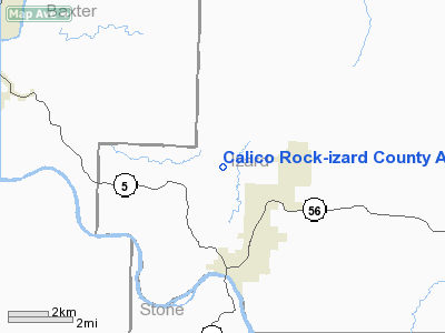
Calico Rock-izard County Airport |
Location
& QuickFacts
|
FAA
Information Effective: |
2005-10-27 |
|
Airport
Identifier: |
37T |
|
Longitude/Latitude: |
092-08-40.1000W/36-09-52.3000N
-92.144472/36.164528 (Estimated) |
|
Elevation: |
733
ft / 223.42 m (Estimated) |
|
Land: |
60
acres |
|
From
nearest city: |
3
nautical miles NW of Calico Rock, AR |
|
Location: |
Izard
County, AR |
|
Magnetic
Variation: |
03E
(1990) |
Owner &
Manager
|
Ownership: |
Publicly
owned |
|
Owner: |
State
Dept Of Corrections |
|
Address: |
Hc
62 Box 300
Calico Rock, AR 72519 |
|
Phone
number: |
870-297-4311 |
|
Manager: |
James
Banks
WARDEN, NORTH CENTRAL UNIT, AR DEPT OF CORRECTION. |
|
Address: |
Izard
County, AR |
|
Phone
number: |
870-297-4311 |
Airport
Operations and Facilities
|
Airport
Use: |
Open
to public |
|
Wind
indicator: |
Yes |
|
Segmented
Circle: |
No |
|
Control
Tower: |
No |
|
Attendance
Schedule: |
UNATNDD |
|
Lighting
Schedule: |
RDO-CTL
ACTVT MIRL RY 15/33 - CTAF. |
|
Sectional
chart: |
Kansas
City |
|
Region: |
ASW
- Southwest |
|
Boundary
ARTCC: |
ZME
- Memphis |
|
Tie-in
FSS: |
JBR
- Jonesboro |
|
FSS
on Airport: |
No |
|
FSS
Phone: |
870-935-3471 |
|
FSS
Toll Free: |
1-800-WX-BRIEF |
|
NOTAMs
Facility: |
JBR
(NOTAM-d service avaliable) |
|
Federal
Agreements: |
N |
Airport
Communications
Runway
Information
Runway
15/33
|
Dimension: |
3000 x 60 ft / 914.4
x 18.3 m |
|
Surface: |
ASPH,
Good Condition |
|
Weight Limit: |
Single
wheel: 12500 lbs. |
|
Edge
Lights: |
Medium |
|
|
Runway
15 |
Runway
33 |
|
Longitude: |
092-08-52.1340W |
092-08-34.1080W |
|
Latitude: |
36-10-09.5490N |
36-09-43.7090N |
|
Elevation: |
733.00
ft |
696.00
ft |
|
Traffic
Pattern: |
Left |
Left |
|
Markings: |
Basic,
Good Condition |
Basic,
Good Condition |
|
Crossing
Height: |
29.00 ft |
29.00 ft |
|
VASI: |
2-light
PAPI on left side |
2-light
PAPI on left side |
|
Visual
Glide Angle: |
4.00° |
4.00° |
|
Runway End Identifier: |
Yes |
Yes |
|
Obstruction: |
, 50:1 slope
to clear |
29
ft trees, 1200.0 ft from runway, 34:1 slope to clear |
|
Radio Navigation
Aids
|
ID |
Type |
Name |
Ch |
Freq |
Var |
Dist |
|
VLX |
NDB |
Wilcox |
|
348.00 |
02E |
18.0
nm |
|
AJX |
NDB |
Ash Flat |
|
344.00 |
03E |
26.1 nm |
|
INY |
NDB |
Independence
County |
|
317.00 |
03E |
32.5
nm |
|
HBZ |
NDB |
Heber Springs |
|
256.00 |
03E |
39.6 nm |
|
UNO |
NDB |
Pomona |
|
335.00 |
02E |
44.5
nm |
|
FLP |
VOR/DME |
Flippin |
075X |
112.80 |
03E |
17.3 nm |
|
HUW |
VOR/DME |
Hutton |
053X |
111.60 |
02E |
44.1
nm |
Remarks
- AIRSPACE
DETERMINATIOIN PENDING.
Calico Rock-izard County Airport
Address: Izard County, AR
Tel: 870-297-4311
Images and information
placed above are from
http://www.airport-data.com/airport/37T/
We thank them for the data!
|
General Info |
|
Country |
United States
|
|
State |
ARKANSAS |
|
FAA ID |
37T |
|
Latitude |
36-09-56.350N
|
|
Longitude |
092-08-42.850W
|
|
Elevation |
720 feet |
|
Near City |
CALICO ROCK
|
We don't guarantee the information is fresh and accurate. The data may be wrong or outdated.
For more up-to-date information please refer to other sources.
|
|


