 |
|
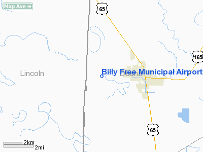
Billy Free Municipal Airport |
Location & QuickFacts
|
FAA Information Effective: |
2005-10-27 |
|
Airport Identifier: |
0M0 |
|
Longitude/Latitude: |
091-32-04.2900W/33-53-05.1100N
-91.534525/33.884753 (Estimated) |
|
Elevation: |
163 ft
/ 49.68 m (Estimated) |
|
Land: |
40 acres |
|
From nearest city: |
2 nautical miles W of Dumas, AR |
|
Location: |
Desha County, AR |
|
Magnetic Variation: |
03E (1985) |
Owner & Manager
| Ownership: |
Publicly owned |
| Owner: |
City Of Dumas |
| Address: |
Po Box 157
Dumas, AR 71639 |
| Phone
number: |
870-382-2121 |
| Manager: |
Deloyd Rankin |
| Address: |
Po Box 356
Dumas, AR 71639 |
| Phone
number: |
870-382-2216 |
Airport Operations and Facilities
| Airport Use: |
Open to public |
|
Wind indicator: |
Yes |
| Segmented Circle: |
Yes |
|
Control Tower: |
No |
| Attendance Schedule: |
ALL/MON-SAT/0800-1700
FOR ARPT ATTENDANT AFT HRS CALL 870-382-5782. |
|
Lighting Schedule: |
DUSK-DAWN
ACTVT MIRL RY 18/36 - CTAF. |
| Beacon Color: |
Clear-Green (lighted land airport) |
|
Landing fee charge: |
No |
| Sectional chart: |
Memphis |
|
Region: |
ASW - Southwest |
| Boundary ARTCC: |
ZME - Memphis |
|
Tie-in FSS: |
JBR - Jonesboro |
| FSS on Airport: |
No |
|
FSS Phone: |
870-935-3471 |
| FSS Toll Free: |
1-800-WX-BRIEF |
|
NOTAMs Facility: |
JBR (NOTAM-d service avaliable) |
| Federal Agreements: |
NGY |
Airport Communications
|
CTAF: |
122.800 |
|
Unicom: |
122.800 |
Airport Services
|
Fuel available: |
100LLA
SELF SERVICE FUEL AVBL 24 HRS WITH CREDIT CARD. |
|
Airframe Repair: |
MAJOR |
|
Power Plant Repair: |
MAJOR |
Runway Information
Runway 18/36
|
Dimension: |
5000
x 75 ft / 1524.0 x 22.9 m |
|
Surface: |
ASPH,
Good Condition |
| Weight
Limit: |
Single
wheel: 15000 lbs. |
|
Edge
Lights: |
Medium |
|
|
Runway 18 |
Runway 36 |
|
Longitude: |
091-32-03.4500W |
091-32-05.1300W |
|
Latitude: |
33-53-29.8300N |
33-52-40.3900N |
|
Elevation: |
162.00 ft |
162.00 ft |
|
Alignment: |
127 |
2 |
|
Traffic Pattern: |
Left |
Left |
|
Markings: |
Basic, Fair Condition |
Non-precision instrument, Fair Condition |
|
Radio Navigation Aids
| ID |
Type |
Name |
Ch |
Freq |
Var |
Dist |
|
REN |
NDB |
Warren |
|
226.00 |
04E |
34.6 nm |
|
RNV |
NDB |
Renova |
|
272.00 |
04E |
38.8 nm |
|
MTQ |
NDB |
Metcalf |
|
359.00 |
03E |
39.1 nm |
|
SGT |
NDB |
Stuttgart |
|
269.00 |
02E |
47.0 nm |
|
IDL |
NDB |
Indianola |
|
284.00 |
03E |
49.4 nm |
|
MON |
VOR/DME |
Monticello |
053X |
111.60 |
04E |
21.4 nm |
|
PBF |
VOR/DME |
Pine Bluff |
107X |
116.00 |
04E |
29.2 nm |
|
GLH |
VOR/DME |
Greenville |
039X |
110.20 |
04E |
35.1 nm |
Billy Free Municipal Airport
Address:
Desha County, AR
Tel:
870-382-2216
Images and information
placed above are from
http://www.airport-data.com/airport/0M0/
We thank them for the data!
|
General
Info |
| Country |
United States |
| State |
ARKANSAS |
| FAA ID |
0M0 |
| Latitude |
33-53-04.371N |
| Longitude |
091-32-03.448W |
| Elevation |
163 feet
|
| Near City |
DUMAS |
We don't guarantee the information is fresh and accurate. The data may be wrong or outdated.
For more up-to-date information please refer to other sources.
|
|


