 |
|
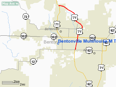
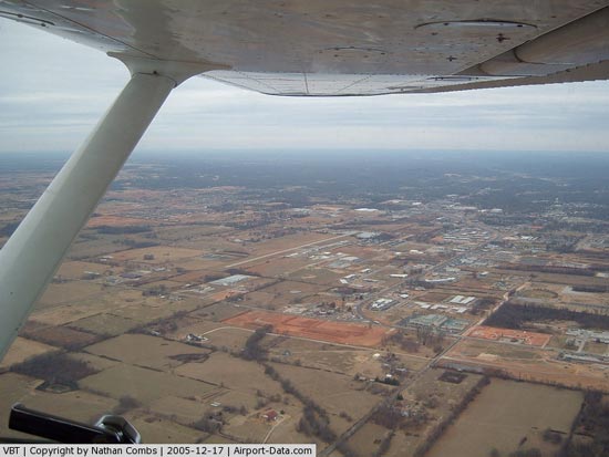
Bentonville Muni/louise M Thaden Field Airport |
Location
& QuickFacts
|
FAA Information
Effective: |
2005-10-27 |
|
Airport Identifier: |
VBT |
|
Longitude/Latitude: |
094-13-09.6420W/36-20-44.5750N
-94.219345/36.345715 (Estimated) |
|
Elevation: |
1296 ft / 395.02 m (Surveyed) |
|
Land: |
130 acres |
|
From nearest city: |
2 nautical miles S of Bentonville, AR |
|
Location: |
Benton County, AR |
|
Magnetic Variation: |
04E (2000) |
Owner &
Manager
|
Ownership: |
Publicly owned |
|
Owner: |
City Of Bentonville |
|
Address: |
117 E Central
Bentonville, AR 72712 |
|
Phone number: |
479-271-3112 |
|
Manager: |
Andy Sams |
|
Address: |
500-7 Airport Road
Bentonville, AR 72712 |
|
Phone number: |
479-254-0817 |
Airport
Operations and Facilities
|
Airport Use: |
Open to public |
|
Wind indicator: |
Yes |
|
Segmented Circle: |
No |
|
Control Tower: |
No |
|
Attendance Schedule: |
ALL/ALL/0700-1700
FOR SVC AFT HRS CALL 479-236-1755. |
|
Lighting Schedule: |
DUSK-DAWN
ACTVT MIRL RY 18/36 - CTAF. |
|
Beacon Color: |
Clear-Green (lighted land airport) |
|
Landing fee charge: |
No |
|
Sectional chart: |
Kansas City |
|
Region: |
ASW - Southwest |
|
Boundary ARTCC: |
ZME - Memphis |
|
Tie-in FSS: |
JBR - Jonesboro |
|
FSS on Airport: |
No |
|
FSS Phone: |
870-935-3471 |
|
FSS Toll Free: |
1-800-WX-BRIEF |
|
NOTAMs Facility: |
VBT (NOTAM-d service avaliable) |
|
Federal Agreements: |
N1 |
Airport
Communications
|
CTAF: 122.800 |
Unicom:
122.800 |
|
CTAF: 122.800 |
Unicom:
122.800 |
Airport Services
|
Fuel available: |
100LLA
100LL AVBL 24 HRS SELF SERVICE WITH CREDIT CARD. |
|
Airframe Repair: |
MAJOR |
|
Power Plant Repair: |
MAJOR |
|
Bottled Oxygen: |
NONE |
|
Bulk Oxygen: |
NONE |
Runway
Information
Runway 18/36
|
Dimension: |
4082
x 65 ft / 1244.2 x 19.8 m |
| Surface: |
ASPH,
Good Condition |
| Weight Limit: |
Single
wheel: 12500 lbs.
Dual wheel: 21500 lbs. |
| Edge Lights: |
Medium |
|
|
Runway
18 |
Runway
36 |
|
Longitude: |
094-13-09.4080W |
094-13-09.7800W |
| Latitude: |
36-21-04.8010N |
36-20-24.4410N |
|
Elevation: |
1288.00
ft |
1290.00
ft |
| Alignment: |
127 |
0 |
|
Traffic
Pattern: |
Left |
Left |
| Markings: |
Non-precision instrument, Fair Condition |
Non-precision instrument, Fair Condition |
|
Displaced
threshold: |
227.00
ft |
0.00
ft |
| Runway
End Identifier: |
Yes
REIL OTS INDEFLY. |
Yes |
|
Obstruction: |
10 ft road, 300.0 ft from runway, 10:1 slope to clear
APCH RATIO 50:1 TO DSPLCD THR. |
4 ft fence, 250.0 ft from runway, 12:1 slope to clear |
|
Radio Navigation
Aids
|
ID |
Type |
Name |
Ch |
Freq |
Var |
Dist |
|
SLG |
NDB |
Siloam Springs |
|
284.00 |
04E |
16.1 nm |
| TQH |
NDB |
Tahlequah |
|
215.00 |
05E |
45.7 nm |
|
DAK |
VOR/DME |
Drake |
025X |
108.80 |
07E |
18.2 nm |
| EOS |
VOR/DME |
Neosho |
120X |
117.30 |
07E |
31.6 nm |
|
HRO |
VOR/DME |
Harrison |
072X |
112.50 |
04E |
48.7 nm |
| RZC |
VORTAC |
Razorback |
111X |
116.40 |
04E |
7.6 nm |
Bentonville Muni/louise M Thaden Field Airport
Address:
Benton
County, AR
Tel: 479-254-0817
Images and information
placed above are from
http://www.airport-data.com/airport/VBT/
We thank them for the data!
|
General Info |
|
Country |
United
States |
|
State |
ARKANSAS
|
|
FAA
ID |
VBT
|
|
Latitude |
36-20-44.575N
|
|
Longitude |
094-13-09.642W
|
|
Elevation |
1296
feet |
|
Near
City |
BENTONVILLE
|
We don't guarantee the information is fresh and accurate. The data may be wrong or outdated.
For more up-to-date information please refer to other sources.
|
|


