 |
|
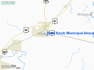
Bald Knob Municipal Airport |
Location
& QuickFacts
|
FAA Information Effective: |
2005-10-27 |
|
Airport Identifier: |
M74 |
|
Longitude/Latitude: |
091-33-27.2750W/35-18-01.5420N
-91.557576/35.300428
(Estimated) |
|
Elevation: |
212
ft / 64.62 m (Estimated) |
|
Land: |
15
acres |
|
From nearest city: |
0
nautical miles SE of Bald Knob, AR |
|
Location: |
White
County, AR |
|
Magnetic Variation: |
03E
(1985) |
Owner &
Manager
|
Ownership: |
Publicly
owned |
|
Owner: |
City
Of Bald Knob |
|
Address: |
City
Hall 1119 Highway Ave
Bald
Knob, AR 72010 |
|
Phone number: |
501-724-6371 |
|
Manager: |
Earl
Strickland
MAYOR |
|
Address: |
City
Hall, 1119 Highway Ave.
Bald
Knob, AR 72010 |
|
Phone number: |
501-724-6215 |
Airport
Operations and Facilities
| Airport Use: |
Open
to public |
|
Wind indicator: |
Yes |
|
Segmented Circle: |
No |
|
Control Tower: |
No |
|
Attendance Schedule: |
UNATNDD |
|
Lighting Schedule: |
DUSK-DAWN |
|
Beacon Color: |
ACTVT
MIRL RY 09/27 - CTAF. |
|
Landing fee charge: |
Clear-Green
(lighted land airport) |
|
Sectional chart: |
No |
|
Region: |
Memphis |
|
Boundary ARTCC: |
ASW
- Southwest |
|
Tie-in FSS: |
ZME
- Memphis |
|
FSS on Airport: |
JBR
- Jonesboro |
|
FSS Phone: |
No |
|
FSS Toll Free: |
870-935-3471 |
|
NOTAMs Facility: |
1-800-WX-BRIEF |
Airport
Communications
Runway Information
Runway 04/22
|
Dimension: |
1850 x 100 ft
/ 563.9 x 30.5 m |
|
Surface: |
TURF,
Fair Condition |
|
|
Runway
04 |
Runway
22 |
|
Traffic Pattern: |
Left |
Left |
|
Obstruction: |
10 ft road |
10 ft road, 220.0 ft from runway, 2:1 slope to clear |
|
Runway 09/27
|
Dimension: |
2228 x 50 ft /
679.1 x 15.2 m |
|
Surface: |
ASPH, Good Condition |
|
|
Runway
09 |
Runway
27 |
|
Traffic Pattern: |
Left |
Left |
|
Markings: |
Basic,
Good Condition |
Basic,
Good Condition |
|
Displaced threshold: |
246.00
ft |
146.00
ft |
|
Obstruction: |
35 ft tree, 250.0 ft from runway, 1:1 slope to clear
APCH SLOPE 17:1 TO DSPLCD THLD.
ROAD
140 FT FM RY END. |
7 ft road, 230.0 ft from runway, 4:1 slope to clear
APCH SLOPE 53:1 TO DSPLCD THLD. |
|
Radio Navigation
Aids
|
ID |
Type |
Name |
Ch |
Freq |
Var |
Dist |
|
SRC |
NDB |
Searcy |
|
323.00 |
02E |
10.1
nm |
|
HBZ |
NDB |
Heber
Springs |
|
256.00 |
03E |
25.7
nm |
|
INY |
NDB |
Independence
County |
|
317.00 |
03E |
27.0
nm |
|
EWP |
NDB |
Newport |
|
400.00 |
04E |
27.6
nm |
|
TYV |
NDB |
Toneyville |
|
290.00 |
04E |
30.9
nm |
|
BKZ |
NDB |
Brinkley |
|
242.00 |
02E |
31.4
nm |
|
SGT |
NDB |
Stuttgart |
|
269.00 |
02E |
38.3
nm |
|
VLX |
NDB |
Wilcox |
|
348.00 |
02E |
43.0
nm |
|
FCY |
NDB |
Forrest
City |
|
332.00 |
01E |
44.2
nm |
|
CWS |
NDB |
Conway |
|
302.00 |
05E |
44.6
nm |
|
LRF |
TACAN |
Jacksonville |
029X |
|
04E |
37.4
nm |
|
LIT |
VORTAC |
Little
Rock |
086X |
113.90 |
05E |
48.4
nm |
Remarks
- REMOTE CONTROL ACFT
FLYING ON & INVOF ARPT.
- PRE-DATES THE ACT.
Bald Knob Municipal Airport
Address:
White County, AR
Tel: 501-724-6215
Images and
information placed above are from
http://www.airport-data.com/airport/M74/
We thank
them for the data!
|
General Info |
|
Country |
United
States |
|
State |
ARKANSAS
|
|
FAA
ID |
M74
|
|
Latitude |
35-18-01.542N
|
|
Longitude |
091-33-27.275W
|
|
Elevation |
212
feet |
|
Near
City |
BALD
KNOB |
We don't guarantee the information is fresh and accurate. The data may be wrong or outdated.
For more up-to-date information please refer to other sources.
|
|


