 |
|
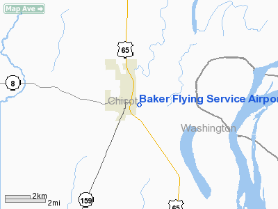
Baker Flying Service Airport |
Location
& QuickFacts
|
FAA Information Effective: |
2005-10-27 |
|
Airport Identifier: |
AR01 |
|
Longitude/Latitude: |
091-15-00.4030W/33-06-30.4370N
-91.250112/33.108455 (Estimated) |
|
Elevation: |
116 ft / 35.36 m (Estimated) |
|
Land: |
60 acres |
|
From nearest city: |
0 nautical
miles E of Eudora, AR |
|
Location: |
Chicot County,
AR |
|
Magnetic Variation: |
03E (1985) |
Owner &
Manager
|
Ownership: |
Privately
owned |
|
Owner: |
Clifford D. Baker |
|
Address: |
P.o.
Box 484
Eudora, AR 71640 |
|
Phone number: |
501-355-2266 |
|
Manager: |
Clifford D. Baker |
|
Address: |
Chicot County,
AR |
|
Phone number: |
501-355-2266 |
Airport
Operations and Facilities
| Airport Use: |
Private |
|
Wind Indicator: |
Yes |
|
Segmented Circle: |
No |
|
Control Tower: |
No |
|
Attendance Schedule: |
ALL/MON-SAT/0800-1700 |
|
Landing fee charge: |
No |
|
Sectional chart: |
Memphis |
|
Region: |
ASW
- Southwest |
|
Boundary ARTCC: |
ZME
- Memphis |
|
Tie-in FSS: |
JBR
- Jonesboro |
|
FSS on Airport: |
No |
|
FSS Phone: |
870-935-3471 |
|
FSS Toll Free: |
1-800-WX-BRIEF |
Airport
Services
| Fuel
available: |
100LL |
|
Airframe
Repair: |
NONE |
| Power
Plant Repair: |
NONE |
|
Bottled
Oxygen: |
NONE |
| Bulk
Oxygen: |
NONE |
Runway Information
Runway 05/23
|
Dimension: |
3800 x 150 ft
/ 1158.2 x 45.7 m |
|
Surface: |
TURF, Fair Condition |
|
|
Runway
05 |
Runway
23 |
|
Traffic Pattern: |
Left |
Left |
|
Radio Navigation
Aids
|
ID |
Type |
Name |
Ch |
Freq |
Var |
Dist |
|
BLE |
NDB |
Lake
Providence |
|
278.00 |
03E |
17.0
nm |
|
MTQ |
NDB |
Metcalf |
|
359.00 |
03E |
23.3
nm |
|
IDL |
NDB |
Indianola |
|
284.00 |
03E |
36.5
nm |
|
BQP |
NDB |
Bastrop |
|
329.00 |
03E |
38.4
nm |
|
RNV |
NDB |
Renova |
|
272.00 |
04E |
48.6
nm |
|
MRK |
NDB |
Molly
Ridge |
|
338.00 |
02E |
49.8
nm |
|
REN |
NDB |
Warren |
|
226.00 |
04E |
50.0
nm |
|
GLH |
VOR/DME |
Greenville |
039X |
110.20 |
04E |
28.3
nm |
|
MON |
VOR/DME |
Monticello |
053X |
111.60 |
04E |
35.9
nm |
Baker Flying Service Airport
Address:
Chicot County, AR
Tel: 501-355-2266
Images and
information placed above are from
http://www.airport-data.com/airport/AR01/
We thank them for the data!
|
General Info |
|
Country |
United
States |
|
State |
ARKANSAS
|
|
FAA
ID |
AR01
|
|
Latitude |
33-06-30.437N
|
|
Longitude |
091-15-00.403W
|
|
Elevation |
116
feet |
|
Near
City |
EUDORA
|
We don't guarantee the information is fresh and accurate. The data may be wrong or outdated.
For more up-to-date information please refer to other sources.
|
|


