Location
& QuickFacts
|
FAA Information Effective: |
2005-10-27 |
|
Airport Identifier: |
AR76 |
|
Longitude/Latitude: |
091-21-30.4620W/35-17-19.3080N
-91.358462/35.288697 (Estimated) |
|
Elevation: |
212
ft / 64.62 m (Estimated) |
|
Land: |
0
acres |
|
From nearest city: |
0
nautical miles N of Augusta, AR |
|
Location: |
Woodruff
County,
AR |
|
Magnetic Variation: |
03E
(1985) |
Owner
& Manager
|
Ownership: |
Publicly
owned |
|
Owner: |
City
Of Augusta |
|
Address: |
623
N. 9th St.
Augusta, AR 72006 |
|
Phone number: |
501-347-2534 |
|
Manager: |
White
River Rural Health Ctr |
|
Address: |
623
N. 9th St.
Augusta, AR 72006 |
|
Phone number: |
501-347-2534 |
Airport
Operations and Facilities
| Airport Use: |
Open
to public |
|
Segmented Circle: |
No |
|
Control Tower: |
No |
|
Attendance Schedule: |
UNATNDD |
|
Sectional chart: |
Memphis |
|
Region: |
ASW
- Southwest |
|
Boundary ARTCC: |
ZME
- Memphis |
|
Tie-in FSS: |
JBR
- Jonesboro |
|
FSS on Airport: |
No |
|
FSS Phone: |
870-935-3471 |
|
FSS Toll Free: |
1-800-WX-BRIEF |
Runway
Information
Helipad
H1
|
Dimension: |
40
x 40 ft / 12.2 x 12.2 m |
|
Surface: |
CONC, |
|
|
Runway
H1 |
Runway
|
|
Traffic Pattern: |
Left |
Left |
|
Radio
Navigation Aids
|
ID |
Type |
Name |
Ch |
Freq |
Var |
Dist |
|
SRC |
NDB |
Searcy |
|
323.00 |
02E |
18.9
nm |
|
EWP |
NDB |
Newport |
|
400.00 |
04E |
23.0
nm |
|
BKZ |
NDB |
Brinkley |
|
242.00 |
02E |
26.0
nm |
|
INY |
NDB |
Independence
County |
|
317.00 |
03E |
32.8
nm |
|
HBZ |
NDB |
Heber
Springs |
|
256.00 |
03E |
34.7
nm |
|
FCY |
NDB |
Forrest
City |
|
332.00 |
01E |
35.5
nm |
|
TYV |
NDB |
Toneyville |
|
290.00 |
04E |
38.3
nm |
|
SGT |
NDB |
Stuttgart |
|
269.00 |
02E |
39.2
nm |
|
LRF |
TACAN |
Jacksonville |
029X |
|
04E |
45.2
nm |
|
GQE |
VOR/DME |
Gilmore |
077X |
113.00 |
04E |
43.3
nm |
Remarks
- PRVDD PLINE NORTH OF
HELIPAD MARKED.
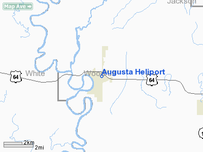
Augusta
Heliport
Address:
Woodruff County, AR
Tel:
501-347-2534
Images
and information placed above are from
http://www.airport-data.com/airport/AR76/
We
thank them for the data!
|
General Info |
|
Country |
United
States |
|
State |
ARKANSAS
|
|
FAA
ID |
AR76
|
|
Latitude |
35-17-19.308N
|
|
Longitude |
091-21-30.462W
|
|
Elevation |
212
feet
|
|
Near
City |
AUGUSTA
|
We don't guarantee the information is fresh and accurate. The data may be wrong or outdated.
For more up-to-date information please refer to other sources.