Location
& QuickFacts
|
FAA Information Effective: |
2005-10-27 |
|
Airport Identifier: |
AR95 |
|
Longitude/Latitude: |
090-29-53.3830W/36-03-03.2480N
-90.498162/36.050902 (Estimated) |
|
Elevation: |
326
ft / 99.36 m (Estimated) |
|
Land: |
0
acres |
|
From nearest city: |
0
nautical miles N of Paragould, AR |
|
Location: |
Greene
County, AR |
|
Magnetic Variation: |
03E
(1985) |
Owner
& Manager
|
Ownership: |
Privately
owned |
|
Owner: |
Arkansas
Methodist Hospital |
|
Address: |
900
West Kings Highway
Paragould, AR 72451 |
|
Phone number: |
501-239-7000 |
|
Manager: |
Ronald K.
Rooney, President |
|
Address: |
900
West Kings Highway
Paragould, AR 72451 |
|
Phone number: |
501-239-7000 |
Airport
Operations and Facilities
| Airport Use: |
Private
MEDICAL USE. |
|
Segmented Circle: |
No |
|
Control Tower: |
No |
|
Attendance Schedule: |
UNATNDD |
|
Lighting Schedule: |
PHONE
REQ
FOR PERIMETER LGTS CALL 501-239-7000. |
|
Sectional chart: |
St
Louis |
|
Region: |
ASW
- Southwest |
|
Boundary ARTCC: |
ZME
- Memphis |
|
Tie-in FSS: |
JBR
- Jonesboro |
|
FSS on Airport: |
No |
|
FSS Phone: |
870-935-3471 |
|
FSS Toll Free: |
1-800-WX-BRIEF |
Runway
Information
Helipad
H1
|
Dimension: |
40 x 40
ft / 12.2 x 12.2 m |
|
Surface: |
CONC, |
|
|
Runway
H1 |
Runway
|
|
Traffic Pattern: |
Left |
Left |
|
Radio
Navigation Aids
|
ID |
Type |
Name |
Ch |
Freq |
Var |
Dist |
|
PGR |
NDB |
Paragould |
|
383.00 |
01E |
0.9
nm |
|
MXA |
NDB |
Manila |
|
282.00 |
01E |
19.2
nm |
|
TNZ |
NDB |
Lawrence
County |
|
227.00 |
01E |
22.6
nm |
|
TKX |
NDB |
Kennett |
|
358.00 |
00E |
24.7
nm |
|
BPW |
NDB |
Osceola |
|
239.00 |
02E |
32.0
nm |
|
IUI |
NDB |
Hicks |
|
350.00 |
01E |
33.0
nm |
|
FD |
NDB |
Earli |
|
278.00 |
03E |
38.0
nm |
|
EWP |
NDB |
Newport |
|
400.00 |
04E |
41.4
nm |
|
GOJ |
VOR |
Gosnell |
|
111.80 |
01E |
27.7
nm |
|
JBR |
VOR/DME |
Jonesboro |
023X |
108.60 |
02E |
11.5
nm |
|
GQE |
VOR/DME |
Gilmore |
077X |
113.00 |
04E |
42.3
nm |
|
ARG |
VORTAC |
Walnut
Ridge |
092X |
114.50 |
04E |
22.4
nm |
|
MAW |
VORTAC |
Malden |
049X |
111.20 |
03E |
41.5
nm |
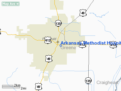
Arkansas
Methodist
Hospital Heliport
Address:
Greene County, AR
Tel: 501-239-7000
Images and information placed above are from
http://www.airport-data.com/airport/AR95/
We thank them for the data!
|
General Info |
|
Country |
United
States |
|
State |
ARKANSAS
|
|
FAA
ID |
AR95
|
|
Latitude |
36-03-03.248N
|
|
Longitude |
090-29-53.383W
|
|
Elevation |
326
feet |
|
Near
City |
PARAGOU |
We don't guarantee the information is fresh and accurate. The data may be wrong or outdated.
For more up-to-date information please refer to other sources.