Location
& QuickFacts
|
FAA Information Effective: |
2005-10-27 |
|
Airport Identifier: |
AR93 |
|
Longitude/Latitude: |
090-16-49.3680W/36-29-08.2120N
-90.280380/36.485614 (Estimated) |
|
Elevation: |
308
ft / 93.88 m (Estimated) |
|
Land: |
0
acres |
|
From nearest city: |
3
nautical miles N of Pollard, AR |
|
Location: |
Clay County, AR |
|
Magnetic Variation: |
02E
(1985) |
Owner
& Manager
|
Ownership: |
Privately
owned |
|
Owner: |
Larry
Flanigan |
|
Address: |
Rt
1
Pollard, AR 72456 |
|
Phone number: |
501-544-2241 |
|
Manager: |
Larry
Flanigan |
|
Address: |
Rt
1
Pollard, AR 72456 |
|
Phone number: |
501-544-2241 |
Airport
Operations and Facilities
| Airport Use: |
Private |
|
Segmented Circle: |
No |
|
Control Tower: |
No |
|
Attendance Schedule: |
UNATNDD |
|
Sectional chart: |
St
Louis |
|
Region: |
ASW
– Southwest |
|
Boundary ARTCC: |
ZME
– Memphis |
|
Tie-in FSS: |
JBR
– Jonesboro |
|
FSS on Airport: |
No |
|
FSS Phone: |
870-935-3471 |
|
FSS Toll Free: |
1-800-WX-BRIEF |
Runway
Information
Runway
09/27
|
Dimension: |
2400
x 90 ft / 731.5 x 27.4 m |
|
Surface: |
TURF, |
|
|
Runway
09 |
Runway
27 |
|
Traffic Pattern: |
Left |
Right |
|
Obstruction: |
18
ft pline |
|
|
Radio
Navigation Aids
|
ID |
Type |
Name |
Ch |
Freq |
Var |
Dist |
|
FD |
NDB |
Earli |
|
278.00 |
03E |
11.2
nm |
|
TKX |
NDB |
Kennett |
|
358.00 |
00E |
19.4
nm |
|
DXE |
NDB |
Dexter |
|
423.00 |
00E |
24.5
nm |
|
PGR |
NDB |
Paragould |
|
383.00 |
01E |
27.8
nm |
|
TNZ |
NDB |
Lawrence County |
|
227.00 |
01E |
35.4
nm |
|
MXA |
NDB |
Manila |
|
282.00 |
01E |
36.2
nm |
|
IUI |
NDB |
Hicks |
|
350.00 |
01E |
39.4
nm |
|
BPW |
NDB |
Osceola |
|
239.00 |
02E |
49.4
nm |
|
CHQ |
NDB |
Charleston |
|
208.00 |
01E |
49.5
nm |
|
GOJ |
VOR |
Gosnell |
|
111.80 |
01E |
36.1
nm |
|
JBR |
VOR/DME |
Jonesboro |
023X |
108.60 |
02E |
39.6
nm |
Remarks
- PRVDD THRS BE LCTD
OR DSPLCD TO PROVIDE A 20:1 APCH SFC AND TFC PATTERNS ARE TO BE
NORTH OF THE ARPT.
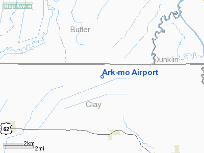
Ark-mo
Airport
Address:
Clay County, AR
Tel:
501-544-2241
Images and information placed above are from
http://www.airport-data.com/airport/AR93/
We thank them for the data!
|
General Info |
|
Country |
United
States
|
|
State |
ARKANSAS |
|
FAA
ID |
AR93
|
|
Latitude |
36-29-08.212N
|
|
Longitude |
090-16-49.368W
|
|
Elevation |
308
feet
|
|
Near
City |
POLLARD
|
We don't guarantee the information is fresh and accurate. The data may be wrong or outdated.
For more up-to-date information please refer to other sources.