Location
& QuickFacts
|
FAA Information Effective: |
2005-10-27 |
|
Airport Identifier: |
AR56 |
|
Longitude/Latitude: |
091-26-00.4750W/35-36-00.2850N
-91.433465/35.600079 (Estimated) |
|
Elevation: |
240
ft / 73.15 m (Estimated) |
|
Land: |
0
acres |
|
From nearest city: |
2
nautical miles NW of Oil Trough, AR |
|
Location: |
Independence
County,
AR |
|
Magnetic Variation: |
03E
(1985) |
Owner
& Manager
|
Ownership: |
Privately
owned |
|
Owner: |
Russ
Amos |
|
Address: |
30
Redbud Dr
Batesville, AR 72501 |
|
Phone number: |
501-264-3308 |
|
Manager: |
Russ
Amos |
|
Address: |
1200
6 Mile Lane
Batesville, AR 72501 |
|
Phone number: |
501-251-1084 |
Airport
Operations and Facilities
| Airport Use: |
Private |
|
Segmented Circle: |
No |
|
Control Tower: |
No |
|
Attendance Schedule: |
UNATNDD |
|
Sectional chart: |
Memphis |
|
Region: |
ASW
– Southwest |
|
Boundary ARTCC: |
ZME
– Memphis |
|
Tie-in FSS: |
JBR
- Jonesboro |
|
FSS Phone: |
870-935-3471 |
|
FSS Toll Free: |
1-800-WX-BRIEF |
Runway
Information
Runway
N/S
|
Dimension: |
2905
x 100 ft / 885.4 x 30.5 m |
| Surface: |
TURF,
|
|
|
Runway
N |
Runway
S |
| Traffic Pattern: |
Left |
Left |
|
Radio
Navigation Aids
|
ID |
Type |
Name |
Ch |
Freq |
Var |
Dist |
|
EWP |
NDB |
Newport |
|
400.00 |
04E |
12.6
nm |
|
INY |
NDB |
Independence County |
|
317.00 |
03E |
18.6
nm |
|
SRC |
NDB |
Searcy |
|
323.00 |
02E |
27.5
nm |
|
HBZ |
NDB |
Heber
Springs |
|
256.00 |
03E |
28.7
nm |
|
AJX |
NDB |
Ash
Flat |
|
344.00 |
03E |
35.9
nm |
|
VLX |
NDB |
Wilcox |
|
348.00 |
02E |
36.0
nm |
|
TNZ |
NDB |
Lawrence County |
|
227.00 |
01E |
44.1
nm |
|
BKZ |
NDB |
Brinkley |
|
242.00 |
02E |
45.0
nm |
|
TYV |
NDB |
Toneyville |
|
290.00 |
04E |
48.4
nm |
|
JBR |
VOR/DME |
Jonesboro |
023X |
108.60 |
02E |
44.4
nm |
|
GQE |
VOR/DME |
Gilmore |
077X |
113.00 |
04E |
49.2
nm |
|
ARG |
VORTAC |
Walnut
Ridge |
092X |
114.50 |
04E |
38.5
nm |
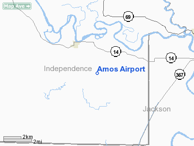
Amos Airport
Address:
Independence County, AR
Tel:
501-251-1084
Images
and information placed above are from
http://www.airport-data.com/airport/AR56/
We
thank them for the data!
|
General
Info |
|
Country |
United
States
|
|
State |
ARKANSAS |
|
FAA ID |
AR56
|
|
Latitude |
35-36-00.285N
|
|
Longitude |
091-26-00.475W
|
|
Elevation |
240
feet
|
|
Near City |
OIL
TROUGH |
We don't guarantee the information is fresh and accurate. The data may be wrong or outdated.
For more up-to-date information please refer to other sources.