 |
|
|
|
|
|
Location & QuickFacts
|
FAA
Information Effective: |
2005-10-27 |
|
Airport
Identifier: |
M73 |
|
Longitude/Latitude: |
091-27-58.8500W/34-24-44.3820N
-91.466347/34.412328 (Estimated) |
|
Elevation: |
211 ft / 64.31 m (Estimated) |
|
Land: |
640 acres |
|
From
nearest city: |
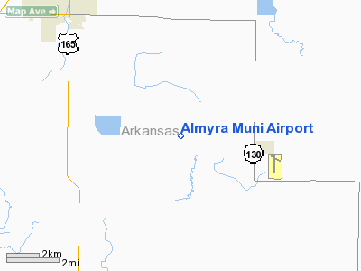
3 nautical miles W of Almyra, AR |
|
Location: |
Arkansas
County, AR |
|
Magnetic
Variation: |
02E (2000) |
Owner & Manager
|
Ownership: |
Publicly
owned |
|
Owner: |
City Of
Almyra |
|
Address: |
P O Box
189
Almyra,
AR 72160 |
|
Phone
number: |
870-673-1591 |
|
Manager: |
Scott Goetz
& Mark Hartz |
|
Address: |
275 Almyra
Airport Road
Almyra,
AR 72003 |
|
Phone
number: |
870-992-3333 |
Airport Operations and Facilities
| Airport
Use: |
Open
to public |
|
Wind indicator: |
Yes |
|
Segmented
Circle: |
Yes |
|
Control
Tower: |
No |
|
Attendance
Schedule: |
UNATNDD |
|
Lighting
Schedule: |
DUSK-DAWN |
|
Beacon
Color: |
Clear-Green (lighted land airport) |
|
Landing
fee charge: |
No |
|
Sectional
chart: |
Memphis |
|
Region: |
ASW
- Southwest |
|
Boundary
ARTCC: |
ZME
- Memphis |
|
Tie-in
FSS: |
JBR
- Jonesboro |
|
FSS on
Airport: |
No |
|
FSS Phone: |
870-935-3471 |
|
FSS Toll
Free: |
1-800-WX-BRIEF |
|
NOTAMs
Facility: |
JBR (NOTAM-d service avaliable) |
|
Federal
Agreements: |
NRY1 |
Runway Information
Runway 10/28
|
Dimension: |
3000
x 50 ft / 914.4 x 15.2 m |
|
Surface: |
ASPH,
Good Condition |
|
Weight
Limit: |
Single
wheel: 4000
lbs. |
|
|
Runway
10 |
Runway
28 |
|
Longitude: |
091-28-03.1900W |
091-27-28.7000W |
|
Latitude: |
34-24-55.5600N |
34-24-47.6000N |
|
Elevation: |
209.00 ft |
204.00 ft |
|
Alignment: |
106 |
127 |
|
Traffic
Pattern: |
Left |
Left |
|
Markings: |
Basic,
Good Condition |
Basic,
Good Condition |
|
Runway 18/36
|
Dimension: |
3496
x 50 ft / 1065.6 x 15.2 m |
|
Surface: |
ASPH,
Fair Condition |
|
Weight
Limit: |
Single
wheel: 4000
lbs. |
|
Edge Lights: |
Medium |
|
|
Runway
18 |
Runway
36 |
|
Longitude: |
091-28-02.8900W |
091-28-03.2500W |
|
Latitude: |
34-24-56.4400N |
34-24-21.8600N |
|
Elevation: |
209.00 ft |
203.00 ft |
|
Alignment: |
127 |
1 |
|
Traffic
Pattern: |
Left |
Left |
|
Markings: |
Basic,
Good Condition |
Non-precision instrument, Good Condition |
|
Obstruction: |
15 ft road,
450.0 ft from runway,
16:1 slope to clear |
,
50:1 slope to clear |
|
Radio Navigation Aids
| ID |
Type |
Name |
Ch |
Freq |
Var |
Dist |
|
SGT |
NDB |
Stuttgart |
|
269.00 |
02E |
16.4
nm |
|
BKZ |
NDB |
Brinkley |
|
242.00 |
02E |
31.6
nm |
|
HEE |
NDB |
Thompson-robbins |
|
251.00 |
01E |
40.3
nm |
|
TYV |
NDB |
Toneyville |
|
290.00 |
04E |
42.4
nm |
|
FCY |
NDB |
Forrest
City |
|
332.00 |
01E |
46.7
nm |
|
CKM |
NDB |
Clarksdale |
|
341.00 |
02E |
47.7
nm |
|
SRC |
NDB |
Searcy |
|
323.00 |
02E |
49.8
nm |
|
LRF |
TACAN |
Jacksonville |
029X |
|
04E |
45.7
nm |
|
PBF |
VOR/DME |
Pine
Bluff |
107X |
116.00 |
04E |
24.9
nm |
|
UJM |
VOR/DME |
Marvell |
033X |
109.60 |
01E |
40.4
nm |
|
LIT |
VORTAC |
Little
Rock |
086X |
113.90 |
05E |
38.8
nm |
Remarks
Almyra Municipal Airport
Address: Arkansas
County, AR
Tel: 870-992-3333
|
General Info |
|
Country |
United
States |
|
State |
ARKANSAS
|
|
FAA
ID |
M73
|
|
Latitude |
34.412328
34° 24' 44.38" N |
|
Longitude |
-91.466347
091° 27' 58.85" W |
|
Elevation |
211 feet
64 meters
|
|
Magnetic
Variation |
001°
E (01/05) |
|
Beacon |
Yes
|
|
Operating
Agency |
MUNICIPAL
|
|
Daylight
Savings Time |
First Sunday in April at 0200 to last Sunday in October
at 0200 local time (Exception Arizona and that portion of
Indiana in the Eastern
Time Zone) |
We don't guarantee the information is fresh and accurate. The data may be wrong or outdated.
For more up-to-date information please refer to other sources.
|
|


